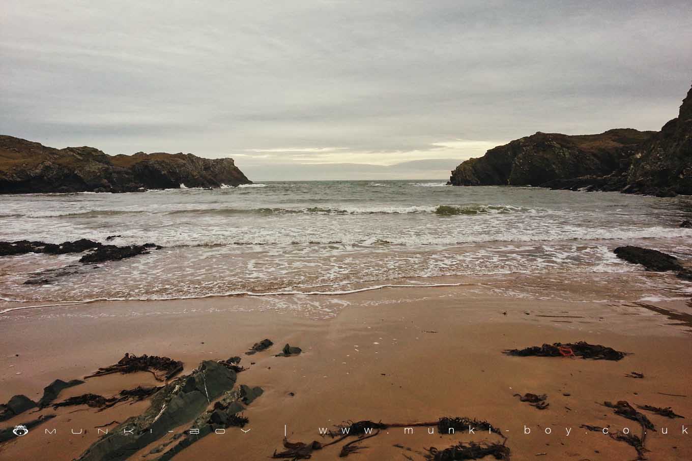
Porth Dafarch by JRL
Porth Dafarch
Porth Dafarch is a small bay on the west coast of Anglesey in North Wales, owned by the National Trust.
Nestled below rugged headlands, is the sheltered sandy beach. The bay is a popular visitor destination because of its sandy beach and is also great for rock-pooling. It is a popular place for watersports, including windsurfing, surfing, canoeing, sailing and jet skiing. Porth Dafarch offers some good snorkelling in its sheltered waters, with lots of marinelife. Scuba divers are able to view the wreck of the steamer Missouri, a 3000-ton vessel that was wrecked in 1886 on its way to Boston, which is situated around half a mile offshore.
The bay, was created from Precambrian rock that has eroded into high cliffs and sea caves. It belongs to the large geological feature known as the Monian Supergroup. Just behind the Beach there are ancient hut circles. They are only just visible and the road to Holyhead covers part of the site.
Looking out to sea from the beach you can still make out the old Customs Post, built in 1819 on the North West side of the Bay. In the same year a harbour was built in Porth Dafarch to allow mail and passengers to be landed on Holy Island when adverse weather conditions made landing at Holyhead impossible. With the commencement of a steam service in 1822, Porth Dafarch was no longer required as an alternative port and once the new harbour was completed at Holyhead in 1873, Porth Dafarch harbour became redundant.
The beach has a Dog ban in force from 1st May until 30th September, with wardens patrolling during the day.
Created: 1 December 2018 Edited: 29 November 2023
Porth Dafarch Beach Information
Porth Dafarch Beach Address
Porthdafarch Rd, Holyhead LL65 2LS, UK
LL65 2LS
Local History around Porth Dafarch
There are some historic monuments around including:
Gogarth Bay round cairn Plas Meilw Hut CirclesRoman Wall Surrounding St Cybi's ChurchyardTre-Arddur Hut Group Holyhead Mountain Hut CirclesTrefignath Burial ChamberEnclosed Hut Circle Settlement at Capel LlochwyddTy-Mawr Standing Stone Ynys Leurad Hut CirclesPorth Dafarch Hut CirclesFfynnon GwenfaenCaer y TŵrDinas Porth Ruffydd Penrhos Feilw Standing Stones.