Penny Rigg Quarry Adit by munki-boy
Penny Rigg Quarry Adit
Penny Rigg Quarry Adit is in The Lake District National Park in England.
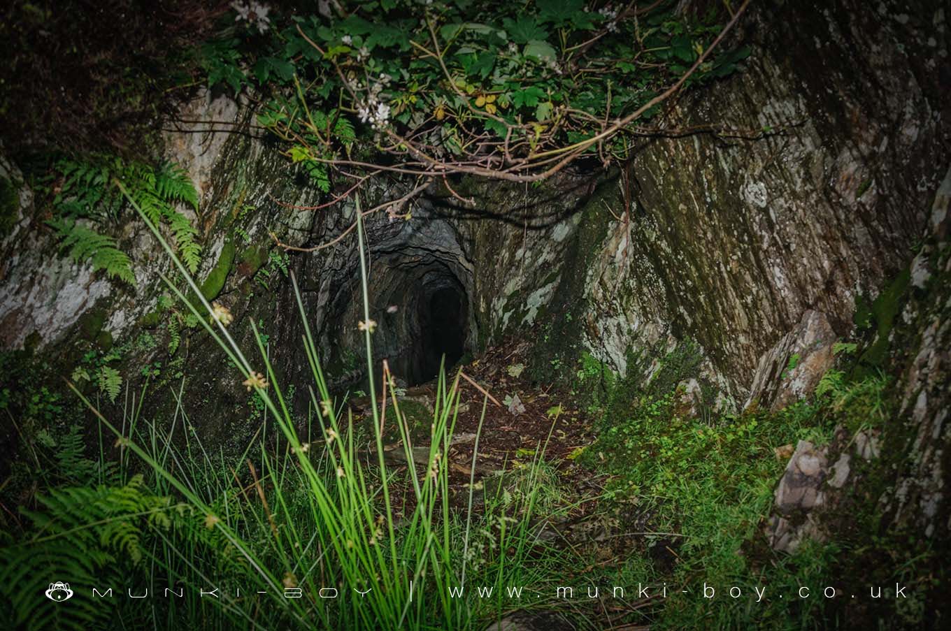
This is actually the leat system used to carry water from Tilberthwaite Gill down to the waterwheel at Penny Rigg Copper Mill.
Part of the old leat is accessible (dangerous) from within the Penny Rigg Quarry and is a constructed section as it passes below the quarry floor. Other sections must have been mined or tunneled through the rock surrounding the quarry.
This section lead through beneath the quarry wall and down to a small pond that fed the waterwheel and is now flooded and blocked at the quarry end by fallen rock.
Created: 27 November 2016 Edited: 29 November 2023
Penny Rigg Quarry Adit
Penny Rigg Quarry Adit LiDAR Map

Contains public sector information licensed under the Open Government Licence v3.0
Local History around Penny Rigg Quarry Adit
There are some historic monuments around including:
Dike, circles and cairns on Bleaberry HawsTwo rifle ranges on Silver HowLong Intakes medieval dispersed settlement and associated kiln 370m south of Fell FootRound cairn, 460m south west of Thompson GroundRoman road in Wrynose BottomGreenburn copper mines and associated ore processing worksRifle Range target and Marker's Hut, 150m north west of Blea MossCastle Howe hillfort, Little LangdaleTwo bloomeries, 340m and 570m NNE of Hoathwaite Landing on Coniston WaterMoot mound at Fell Foot Farm, Little LangdaleRoman road up Wrynose PassCairns on Foul ScrowMickleden Beck prehistoric cairnfield and field system, funerary cairn and a medieval dispersed settlement centred 840m south west of Pike of StickleThe Langdale Boulders, two prehistoric rock art sites in Great Langdale 250m south of Harry PlaceCairns and enclosure on The Rigg, BanisheadYewdale lime kiln 380m south west of Low YewdaleConiston copper minesSeven Intakes medieval dispersed settlement 210m south west of Fell Foot.