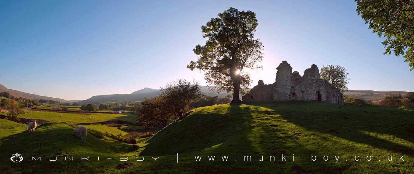
Pendragon Castle by munki-boy
Pendragon Castle
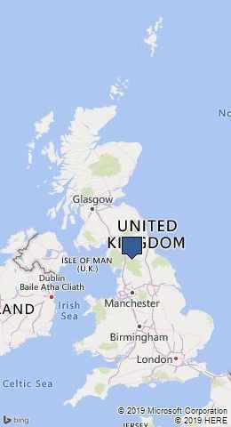
Pendragon Castle is in The Yorkshire Dales National Park in England.
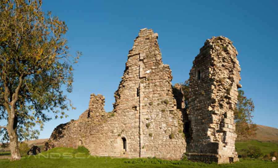
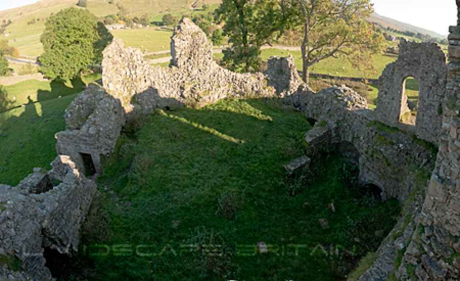
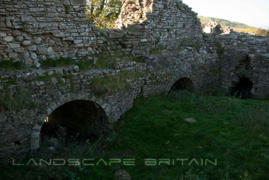
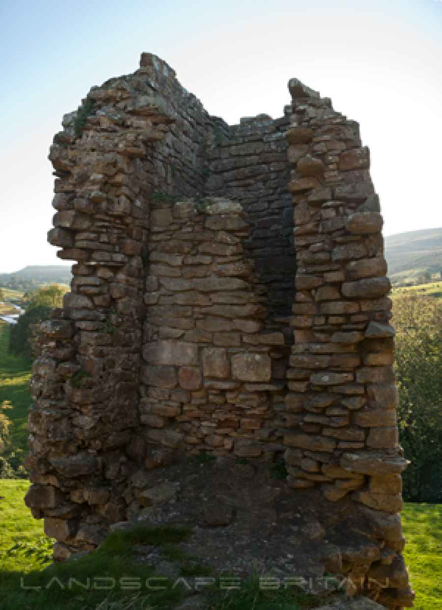
A small castle in a somewhat fragile state, but very interesting all the same. The castle is a roughly square shape with a tower in one corner that has been added at a later date. There is also evidence of some modification around what was presumably the entrance. There is much loose stone and uneven flooring so care must be taken. The interior of Pendragon Castle is filled with debris and soil covered with grass, it is much higher than the ground level of the surrounding landscape.
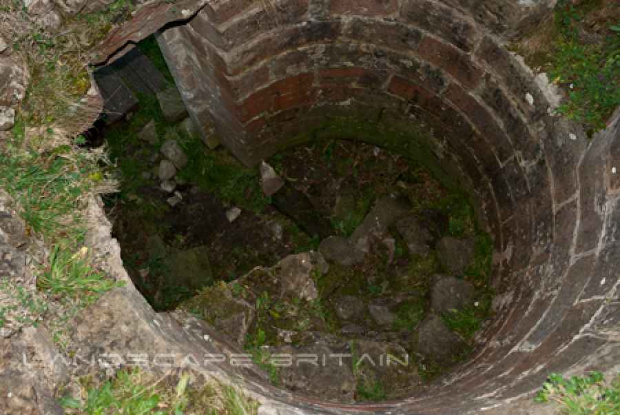
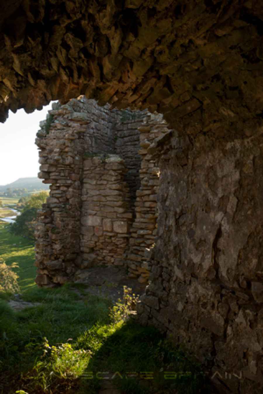
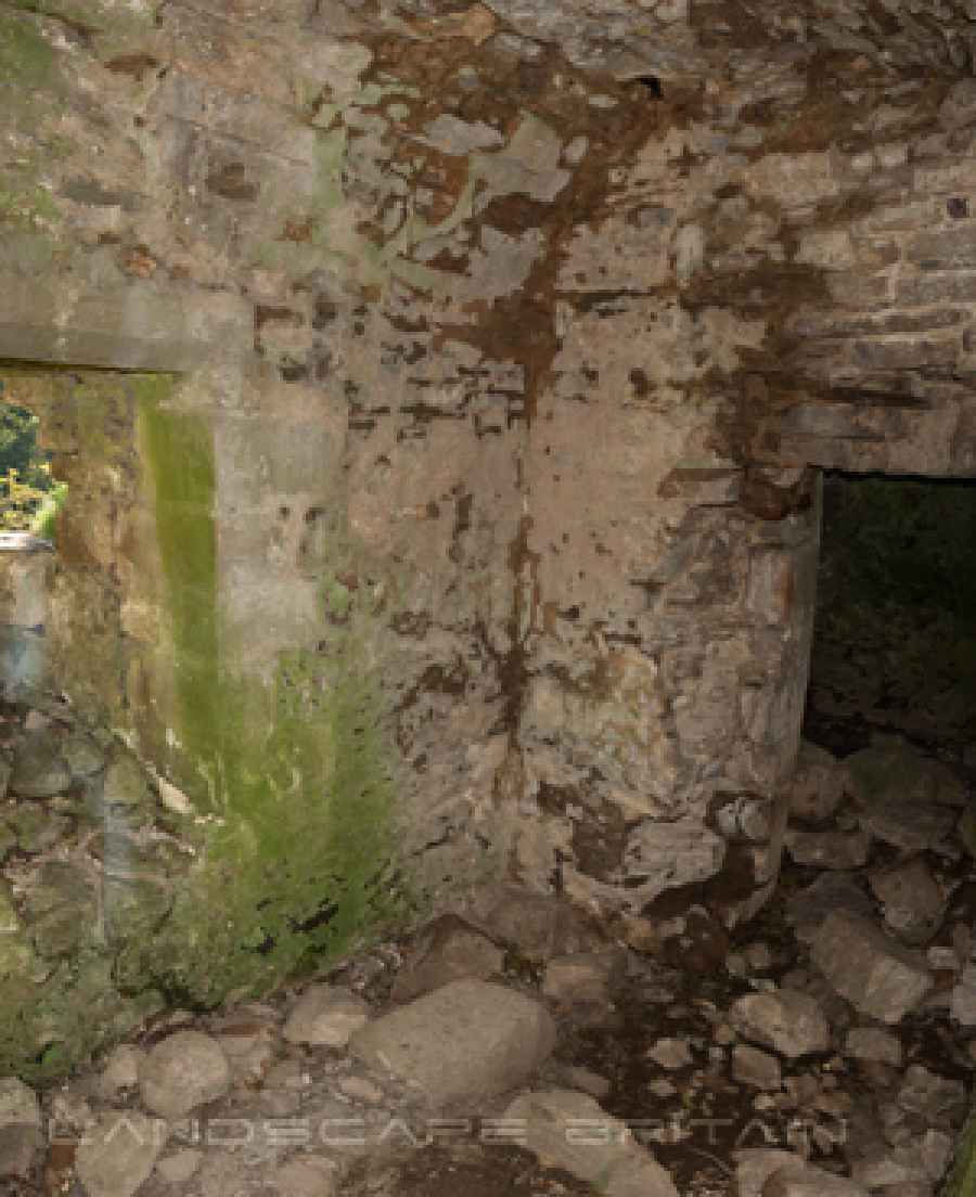
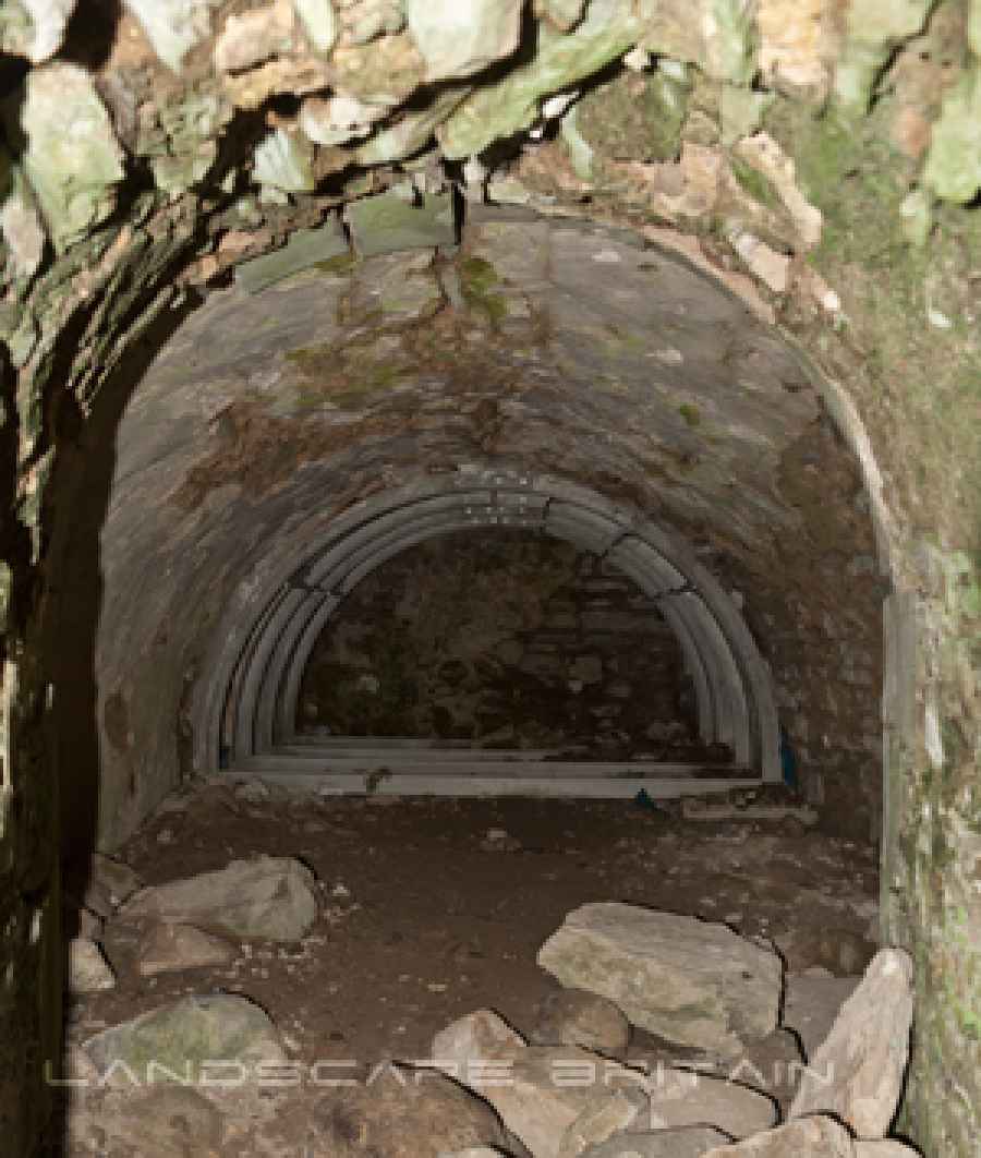
Apparently there are local rumours of a secret tunnel at Pendragon Castle, this may be possible but I expect it would be difficult to locate due to the quantity of soil and rubble filling the interior ground floor area of the castle. The thick tower walls still contain several well preserved vaulted chambers. It is possible that these chambers were at one time buried beneath the soil level and became lost. Alternatively there could be some real hidden tunnel, dungeon, cellar or well that is now buried. There are many small chambers below Pendragon Castle, either small rooms or for access to arrow loops. Most are reasonably intact but one chamber has a modern metal reinforcement inside.
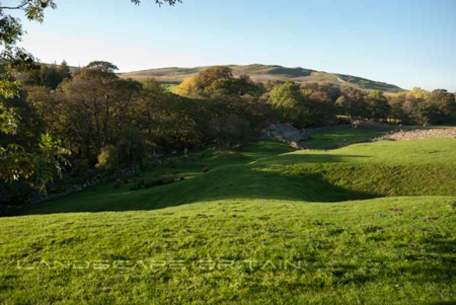
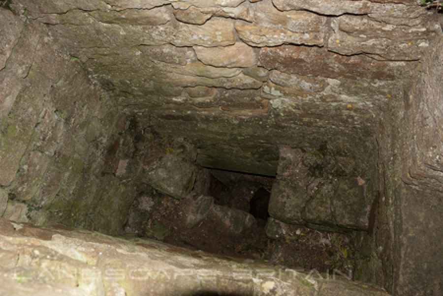
The crumbling tower was apparently a later addition to Pendragon Castle and was in fact a garderobe or toilet. A chute like a chimney was used to transport waste out through a hole in the bottom. There is one room remaining partially intact in the upper part of the castle, the room has one small window or arrow loop and an arched ceiling, similar to the chambers on the lower level. Moat-like earthwork ditches surround the castle.
Created: 27 November 2016 Edited: 29 November 2023
Pendragon Castle
Pendragon Castle LiDAR Map

Contains public sector information licensed under the Open Government Licence v3.0
Local History around Pendragon Castle
There are some historic monuments around including:
Lammerside Castle medieval tower houseCroglam Castle defended Iron Age settlementRomano-British farmstead 670m ESE of WhingillSettlement N of Hartley QuarriesHartley Castle and associated earthworksRookby Scarth medieval settlementGiants' Graves, four pillow mounds 300m south east of White Brackens HouseThree round cairns 190m south of White Brackens HouseRound barrow 1/4 mile (400m) N of Lammerside CastleRomano-British farmstead 700m east of WhingillWhitber Romano-British farmstead 660m south west of Highmore HillWaitby Castle enclosed Romano-British settlement and part of a medieval dykeTwo Romano-British enclosed settlements and an associated regular aggregate field system at Waitby IntakePendragon CastleIntake Bottom settlement enclosure and hut circle, 500m WSW of Croglam CastleRound barrow 1/4 mile (400m) N of Wharton HallRound cairn on the summit of Rasett HillWharton Hall, gatehouse, banqueting hall and kitchenRomano-British farmstead 650m south east of WhingillRound barrow 200yds (180m) NE of Hell Gill HoweWaitby medieval village, part of associated open field system, and site of an associated chapelLynchets WNW of Wharton Hall.