Peel Park - Bradford by Karam-Alani
Peel Park
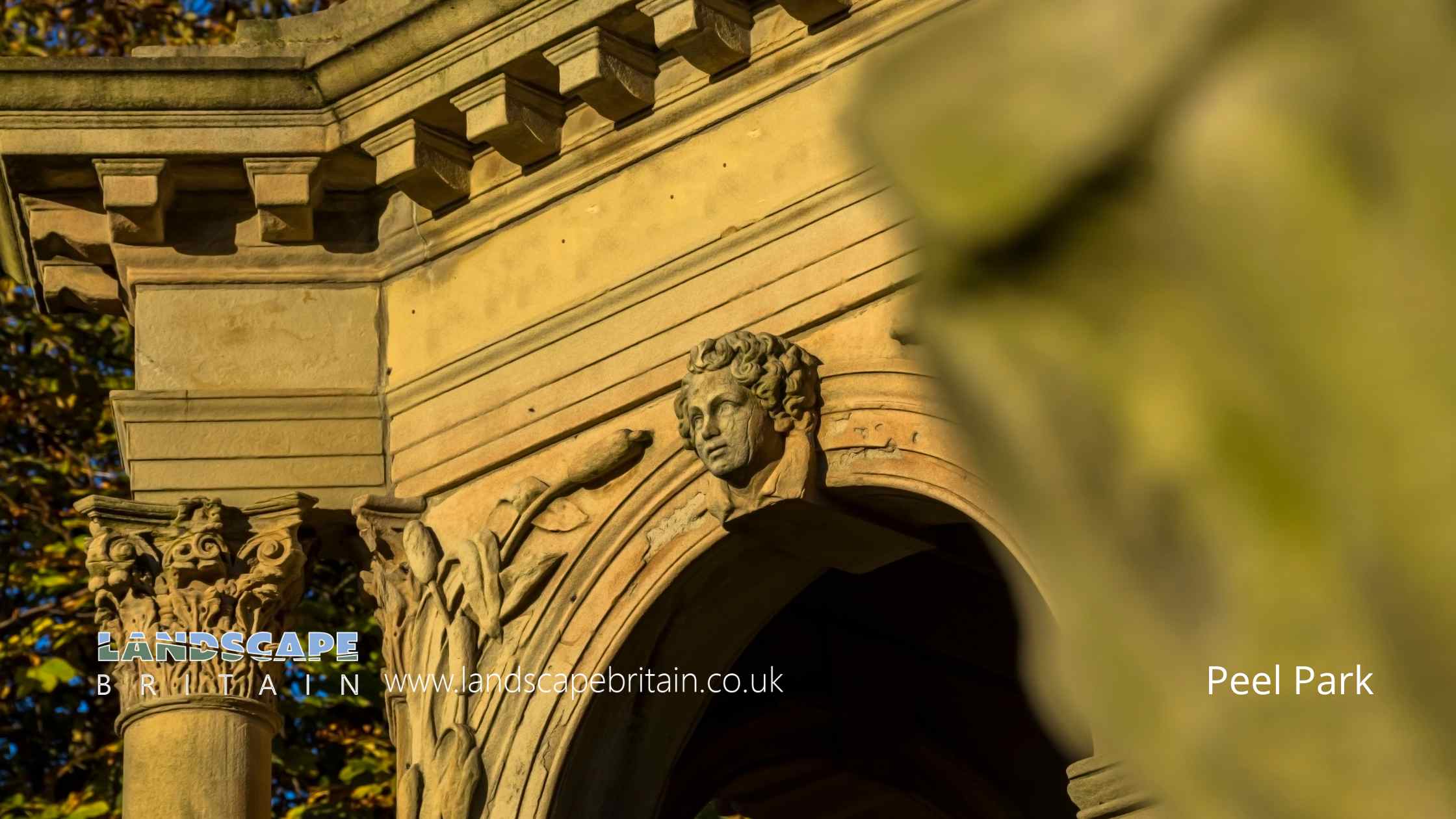
Peel Park, nestled in the heart of Bradford, West Yorkshire, is a splendid oasis of green in the midst of urban surroundings, offering a refreshing retreat for both city dwellers and visitors. Named after Sir Robert Peel, the park was one of the first public parks in England, officially opened in 1853, and is a testament to the Victorian era’s commitment to public recreational spaces. Its historical significance is mirrored in its classic layout and design, featuring expansive lawns, ornate flower beds, and winding pathways that invite leisurely strolls.
One of the park’s most striking features is the ornamental lake, a serene focal point surrounded by mature trees and vibrant plantings, creating a picturesque setting for relaxation and contemplation. The park also boasts a variety of facilities, including play areas for children, sports pitches, and a bowling green, making it a versatile destination for families and sports enthusiasts alike. The grandeur of the Victorian bandstand, restored to its former glory, adds a touch of elegance and nostalgia, often serving as a gathering point for community events and concerts, filling the park with music and festivity.
Throughout the year, Peel Park becomes a hub of activity, hosting various events and programs that celebrate the cultural diversity and community spirit of Bradford. From outdoor theater performances and art installations to community festivals and educational workshops, the park actively fosters a sense of community and engagement. The landscape of the park changes with the seasons, offering a dynamic beauty whether in the vibrant blooms of spring, the lush greenery of summer, the rich hues of autumn, or the stark, frosty elegance of winter.
Furthermore, Peel Park holds an important place in the academic and social life of the city, being adjacent to the University of Bradford. This proximity creates a unique blend of students, academics, and local residents, all enjoying and contributing to the park’s vibrant atmosphere. The park not only provides recreational space but also serves as a green “lung” in the urban environment, contributing to the wellbeing and quality of life of those who visit. In this way, Peel Park stands not just as a historical landmark but as a living, breathing part of Bradford’s urban landscape, cherished by all who wander its paths, relax by its lake, or simply enjoy the green, peaceful spaces it offers amidst the bustling city life.
Created: 27 October 2023 Edited: 5 January 2024
Peel Park
Local History around Peel Park
There are some historic monuments around including:
Carved rock near north east corner of Glovershaw quarryCup marked rock 60m south west of the War Memorial at Crowgill ParkRock with large number of cup marks south of Dobrudden caravan parkCup-marked rock on slight bank north east of Glovershaw quarryCup-marked bedrock near Old Glen HouseCup and ring marked rock in Dawson Wood, 370m north east of Heaton ShayCup and groove marked rock north of Birch Close Farm house, High EldwickSmall carved rock in path east of Glovershaw quarryCarved rock in the wall at north edge of Otley Road north west of the Fleece InnCup marked rock 71m south east of Dobrudden caravan parkSouthernmost of two cairns east of Glovershaw quarryCarved rock in Hawksworth SpringPrehistoric enclosure, carved rocks and orthostat wall, Buck Wood, 195m west of football groundCup-marked rock west of confluence of Lodepit Beck and Glovershaw BeckCarved rock in spoil of shaft mound south east of Dobrudden caravan parkCup and ring marked rock east of Eaves Crag, Baildon MoorRock with single cup mark south of Dobrudden caravan parkCarved bedrock close to road north east of the public toilets on Bracken Hall GreenCup and ring marked rock at Hoyle Court Drive, CharlestownBoulder with prehistoric rock art at Glovershaw FarmCarved rock in field behind Bracken Hall FarmOwlcotes deserted medieval villageCup and ring marked rock north of Pennythorn HillCup marked rock in Calverley Wood, 200m north east of junction of Calverley Cutting and Thornhill DriveCarved rock above Bracken Hall Crag, north of the bottom of the track to Mitton SpringRock with single cup mark between road and Pennythorn HillRound cairn on east flank of Baildon HillNorthernmost of two cairns east of Glovershaw quarry, including adjacent cup-marked rockCup and groove-marked rock on east edge of Glovershaw quarryCup and ring marked rock 40m south east of Hillcourt, RawdonRock with one cup mark north east of the Cricketers' Arms, Baildon GreenRoadblock, Bracken Hall Green, Baildon MoorCup and ring marked rock at Faweather Farm, High EldwickEnclosed settlement known as `Soldier's Trench' including a cup-marked rockSmall cup-marked rock 30m east of Glovershaw quarryCup marked rock 180m north of the covered reservoir at BaildonCairnfield including ring cairn and carved rocks on Low Plain, Baildon MoorRound barrow and L-shaped earthwork on Baildon Golf CourseCup and groove marked rock in garden of Oakwood Barn, High EldwickCup-marked rock close to road south east of a small car park south east of Bracken Hall Farm.Cup and ring marked rock 42m south of Dobrudden caravan parkCup-marked rock between road and public toilets at Bracken Hall GreenRound cairn and curving bank on Pennythorn HillCup marked rock and round cairn south east of Dobrudden caravan park.


