Parrock Quarry by munki-boy
Parrock Quarry
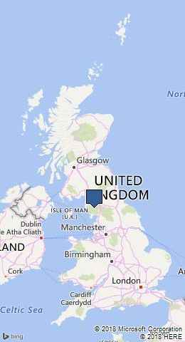
Parrock Quarry is in The Lake District National Park in England.
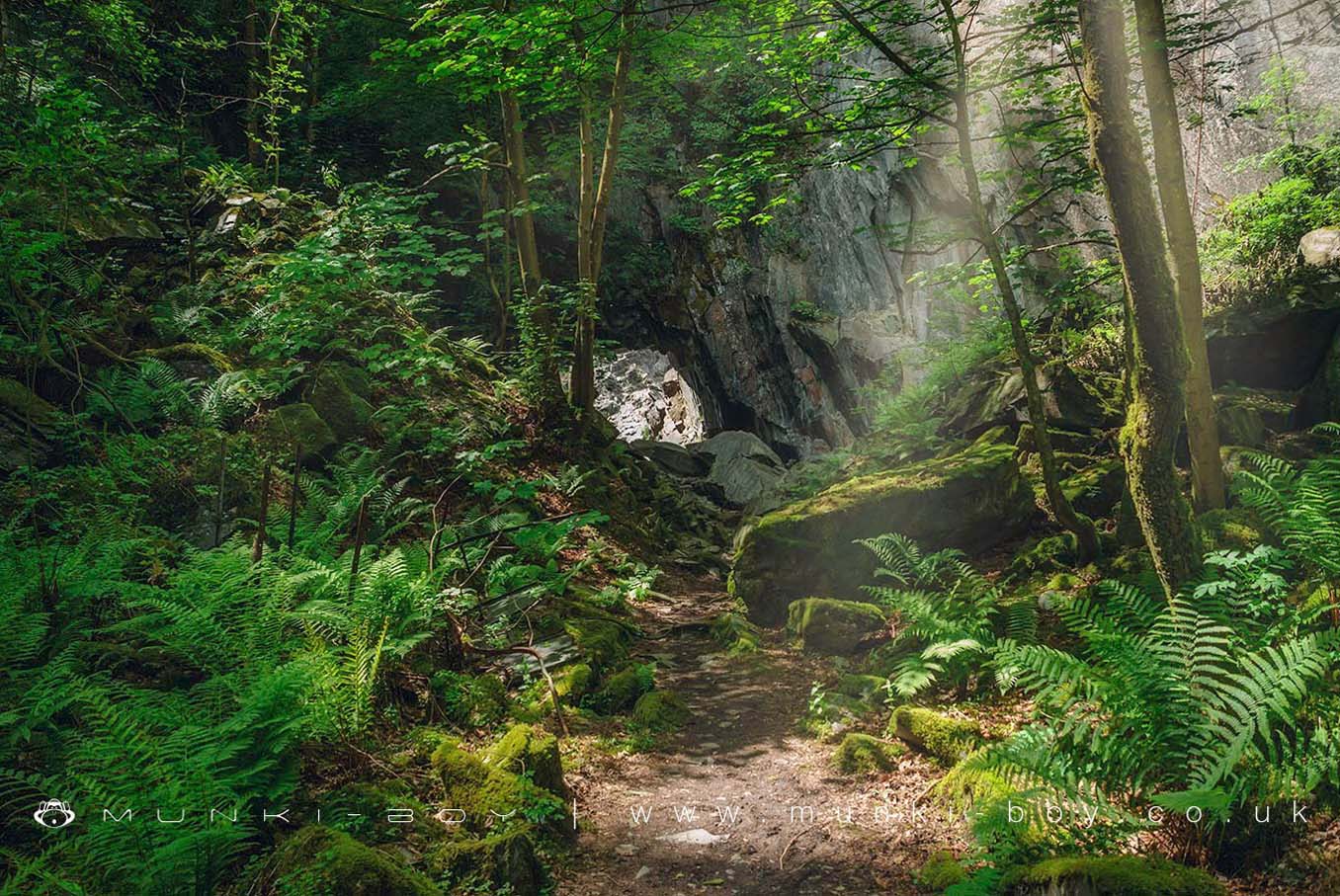
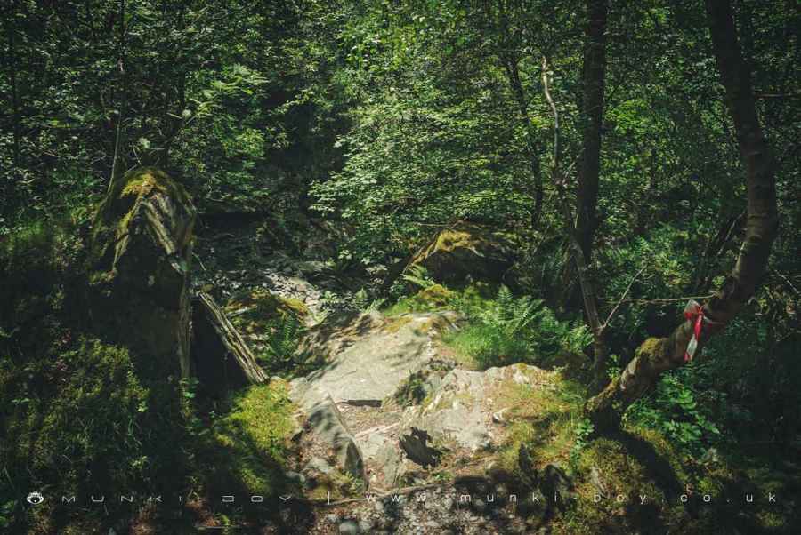
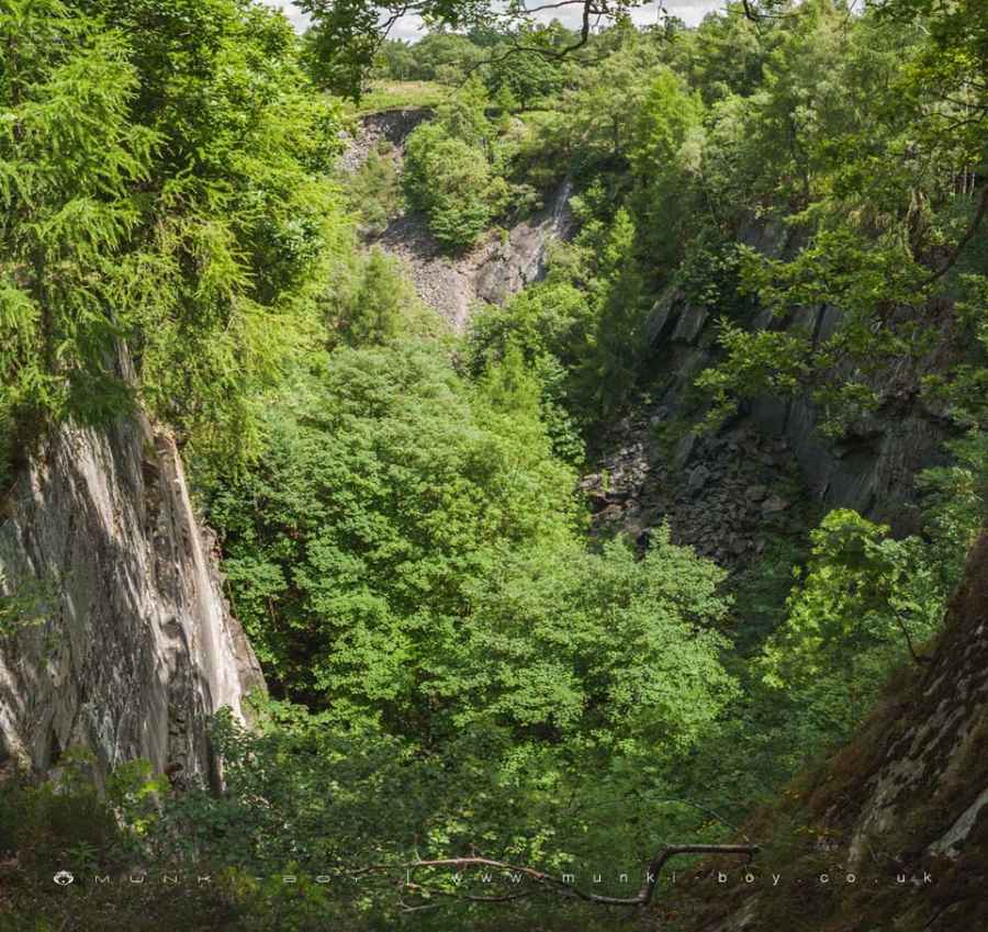
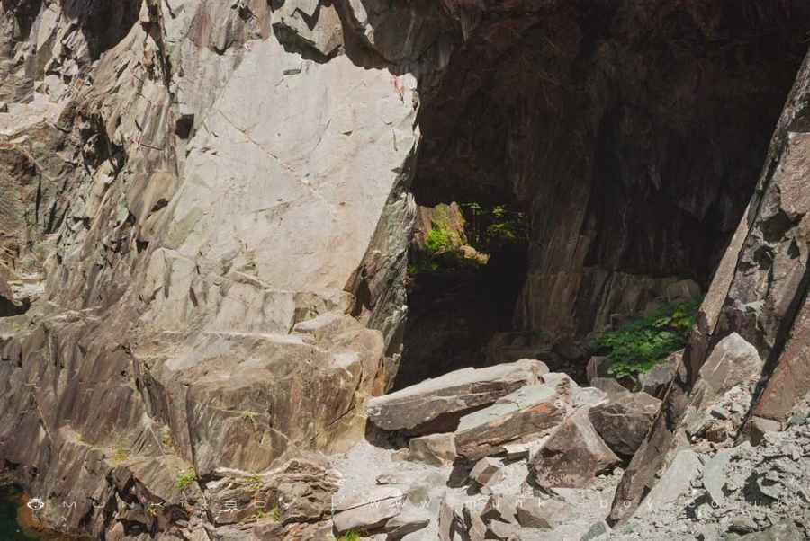
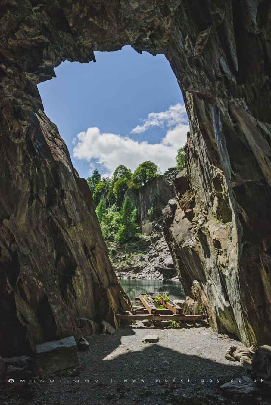
Parrock Quarry is quite deep with steep sides and a lot of vegetation hiding industrial remains, some litter and a fascinating number of cave-like tunnels, some of which give access to the water level of adjacent Hodge Close.
Parrock Quarry is probably quite dangerous if you’re not used to such things or if you’re unlucky, rockfalls, jagged rocks, falling onto jagged rocks ets. Access without getting wet or abseiling is steep and rocky, besides the risks, it’s a very interesting and often good-looking site to explore.
“DANGER - STEEP UNFENCED ROCKFACES - DEEP WATER - Roofing slate has been quarried here for over 200 years please respect this area and be aware of all possible dangers” National Park Authority and Leconfield Estates
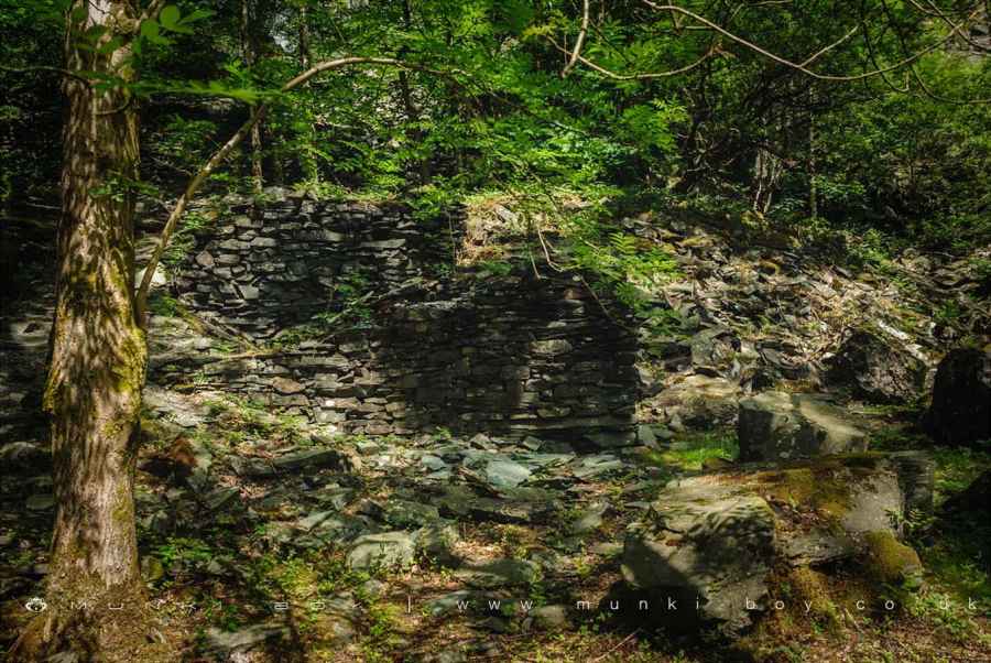
The quarry itself is an excellent explore, especially if combined with its neighbor. There’s quite a lot of ironwork around the quarry floor and a few small trials but the best bit has to be the large holes cut into the rock to give access to Hodge Close. It’s probably the only way to reach the shore on this side without swimming or using a boat. There are huge rusting tracks or maybe collapsed cranes on the ground and a lot of other industrial ironwork.
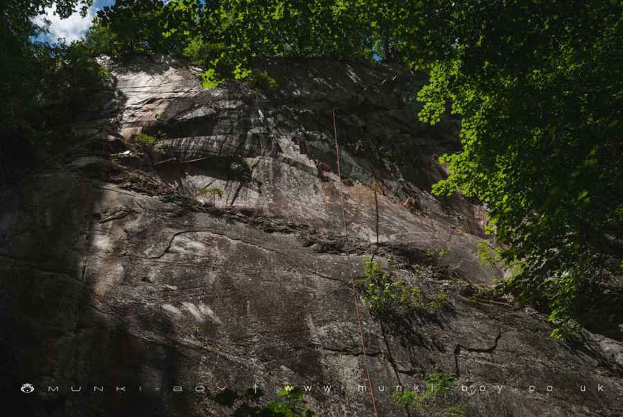
As with a lot of rock faces round here, Parrock Quarry is popular with rock climbers.
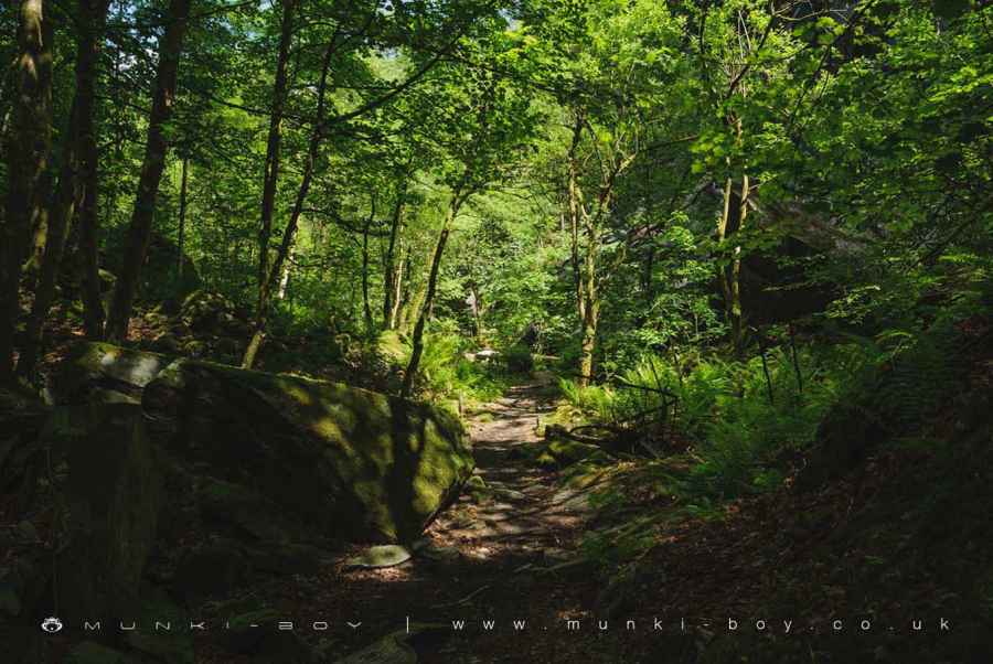
Parrock Quarry is notably verdant in Spring and Summer with lots of ferns giving an exotic, jungle look. Great for photography on the right day.
Created: 27 November 2016 Edited: 29 November 2023
Parrock Quarry
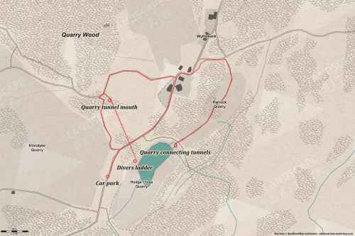
Parrock Quarry LiDAR Map

Contains public sector information licensed under the Open Government Licence v3.0
Walks in Parrock Quarry
Local History around Parrock Quarry
There are some historic monuments around including:
Rifle Range target and Marker's Hut, 150m north west of Blea MossRoman road up Wrynose PassSeven Intakes medieval dispersed settlement 210m south west of Fell FootLong Intakes medieval dispersed settlement and associated kiln 370m south of Fell FootCairns and enclosure on The Rigg, BanisheadCastle Howe hillfort, Little LangdaleTwo bloomeries, 340m and 570m NNE of Hoathwaite Landing on Coniston WaterCairns on Foul ScrowRoman road in Wrynose BottomTwo rifle ranges on Silver HowLead mine and ore works at Greenhead Gill, GrasmereRound cairn, 460m south west of Thompson GroundThe Langdale Boulders, two prehistoric rock art sites in Great Langdale 250m south of Harry PlaceMoot mound at Fell Foot Farm, Little LangdaleYewdale lime kiln 380m south west of Low YewdaleConiston copper minesGreenburn copper mines and associated ore processing works.