
Ogden Water Country Park
Ogden Water Country Park
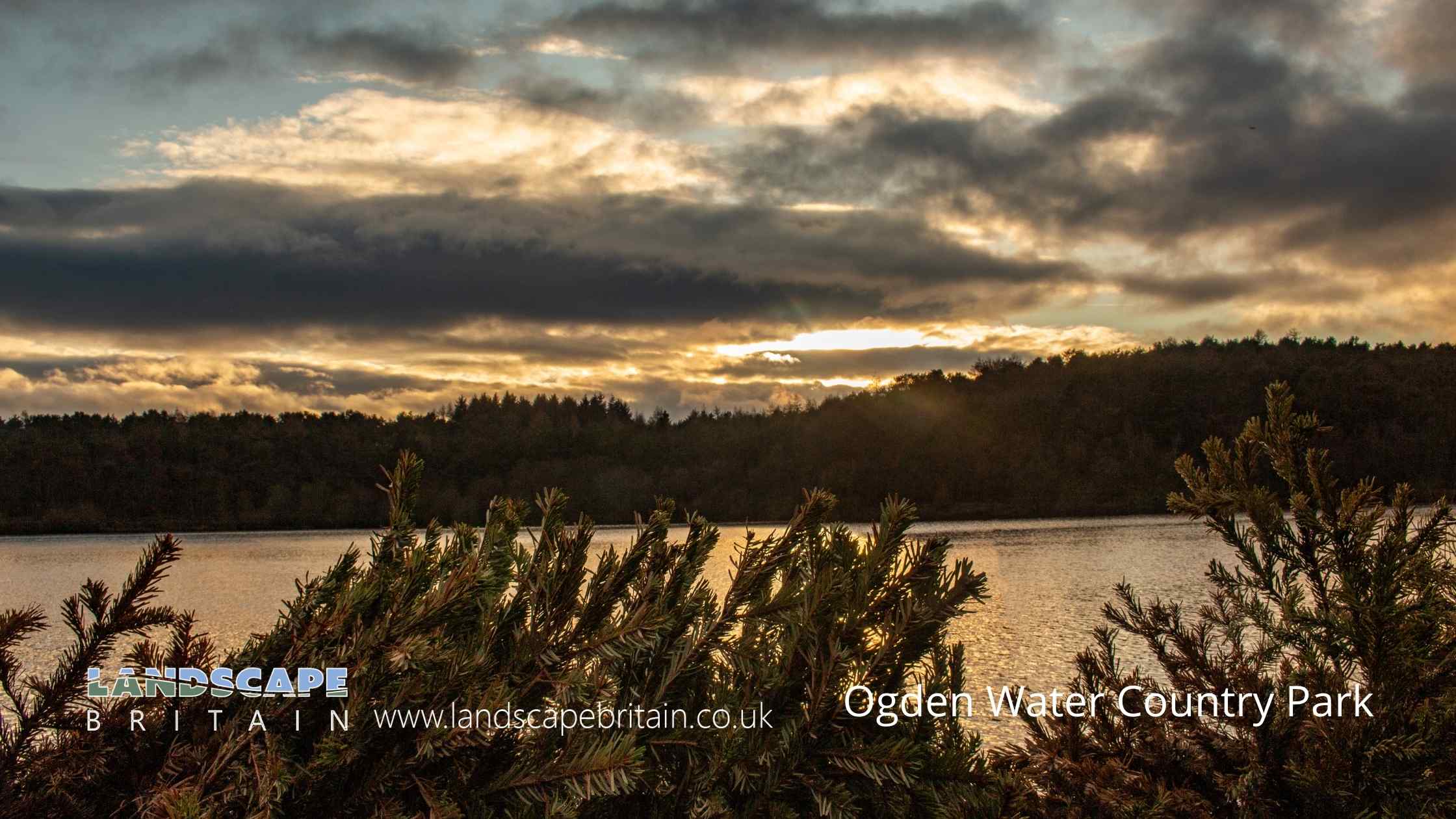
Ogden Water Country Park is based around Ogden Water or Ogden Reservoir as it is now known.
Located to the north of Halifax, Ogden Water Country Park is a stunning nature reserve that is perfect for a day out with the family. With its beautiful lakeside views, verdant landscape and ample opportunities for walking and picnicking, the park is a great place to relax and take in the natural beauty of West Yorkshire.
There are several trails that wind their way through the park, so you can explore at your own pace. The Water Walk Trail is a short but scenic route that takes you around the lake, while the Woodland Walk Trail offers a more challenging hike through the woods. Whichever trail you choose, you’re sure to be rewarded with some stunning views.
So why not come and enjoy a day out in Ogden Water Country Park? It’s the perfect place to escape the hustle and bustle of everyday life and connect with nature.
Created: 7 August 2022 Edited: 29 November 2023
Ogden Water Country Park Information
Ogden Water Country Park Address
Ogden Ln, Halifax HX2 8XZ, UK
HX2 8XZ
Website: https://www.ogdenwater.org.uk/
Get directionsLocal History around Ogden Water Country Park
There are some historic monuments around including:
The gibbet platformLate prehistoric enclosed settlement 350m south west of Goose Clough at Hunter Hill, OvendenLate prehistoric enclosed settlement known as Catstones Ring on Catstones HillCairn known as Millers Grave on Midgley MoorLate prehistoric enclosed settlement known as Castle Stead RingMill gas plant, Shaw Lodge MillsCup marked boundary stone known as Churn Milk Joan on Crow Hill, Midgley Moor, 580m north of Foster Clough BridgeVentilation chimney and furnace house 260m south of Park FarmRing cairn on Midgley Moor, 360m north east of Upper Han RoydCairn with an oval bank on Midgley Moor, 430m north east of Upper Han RoydLate prehistoric enclosed settlement 150m north of Shaygate Farm, WilsdenEnclosed Bronze Age urnfield 160m west of Overgreen Royd Farm, MixendenFive carved rocks in Cottingley Woods, 600m NNE of Lee FarmCairn on Midgley Moor, 400m north east of Upper Han RoydBrow Pit mine shaft, gin circle, spoil heap and tramway, 270m south west of Catherine Slack FarmCastle Hill motte castle 270m north east of Rosemary HallLate prehistoric enclosed settlement 500m north west of Goose Clough on Ovenden Moor.


