Norton Tower (ruin) by munki-boy
Norton Tower (ruin)
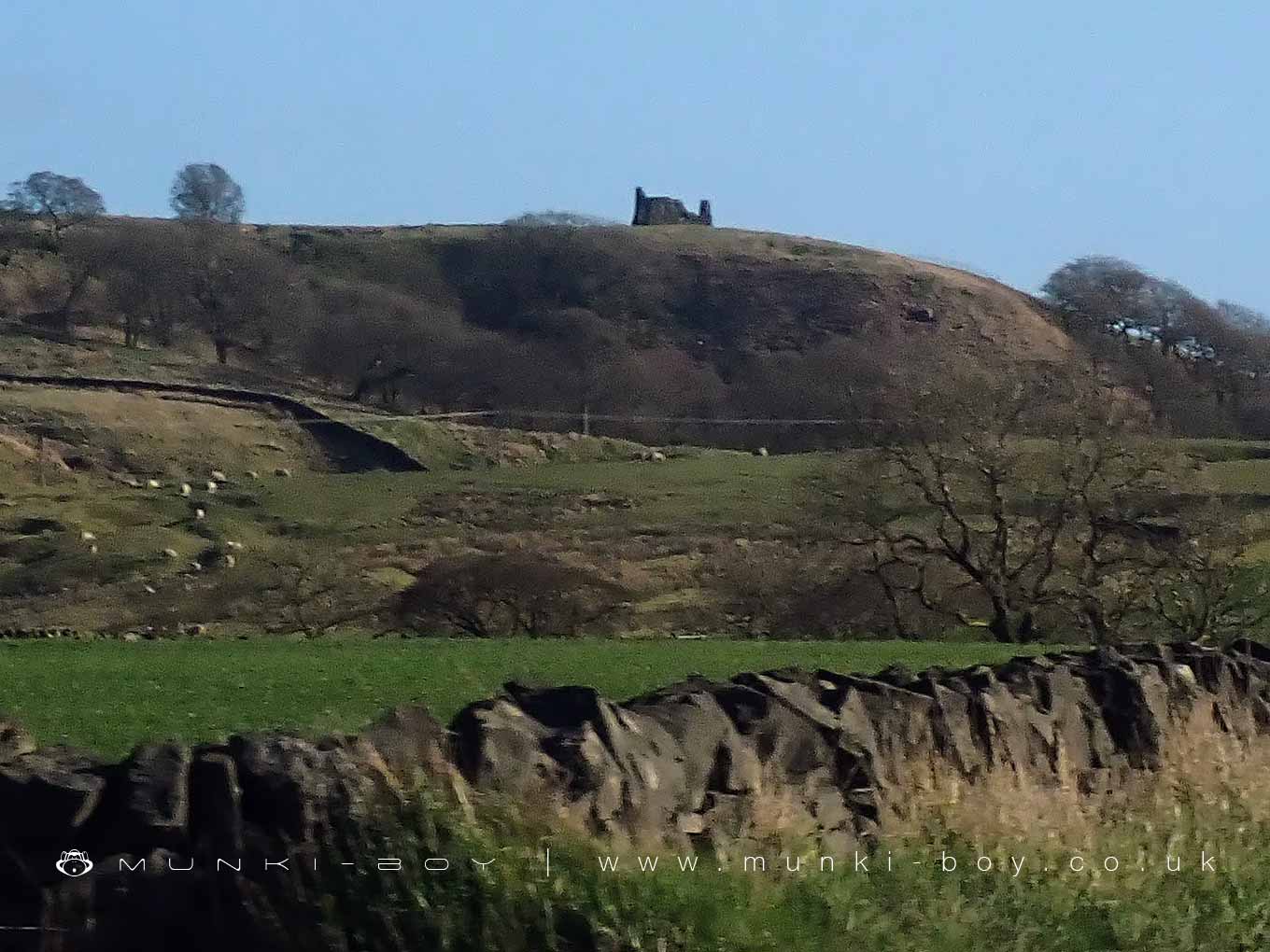
Norton Tower (ruin) is in The Yorkshire Dales National Park in England.
The ruins of Norton Tower stand in open countryside near Rylstone in North Yorkshire. This Grade II listed structure dates back to the 16th century and was built for Richard Norton, a member of the powerful Norton family, who held estates at both Rylstone and Norton Conyers. The building was originally used as a hunting lodge, reflecting the family’s high status and their use of the surrounding moorland for sport and leisure.
The structure is built from coursed gritstone and was originally square in plan, measuring approximately 10 by 15 metres. Today, only parts of the building remain. The corners still stand to a height of around three metres, but most of the walls have been slighted or reduced, leaving the interior open to the elements. It is believed that the original entrance was on the south side. On the east side of the ruin, the remains of a fireplace and a stone newel stair can still be seen, though no windows have survived.
Norton Tower does not stand in isolation. It is part of a wider archaeological site that includes earthworks associated with rabbit warrens, sometimes called pillow mounds, as well as what are thought to be prehistoric field clearance cairns to the south. These features suggest long-term use of the landscape, spanning from prehistoric agricultural activity to Tudor hunting practices.
The lodge was abandoned and damaged after the Norton family took part in the Rising of the North in 1569—a Catholic rebellion against Elizabeth I. Following the failure of the uprising, the family fell from favour and their properties, including Norton Tower, were either confiscated or deliberately slighted to prevent further use.
Today, the site is a ruin, but it offers a glimpse into the turbulent history of the region and the rise and fall of one of its prominent families. It remains a quiet, atmospheric spot, often visited by walkers exploring the nearby moors and hills.
Created: 3 April 2025 Edited: 3 April 2025
Norton Tower (ruin)
Norton Tower (ruin) LiDAR Map

Contains public sector information licensed under the Open Government Licence v3.0
Local History around Norton Tower (ruin)
There are some historic monuments around including:
Rock with at least 15 cups 240m south of Great Wood Laithe, Horse Close HillCup and ring marked rock in wall at High Snaygill 80m east of High LaitheRock with one cup in field south east of Great Wood Plantation, 450m north east of Cawder Hall Farm, Horse Close HillScale Hill round cairnMedieval farmstead and field system, 530m south east of The GrangeHigh Wood bowl barrowRock with one cup in east end of Great Wood Plantation, 375m NNE of Cawder Hall Farm, Horse Close HillCarved rock on bank at side of track opposite Garth House, 60m south west of Snaygill FarmLinton churchyard cross and sundialRedmayne packhorse bridgePrehistoric unenclosed hut circle settlement and associated field system at Little WoodPark Hill earthworkRoman villa at Kirk SinkHydro-electric power house and associated weir 250m north west of Tin BridgeCalton Gill round cairnPillow mounds east of Friars Head, known as Giants' GravesCup marked rock in wall east of Scarnber Wood, 500m north east of Bark Laithe, WinterburnMoated site W of Paget HallRock with one cup at the base of a wall, 250m NNE of Cawder Hall Farm, Horse Close HillTwo carved rocks in field 130m north east of Cawder Hall Farm, Horse Close HillSubcircular enclosed settlement on Horse Close Hill 250m north of Horse Close FarmRock with at least one cup mark 310m east of Cawder Hall Farm.


