Bradwell Windmill
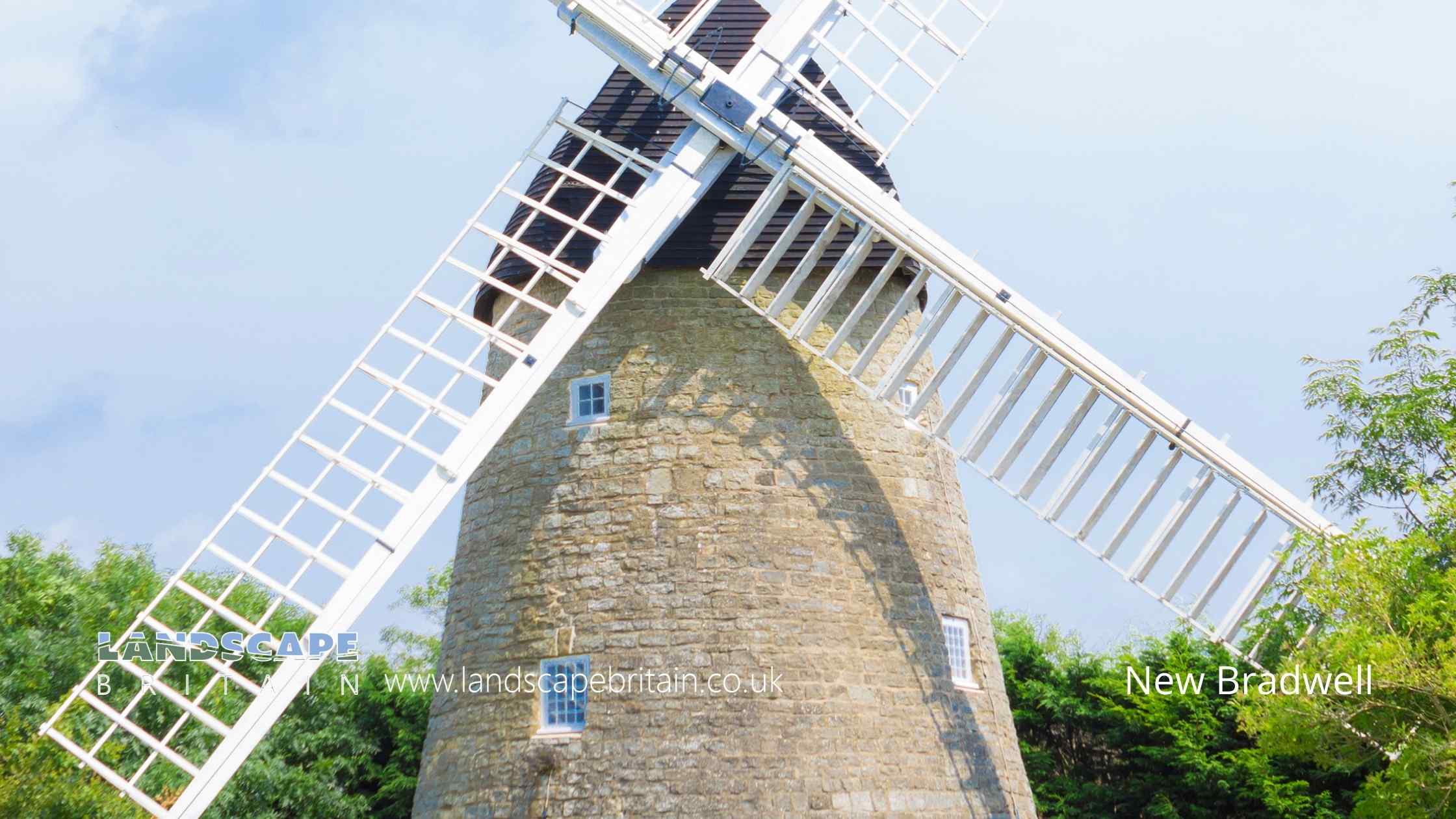
New Bradwell
New Bradwell is a village in Milton Keynes with a well-known windmill. The village contains many old thatched cottages, an ancient church and a pub. It is located on the Ouse Valley Way and is popular with walkers and cyclists.
The windmill in New Bradwell is a Grade II listed building. It was built in 1847 and has been used as a flour mill, a corn mill and a sawmill. It is now owned by Milton Keynes Council and is open to the public.
The ancient church of St James is another Grade II listed building in New Bradwell. It dates from the 13th century and contains some beautiful medieval stained glass windows. The church also has a unique feature known as the ‘Ducking Stool’. This was used to murder women in the river who were suspected of being witches!
Created: 4 October 2022 Edited: 29 November 2023
Bradwell Windmill Information
Bradwell Windmill Address
5 Mill Ln, Bradville, Milton Keynes
MK13 7JH
Website: http://www.miltonkeynesmuseum.org.uk/home/bradwell-windmill/
Get directionsLocal History around New Bradwell
There are some historic monuments around including:
Moated site, fishpond and associated earthworks 150m west of Loughton ManorMoated site, fishponds and associated earthworks 150m south-east of Haversham ManorSnelshall Benedictine Priory: a moated priory site and fishponds north of Briary PlantationRemains of the church and churchyard of St Mary MagdalenMoated site and fishponds at Great WoolstoneMoated site and associated fishpond south of Mill LaneThe Toot: a motte and bailey castle and later manorial complex 450m south west of St Mary's ChurchMoated site, fishponds and deserted medieval village of Tattenhoe, 300m west of Home Park Farm.Moated site 70m south of Long Plantation, Hanslope ParkBradwell castle mound: a motte and bailey castle 80m north east of St. Lawrence's Church.Moated site with associated earthworks, 770m south of St Mary's Church, south of the junction of Childs Way and Fulmer StreetCivil War defences in Bury FieldA bowl barrow on Church Hill 200m south of churchWolverton iron trunk aqueductGreat Linford BrickworksBradwell Abbey: a Benedictine priory, chapel and fishpondMotte and bailey castle, deserted village and monastic grange at Old WolvertonShrunken Medieval Village, Woughton on the GreenSecklow Hundred mound: a moot at the junction of North Row and North Ninth Street.A medieval manorial complex comprising a twin moated site, fishpond and associated earthworks 750m west of St Mary's ChurchTyringham BridgeCastlethorpe Castle: a motte and bailey, possible ringwork and associated earthworks 200m south-east of Castlethorpe LodgeRoman villa SE of Cosgrove HallMoated site and fishpond at Old Rectory Farm.Bradwell Bury: a moated site and associated manor house remains at Moat HouseGroup of ring ditches and enclosures at Tyringham.


