Middleton-in-Teesdale
Middleton-in-Teesdale
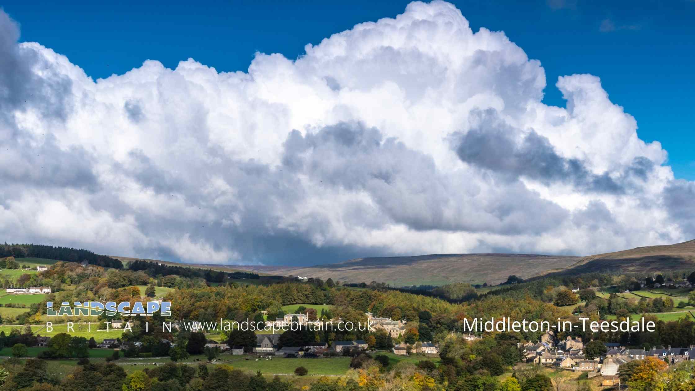
Middleton-in-Teesdale is a charming market town located in the heart of the stunning North Pennines Area of Outstanding Natural Beauty in County Durham, England.
Explore the Outdoors: Middleton-in-Teesdale is the perfect destination for outdoor enthusiasts, with numerous walking and cycling trails to enjoy. The town is located close to the beautiful High Force waterfall, which is a must-see attraction for visitors.
Visit the Local Shops: Middleton-in-Teesdale has a selection of independent shops and cafes to explore, including an art gallery, gift shops, and a bakery. Take a stroll along the main street and pop into the local businesses to get a feel for the town.
Take a Historical Tour: The town has a rich history, with buildings dating back to the 17th and 18th centuries. You can take a guided tour of the town to learn about its history, including its mining heritage.
Visit the Bowes Museum: Just a short drive from Middleton-in-Teesdale is the Bowes Museum, which is home to an impressive collection of art and artifacts. The museum is housed in a beautiful French-style chateau and is definitely worth a visit.
Enjoy Local Cuisine: There are a number of pubs and restaurants in Middleton-in-Teesdale that serve up delicious food using locally sourced ingredients. Try some of the local specialties, such as stotties, a type of bread, or Durham beef.
Overall, Middleton-in-Teesdale is a beautiful town that offers visitors a taste of rural England. It’s the perfect place to visit if you’re looking to get away from the hustle and bustle of city life and enjoy some time in the great outdoors.
Created: 20 April 2023 Edited: 29 November 2023
Middleton-in-Teesdale
Local History around Middleton-in-Teesdale
There are some historic monuments around including:
Cup marked rock outcrop at the base of a wall 120m east of East Loups's, Cotherstone MoorRing cairn on Goldsborough, Cotherstone Moor, 840m south of Pitcher HouseCup marked rock on the summit of the hill, 420m west of Howgill GrangePike Law lead hushes and minesTwo burnt mounds south of Blackmea Crag Sike, 590m south west of Castle HouseColdberry lead mine and associated hushesMedieval farmstead 330m north west of Water KnottThree prehistoric carved rocks on Goldsborough Rigg, Cotherstone Moor, 860m SSE Pitcher HouseRoman period native settlement and field system 260m west of Wynch BridgeCup and groove marked rock on Goldsborough Rigg, Cotherstone Moor, 920m south east of Pitcher HouseRock with one cup on Goldsborough Rigg, Cotherstone Moor, 860m north west of West Loups'sCup and ring marked rock on Goldsborough Rigg, Cotherstone Moor, 870m south south east of Pitcher HouseTwo burnt mounds 350m north east of Stotley GrangeBurnt mound at Knott Well 370m north east of Stotley GrangeA palisaded hilltop enclosure, a carved rock and a small enclosure, 480m north west of Brier Dykes, BaldersdaleGroup of eight shielings and a track on Crossthwaite Scars 675m north west of Park EndRoman period native farmstead at Hind Gate, 140m south of Green HouseCup and ring marked rock on Goldsborough Rigg, Cotherstone Moor, 860m south east of Pitcher HouseMedieval farmstead 390m south of Lodge Sike FarmA prehistoric carved rock with four cups 620m north of Brier Dykes, BaldersdaleCup and groove marked rock 590m north of Brier Dykes, BaldersdaleTwo Romano-British hut circles and three shielings on Holwick Scars 250m south of Hungry HallRomano-British and medieval settlement and field systems,leadmines and charcoal pit on Crossthwaite Common, south of Park End QuarryA group of six shielings and tracks on Holwick Scars, 280m west of Hungry HallBurnt mound between Knottwell Sike and Bell Sike, 420m north east of Stotley GrangeCup and groove marked rock on the south bank of Scaletree Gill, 560m north west of Park House Farm, BaldersdaleCup and groove marked rock 450m WNW of Howgill Grange, BaldersdaleCup and ring marked rock on Cotherstone Moor 520m north west of East Loups'sA carved rock with at least 12 cups, 560m north of Brier Dykes, BaldersdaleCup, ring and groove marked rock 310m west of East Loups's, Cotherstone MoorFour carved rocks on Blake Hill, 520m NNW of Hill Gill Farm, BaldersdaleMedieval iron industry and settlement and Bronze Age burial cairns extending from 260m north west of Eel Beck to 140m south east of Wash BeckPrehistoric settlement, two burnt mounds and a burial cairn on the north bank of Blackmea Crag Sike, 570m south west of Middle FarmMedieval linear earthwork, enclosures and farmstead and Bronze Age burnt mound 110m and 420m north west of Heatherlea.


