The Mayborough Monolith by munki-boy
Mayburgh Henge
Mayburgh Henge is in The Lake District National Park in England.
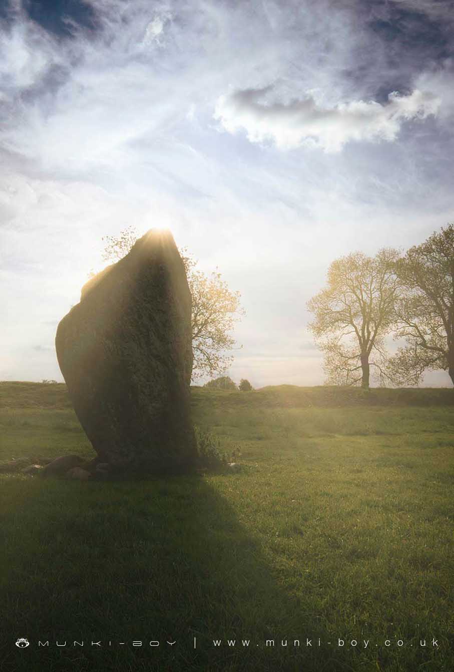
The monument is Mayburgh henge. It is located upon a low knoll of glacial drift a short distance from the confluence of the Rivers Eamont and Lowther, and includes a stone bank enclosing a flat circular area within which there is a large standing stone. The bank is composed of water-worn stones presumably removed from the River Eamont, and varies in size between 33.7m wide and 3.8m high externally on the northern side, to 45m wide and 7.3m high externally on the southern side. There is an entrance 12.5m wide on the eastern side which narrows to 6.2m wide as it approaches the interior. The henge is virtually circular in plan with a comparatively flat internal area measuring 90m from north to south by 87.5m from east to west. Approximately 10m north west of the centre of the monument is an upstanding granite stone measuring 2.79m high by 1.82m maximum width, which is the only survivor of eight similar stones recorded within the henge during the mid 17th century; four of which stood close to the centre and four of which were located in the entrance. An axe-head of brass or bronze was reportedly found during ploughing of the monument’s interior in the late 18th century, and about one hundred years later a broken polished stone axe of the Langdale type was found beneath the turf in the entrance. The monument is in the guardianship of the Secretary of State. Garden fences on the western side of the monument are excluded from the scheduling but the ground beneath them is included. Mayburgh henge is a very unusual type of henge; its enclosing bank is much larger and more monumental than is normally the case. Additionally it would not appear to have had an internal ditch. Despite the removal of some of the stones in the centre of the site and limited quarrying of the surrounding bank, this site survives well and remains a visually impressive monument in the landscape. It is also one of a group of three henges near the confluence of the Eamont and Lowther rivers. Extract from Record of Scheduled Monuments
Created: 27 November 2016 Edited: 29 November 2023
Mayburgh Henge
Mayburgh Henge LiDAR Map

Contains public sector information licensed under the Open Government Licence v3.0
Local History around Mayburgh Henge
There are some historic monuments around including:
Roman marching camp 450yds (410m) NE of BrovacumRomano-British settlement at Cragside WoodRing cairn on Askham Fell including The Cop StoneSewborrans standing stone 400m south west of SewborwensHolme Head standing stone 260m north west of Kitchenhill BridgeTwo round cairns 415m and 420m NNE of The Cockpit, Moor DivockLong cairn 330m east of MossthornRound cairn 280m south-east of The Cockpit stone circleRound cairn 285m south east of White Raise round cairn, Askham FellThe Giant's Thumb - Anglian high cross in St Andrew's churchyard, PenrithRound cairn 50m north east of White Raise round cairn, Askham FellLinear stone bank on Askham FellRoman camp north west of Balmer's FarmTwo standing stones and a round cairn south of CrooklandsBridge over Heltondale Beck 250yds (230m) SSW of WidewathRound cairn 520m north east of The Cockpit, Askham FellWhite Raise round cairn, Askham FellSkirsgill Romano-British enclosed stone hut circle settlement, Romano-British farmstead, and Romano-British regular aggregate field systemRing cairn on Askham Fell and four adjacent stonesLong cairn 370m ESE of Mossthorn FarmThe Cockpit stone circle and seven adjacent clearance cairns, Moor DivockKing Arthur's Round Table hengeBrougham Roman fort (Brocavum) and civil settlement and Brougham CastleCastlesteads multivallate prehistoric defended enclosureStrickland's Pele Tower and Penrith CastleSite of Catterlen Old HallRound cairn 515m south east of White Raise round cairn, Askham FellSt Ninian's preconquest monastic site, site of nucleated medieval settlement, St Ninian's Church and churchyardClifton Hall towerThe Countess PillarRound cairn 475m south east of White Raise round cairn, Askham FellRound cairn 660m north east of The Cockpit, Askham FellRound cairn 490m south east of White Raise round cairn, Askham FellStanding stone 180m NNE of SkirsgillRound cairn 580m north east of The Cockpit, Askham FellBowl barrow 350m north east of The WreayLong barrow on Trainford BrowThe Giant's Grave - Two Anglian cross-shafts and four hogback stones in St Andrew's churchyard, PenrithStone circle 800m east of Wetheriggs PotteryBowl barrow 850m WSW of Yanwath Woodhouse FarmEamont BridgeThe Old Kiln, Wetheriggs PotteryBridge over Heltondale Beck 550ft (170m) S of WidewathMoated site and annexe east of Setterahpark WoodRound cairn on Askham Fell, 270m north of The Cop StoneMoated site east of Newton ReignyFour funerary cairns and a surrounding cairnfield on Threepow RaiseRound cairn on Heughscar HillRing cairn east of Threepow RaiseRomano-British settlement and regular aggregate field system north of Yanwath WoodRound cairn on Askham Fell, 335m north of the Cop StoneCatterlen Hall tower houseRoman road and enclosures SE of FrenchfieldLittle Round Table hengeMelkinthorpe medieval settlement, part of its associated open field system and the site of Melkinthorpe HallSettlement 1/3 mile (540m) ENE of Brougham CastleMayburgh hengeAskham Fell stone alignmentRound cairn west of Riddingleys Top, Askham FellSettlement 100yds (90m) SE of Sceugh Farm.