Malham by munki-boy
Malham
Malham is in The Yorkshire Dales National Park in England.
Malham is a small village in the Yorkshire Dales in North Yorkshire, in England.
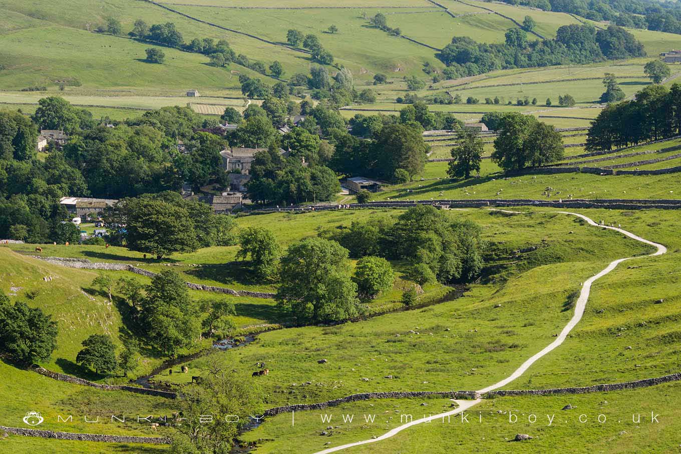
Malham is a pretty village, surrounded by limestone dry stone walls. Malham Beck runs through the middle of the village.
The countryside surrounding Malham, is well known for its limestone pavements and other areas of limestone scenery.
A half hour walk from the village will bring you to Malham Cove, a natural limestone crescent shaped cliff. To the east of Malham village is Gordale Scar, an impressive limestone gorge which is regarded as one of the natural wonders of England. Janet’s Foss, is an attractive waterfall said to be home to Janet, Queen of the Fairies. Other tourist attractions include Malham Tarn and the Dry Valley.
Malham village has a National Park Information Centre and a large car park. The car park is a designated Dark Sky Discovery site.
The Pennine Way long distance path, passes through the village.
Created: 27 November 2016 Edited: 25 March 2025
Malham Tarn Estate Information
Malham Tarn Estate Address
Yorkshire Dales Estate Office, Pennine Way, Settle BD24 9PT, UK
BD24 9PT
Website: https://www.nationaltrust.org.uk/malham-tarn-estate
Get directionsLocal History around Malham
There are some historic monuments around including:
Medieval settlements and lynchets extending NW from Town HeadSettlement sites on Jorden ScarCrane Field round barrowIcehouse in Coniston Hall Park, 390m south east of Coniston HallRound barrow north of Moor Syke, Crane FieldRound barrow 400m south west of Crane Field LaitheCup marked rock in wall east of Scarnber Wood, 500m north east of Bark Laithe, WinterburnSettlement on Ing ScarRoman temporary camp and medieval monastic cross base, Mastiles Lane.Cairn 80m north of Pikedaw HillBoundary dyke W of Capon HallLower Colgarth Hill round cairnHut circle on Comb ScarRound cairn south east of Broad FlatsPillow mounds east of Friars Head, known as Giants' GravesHut circles, enclosures and fields N of Shorkley HillEnclosed prehistoric settlement east of Malham CoveRing cairn north west of Ewe MoorEnclosure E of Malham LingsMedieval monastic wayside cross baseMedieval monastic wayside cross base, Water Sinks GateLime kiln and associated quarry 75m south of High Scarth BarnLynchets N of Malham villageSettlement 500ft (150m) NW of Ing Scar CragEnclosure on Steeling HillTwo rectangular house sites on Malham LingsRound cairn on Broad FlatsHellifield PeelCairn on Great Close HillPikedaw Hill southern cairnSettlement 1/3 mile (540m) NW of Langscar GateSettlement N of Stridebut EdgeSettlement at Dew BottomsEnclosure and hut circles on Prior RakesMedieval monastic wayside cross baseField system S of Malham CoveRound barrow 550m south west of Park HillSettlement on Prior RakesSettlement 1250yds (1140m) NE of Malham Tarn HouseFarm sites and field systems on Malham LingsSheriff Hill round cairnSeaty Hill round cairnFarmhouse sites on Highfolds Scar.