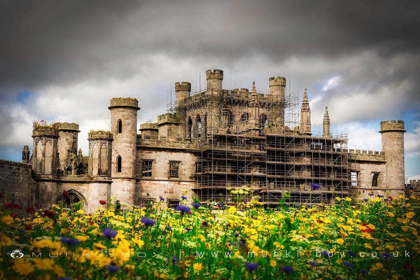
Lowther Castle by munki-boy
Lowther Castle
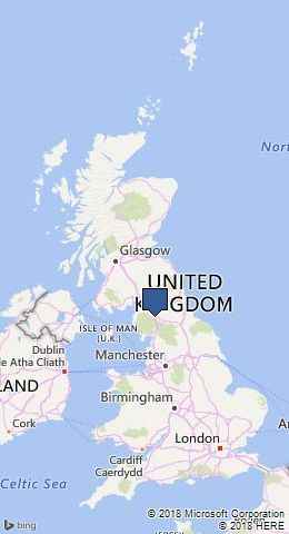
Lowther Castle is in The Lake District National Park in England.
In the late 17th century John Lowther, 1st Viscount Lonsdale rebuilt the family home, then known as Lowther Hall, on a grand scale. The current building is a castellated mansion which was built by Robert Smirke for William Lowther, 1st Earl of Lonsdale between 1806 and 1814, and it was only at that time that Lowther was designated a “castle”. The ruins of the historic, Grade 2 listed Lowther Castle, are a being made safe for public access but are currently available to view from outside a perimeter fence. The massive building is very impressive and well worth a visit.
The site also includes a “lost” garden which is also currently being restored, but is a great explore in its present overgrown state, if like me you enjoy that sort of place, it’s a good idea to visit now before the restoration is completed. The whole garden and surroundings are fully accessible as part of the admission fee.
The transformation of the historic castle and gardens at Lowther in the Lake District National Park is well underway and the gardens and grounds are now open.
Lowther Castle was undergoing a complete restoration when we first visited in 2012. Now in 2018 the Castle and grounds look very different after the transformation.
Created: 27 November 2016 Edited: 29 November 2023
Lowther Castle
Lowther Castle LiDAR Map
please wait...
Contains public sector information licensed under the Open Government Licence v3.0
Walks in Lowther Castle
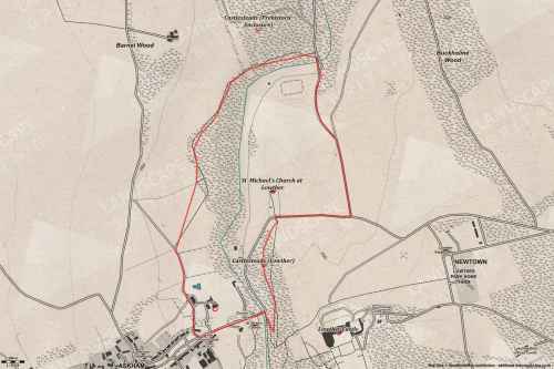
Local History around Lowther Castle
There are some historic monuments around including:
Moated site and annexe east of Setterahpark WoodRomano-British farmstead at HaweswaterCastlesteads multivallate prehistoric defended enclosureRound cairn west of Riddingleys Top, Askham FellMelkinthorpe medieval settlement, part of its associated open field system and the site of Melkinthorpe HallTwo standing stones north-west of Four Stones HillThe Cockpit stone circle and seven adjacent clearance cairns, Moor DivockClifton Hall towerSettlement 100yds (90m) SE of Sceugh FarmSewborrans standing stone 400m south west of SewborwensRoman road and enclosures SE of FrenchfieldKing Arthur's Round Table hengeRound cairn 580m north east of The Cockpit, Askham FellRound cairn on Burn BanksRound cairn 515m south east of White Raise round cairn, Askham FellSt Ninian's preconquest monastic site, site of nucleated medieval settlement, St Ninian's Church and churchyardRomano-British settlement at Cragside WoodBridge over Heltondale Beck 550ft (170m) S of WidewathRomano-British settlement and regular aggregate field system north of Yanwath WoodRound cairn on Heughscar HillStanding stone 180m NNE of SkirsgillBridge over Heltondale Beck 250yds (230m) SSW of WidewathRing cairn on Askham Fell including The Cop StoneThe Old Kiln, Wetheriggs PotterySlight univallate hillfort in Scarside PlantationRound cairn west of enclosure on Four Stones HillSkirsgill Romano-British enclosed stone hut circle settlement, Romano-British farmstead, and Romano-British regular aggregate field systemSettlement 1/3 mile (540m) ENE of Brougham CastleMoated site east of Newton ReignyRound cairn 50m north east of White Raise round cairn, Askham FellAskham Fell stone alignmentRound cairn on Askham Fell, 335m north of the Cop StoneRing cairn east of Threepow RaiseRound cairn 520m north east of The Cockpit, Askham FellMayburgh hengeRound cairn north of Four Stones HillBowl barrow 350m north east of The WreayEamont BridgeTwo standing stones and a round cairn south of CrooklandsRound cairn 660m north east of The Cockpit, Askham FellLong cairn 370m ESE of Mossthorn FarmLong cairn 330m east of MossthornRound cairn 680m ENE of DalefootWhite Raise round cairn, Askham FellRing cairn on Knipescar Common south of Inscar PlantationBowl barrow 80m east of Scarside PlantationRound cairn 490m south east of White Raise round cairn, Askham FellRound barrow 150m east of Scarside PlantationRoman marching camp 450yds (410m) NE of BrovacumRound cairn 285m south east of White Raise round cairn, Askham FellRing cairn on Knipescar CommonStrickland's Pele Tower and Penrith CastleFour funerary cairns and a surrounding cairnfield on Threepow RaiseThe Giant's Thumb - Anglian high cross in St Andrew's churchyard, PenrithLittle Round Table hengeRound cairn 280m south-east of The Cockpit stone circleRound cairn 475m south east of White Raise round cairn, Askham FellThe Giant's Grave - Two Anglian cross-shafts and four hogback stones in St Andrew's churchyard, PenrithLinear stone bank on Askham FellRound cairn 490m ENE of Rough Hill TarnTwo round cairns 415m and 420m NNE of The Cockpit, Moor DivockBrougham Roman fort (Brocavum) and civil settlement and Brougham CastleLong barrow on Trainford BrowEnclosure containing four clearance cairns and a stone bank west of Four Stones HillStone bridge, Cawdale BeckTowtop Kirk early Christian enclosureBowl barrow 850m WSW of Yanwath Woodhouse FarmRing cairn on Askham Fell and four adjacent stonesStone circle 800m east of Wetheriggs PotteryThe Countess PillarRound cairn on Askham Fell, 270m north of The Cop Stone.