Lower Force - Aysgarth by Arthur S
Lower Force - Aysgarth
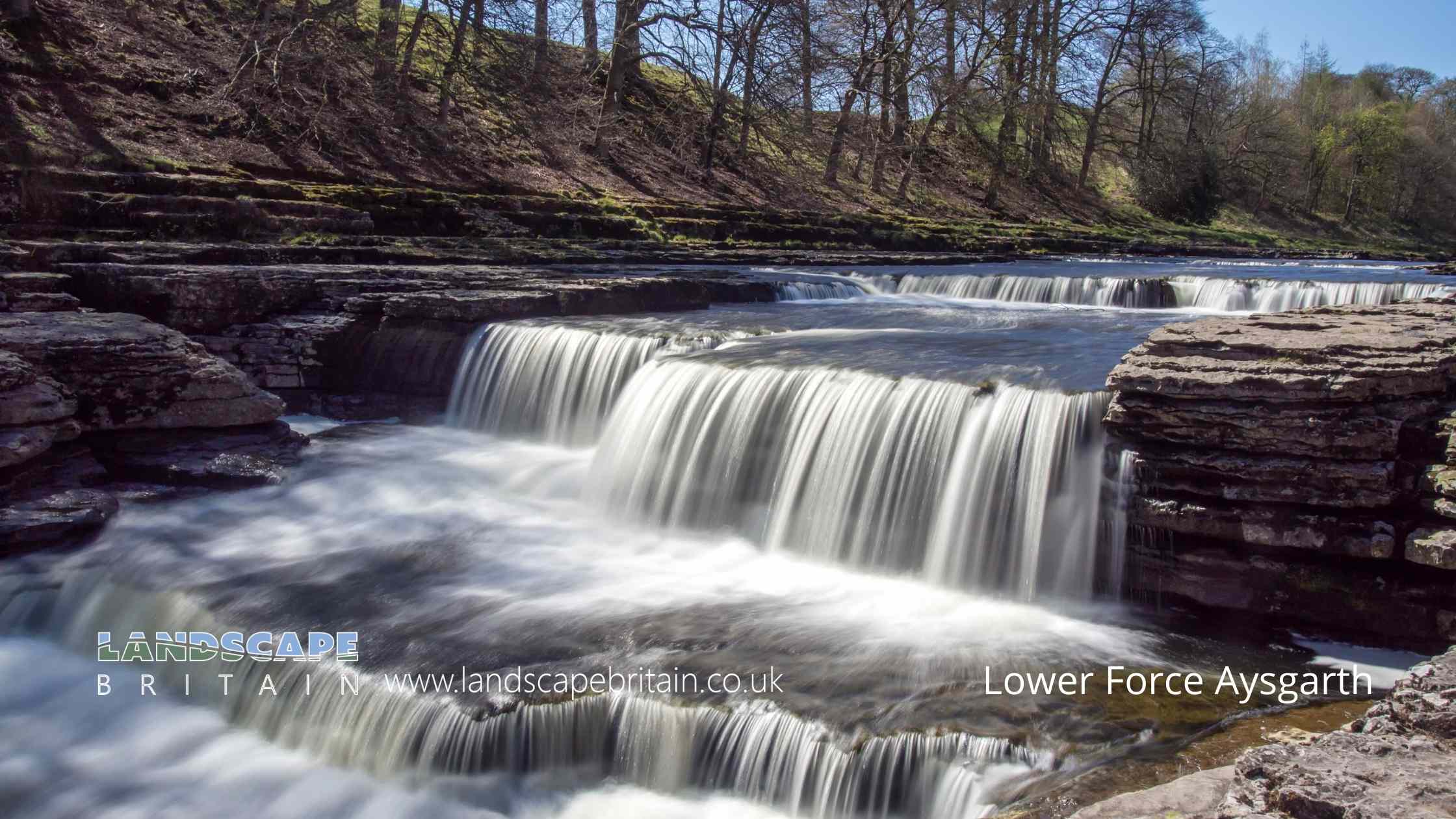
Lower Force - Aysgarth is in The Yorkshire Dales National Park in England.
A shallow but wide waterfall on the River Ure at Aysgarth, the furthest downstream of three nearby known as the Aysgarth Falls, to which the name relates rather than a high drop.
Not overly impressive unless in full force but easy to visit just by the village.
Created: 24 May 2019 Edited: 29 November 2023
Lower Force - Aysgarth
Lower Force - Aysgarth LiDAR Map

Contains public sector information licensed under the Open Government Licence v3.0
Local History around Lower Force - Aysgarth
There are some historic monuments around including:
Ox Close small stone circle, Nab EndDeserted medieval villageGrinton ore hearth lead smelt mill, flue, fuel store and associated earthworksCarperby market crossSettlement on Burton MoorPenhill Knights Templar preceptory and earlier field system at Temple FarmCobscar Mill ore hearth lead smeltmill, flue and chimneyCastle Dykes HengeCobscar calamine house on Cobscar Rake, 770m east of Cobscar MillBolton CastleBolton Parks Lead Mine and ore worksStone circle north east of Thackthwaite BeckRing cairn on Thorny Bank Hill.


