

Lister Park by Arthur S
Lister Park
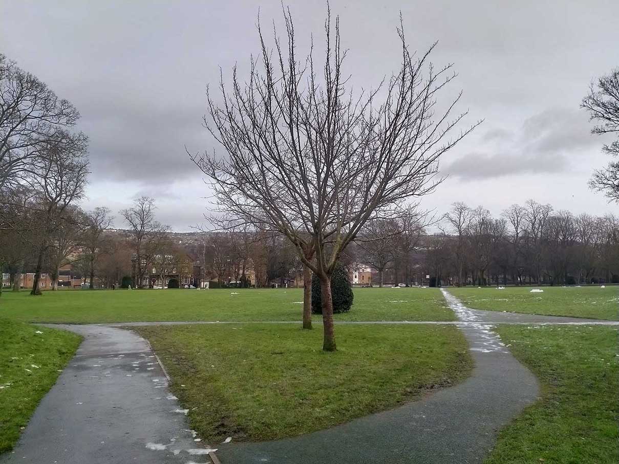
Once the home of the Lister family, opened as a 22.5 hectare public park in 1870.
- Samuel Cunliffe Lister Statue
- Formal Gardens
- Cartwright Hall
- Bowling Pavillion and Greens
- Bandstand
- Botanical Gardens and Geological Trail
- Meteorological Station
- Fossil Tree and Geological Fossil Clock
- Sir Titus Salt Statue
- Norman Arch
- Boating Lake
- Coffee Shop
- Junior and Toddler Play Area
- Ranger Contact Point
Created: 17 January 2021 Edited: 29 November 2023
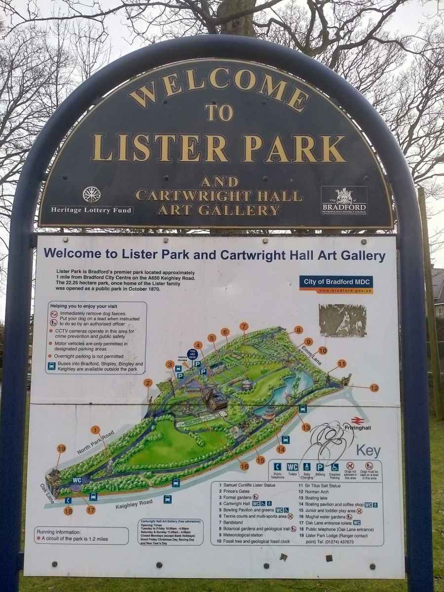
Lister Park Map
Lister Park Information
Lister Park Address
Park Rd, Bradford
BD9 4JN
Website: http://www.bradforddistrictparks.org/contacts/index.php
Get directionsLocal History around Lister Park
There are some historic monuments around including:
Carved rock in spoil of shaft mound south east of Dobrudden caravan parkCup and groove-marked rock north of Drake HillRound cairn on east flank of Baildon HillCarved rock in field behind Bracken Hall FarmSmall carved rock in path east of Glovershaw quarryCup and ring marked rock at Hoyle Court Drive, CharlestownCup marked rock 60m south west of the War Memorial at Crowgill ParkCup-marked bedrock near Old Glen HouseRock with single cup near track north of Drake HillCup-marked rock between road and public toilets at Bracken Hall GreenCup and ring marked rock north of Pennythorn HillRoadblock, Bracken Hall Green, Baildon MoorCarved rock in the wall at north edge of Otley Road north west of the Fleece InnRound barrow and L-shaped earthwork on Baildon Golf CourseBoulder with prehistoric rock art at Glovershaw FarmCup marked rock 71m south east of Dobrudden caravan parkCarved rock near north east corner of Glovershaw quarrySouthernmost of two cairns east of Glovershaw quarryCup marked rock 180m north of the covered reservoir at BaildonCup and groove marked rock north of Birch Close Farm house, High EldwickRock with one cup mark north east of the Cricketers' Arms, Baildon GreenCup and ring marked rock in Dawson Wood, 370m north east of Heaton ShayPrehistoric enclosure, carved rocks and orthostat wall, Buck Wood, 195m west of football groundEnclosed settlement known as `Soldier's Trench' including a cup-marked rockLate prehistoric enclosed settlement in Crosley Wood, Bingley, 185m north of Scourer BridgeCup and groove marked rock in garden of Oakwood Barn, High EldwickCup and ring marked rock at Faweather Farm, High EldwickRock with large number of cup marks south of Dobrudden caravan parkCairnfield including ring cairn and carved rocks on Low Plain, Baildon MoorCup marked rock and round cairn south east of Dobrudden caravan parkCarved rock in Hawksworth SpringSmall cup-marked rock 30m east of Glovershaw quarryCup-marked rock west of confluence of Lodepit Beck and Glovershaw BeckCup-marked rock close to road south east of a small car park south east of Bracken Hall Farm.Cup and groove-marked rock on east edge of Glovershaw quarryRock with single cup mark south of Dobrudden caravan parkCarved rock east of track north of Drake HillCup and ring marked rock 42m south of Dobrudden caravan parkCup and ring marked rock east of Eaves Crag, Baildon MoorRound cairn and curving bank on Pennythorn HillCarved bedrock close to road north east of the public toilets on Bracken Hall GreenNorthernmost of two cairns east of Glovershaw quarry, including adjacent cup-marked rockCup-marked rock on slight bank north east of Glovershaw quarryCarved rock above Bracken Hall Crag, north of the bottom of the track to Mitton SpringRock with single cup mark between road and Pennythorn Hill.


