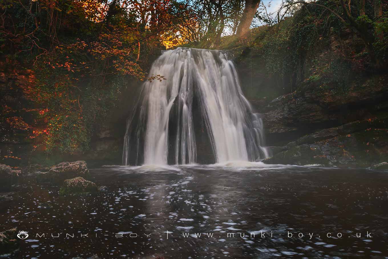
Janet's Foss in Autumn by munki-boy
Janet's Foss
Janet's Foss is in The Yorkshire Dales National Park in England.
Janet’s Foss is a small but picturesque waterfall in a woodland area close to Malham. It is supposedly named after a witch who used to live in the small cave to the right of the waterfall.
If you climb around the slippery rocks to the cave where Janet the witch is supposed to have lived, you’ll find it’s quite small.
Created: 27 November 2016 Edited: 29 November 2023
Malham Tarn Estate Information
Malham Tarn Estate Address
Yorkshire Dales Estate Office, Pennine Way, Settle BD24 9PT, UK
BD24 9PT
Website: https://www.nationaltrust.org.uk/malham-tarn-estate
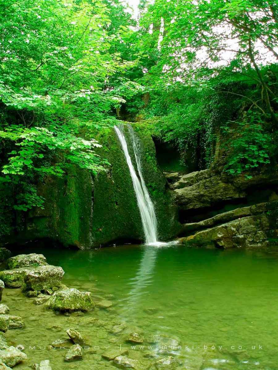
Get directionsJanet's Foss Woodland
Janets Foss is a woodland area in North Yorkshire, managed by National Trust.Gordale Beck from Source to Malham Beck Details
Gordale Beck from Source to Malham Beck
Gordale Beck from Source to Malham Beck is a river in West Yorkshire
Gordale Beck from Source to Malham Beck takes in water from an area around 12.61 km2 in size and is part of the Aire Upper catchment area.
Gordale Beck from Source to Malham Beck is 7.225 km long and is not designated artificial or heavily modified.
Janet's Foss LiDAR Map
please wait...
Contains public sector information licensed under the Open Government Licence v3.0
Local History around Janet's Foss
There are some historic monuments around including:
Settlement 1/3 mile (540m) NW of Langscar GateMedieval settlements and lynchets extending NW from Town HeadMedieval monastic wayside cross baseEnclosure E of Malham LingsSettlement on Prior RakesSettlement SE of Druid's AltarPillow mounds east of Friars Head, known as Giants' GravesHut circle on Comb ScarKilnsey Moor settlementRound barrow 550m south west of Park HillCrane Field round barrowSettlement on Blue ScarSeaty Hill round cairnHut circles, enclosures and fields N of Shorkley HillRound cairn on Broad FlatsSettlement N of Stridebut EdgeSettlement 500ft (150m) NW of Ing Scar CragCairn on Great Close HillCup marked rock in wall east of Scarnber Wood, 500m north east of Bark Laithe, WinterburnFarmhouse sites on Highfolds ScarCairn 80m north of Pikedaw HillEnclosed prehistoric settlement east of Malham CoveSheriff Hill round cairnTwo rectangular house sites on Malham LingsPikedaw Hill southern cairn'Douky Bottom Cave' Hawkswick Clowder, near KilnseyHigh Wood bowl barrowSettlement sites on Jorden ScarLynchets N of Malham villageField system S of Malham CoveRound cairn south east of Broad FlatsSettlement on Cow Bank 1/4 mile (400m) NW of DarnbrookMedieval monastic wayside cross baseEnclosure and hut circles on Prior RakesSettlement at Dew BottomsLower Colgarth Hill round cairnDruid's Altar four poster stone circleFarm sites and field systems on Malham LingsRing cairn north west of Ewe MoorLime kiln and associated quarry 75m south of High Scarth BarnRound barrow north of Moor Syke, Crane FieldRoman temporary camp and medieval monastic cross base, Mastiles Lane.Round barrow 400m south west of Crane Field LaitheSettlement 1250yds (1140m) NE of Malham Tarn HouseCairn on Blue Scar 460m NW of Springs CaveSettlement on Ing ScarMedieval monastic wayside cross base, Water Sinks Gate.


