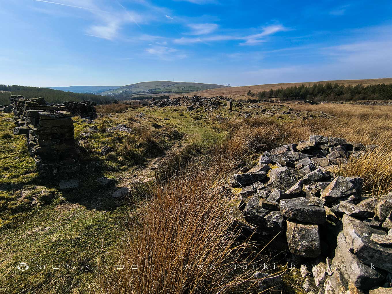
Horelaw or Wholaw (ruin) by munki-boy
Horelaw or Wholaw (ruin)
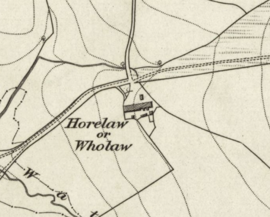
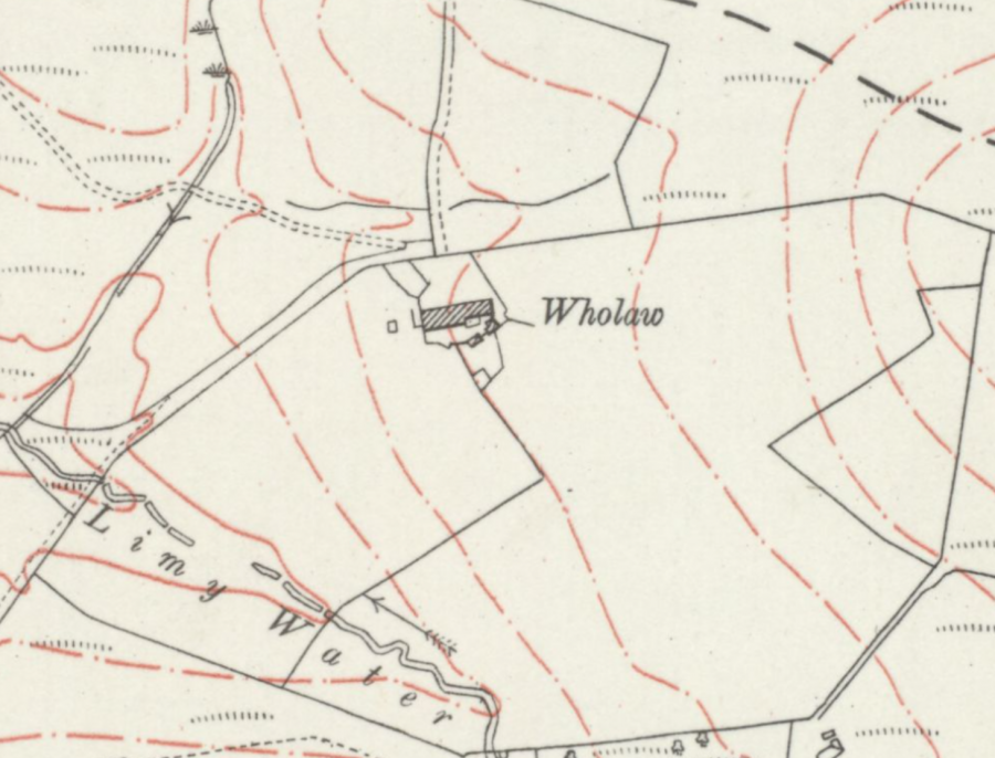
The ruins of a relatively large moorland farm originally known as Horelaw and later Wholaw, in the Crown Point area above Burnley.
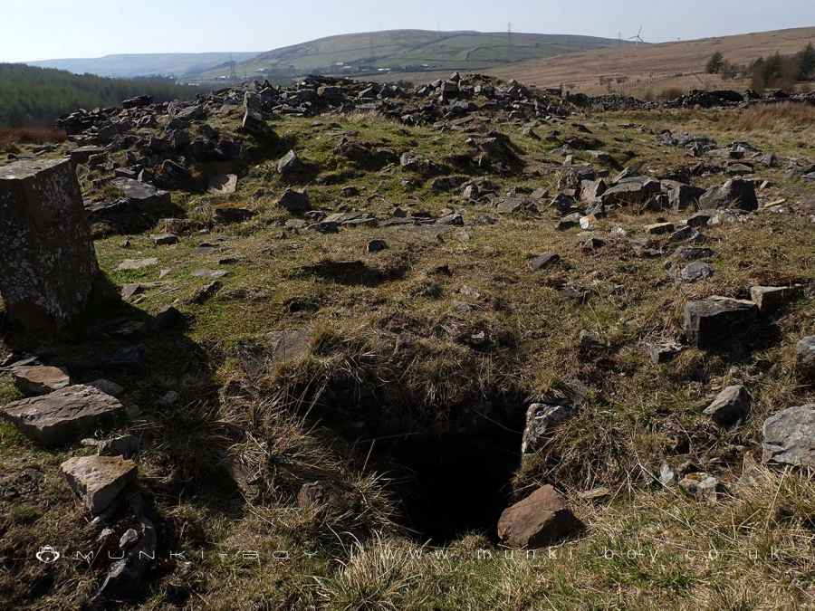
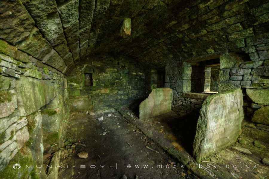
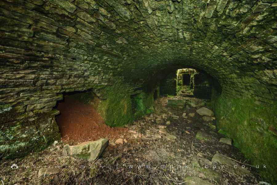
Demolished and leaving low stone walls of the numerous buildings with rubble filled interiors the ruins are quite impressive, and unlike many of the moorland farms not immediately abandoned for the industrial mills. In fact surviving as Wholaw until the latter half of the 20th Century, there are a few relatively ‘modern’ looking bricks amongst the otherwise sandstone rubble.
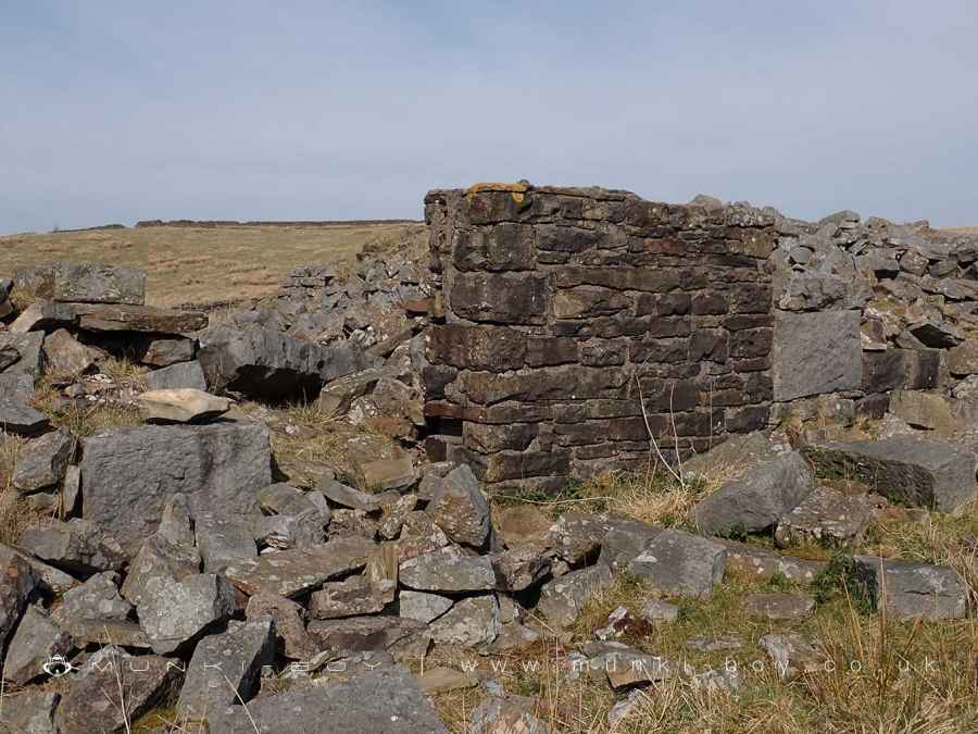
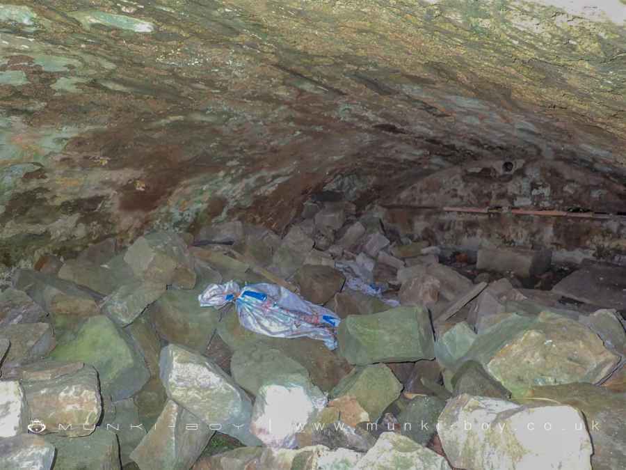
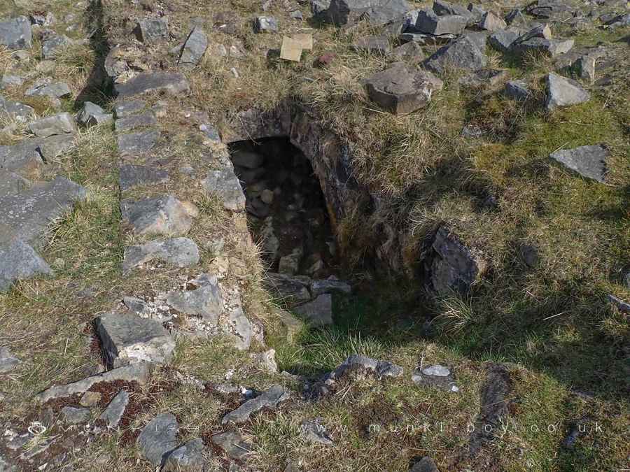
One interesting feature that survives is a small section of vaulted cellar, now mostly filled with rubble, the hole for the stair access is easy to spot, and there’s also another, vertical hole at the other end, which is found in other examples. This cellar was probably used a storage for vegetables and other foods.
There are two other farm structures with vaulted cellars not too far away and in better condition. The very similar cellar at Binns Farm above the Piethorne Valley and the so-called cattle byre at Wheelton Plantation, Brinscall.
Created: 12 April 2025 Edited: 12 April 2025
Horelaw or Wholaw (ruin)
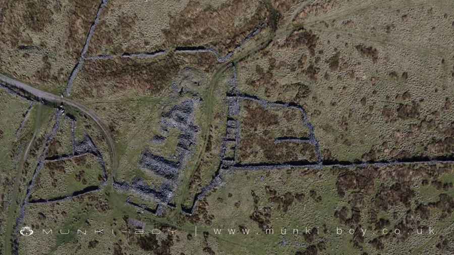
Horelaw or Wholaw (ruin) LiDAR Map

Contains public sector information licensed under the Open Government Licence v3.0
Local History around Horelaw or Wholaw (ruin)
There are some historic monuments around including:
Ring cairn on Slipper HillSpigot mortar (Blacker Bombard) positionWarren at Everage Clough 450m north east of New Copy FarmThieveley lead mine 330m south west and 910m WSW of BuckleysIce house at Towneley HallOakmount Mill engine and engine house, Wiseman StreetHameldon Hill World War II bombing decoy, 390m north of Heights FarmIghtenhill Manor (site of).


