


Hope Valley
Hope Valley
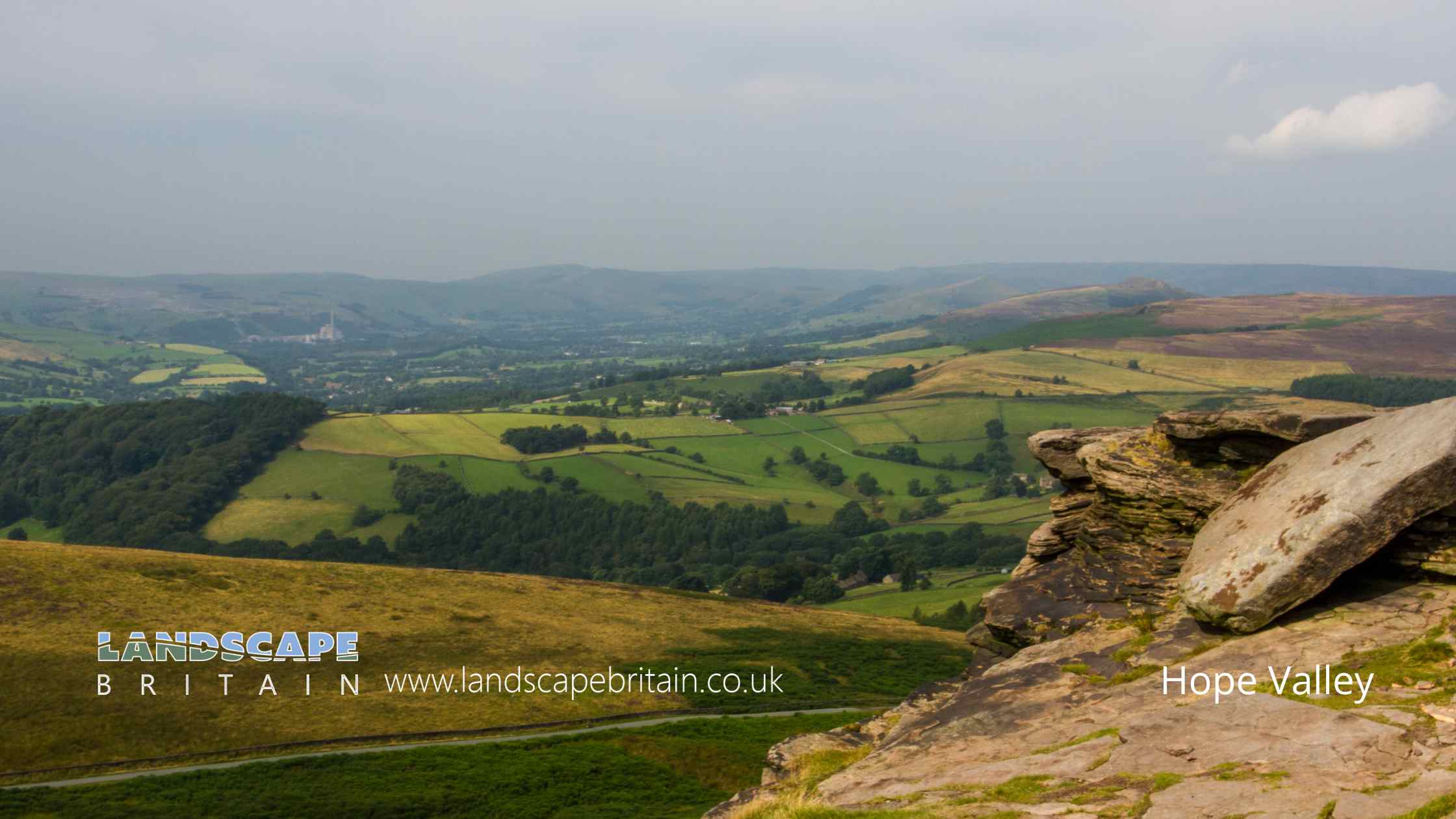
Hope Valley is in The Peak District National Park in England.
Hope Valley is a stunningly beautiful valley located in the heart of the Peak District National Park, in Derbyshire, England.
It is known for its breathtaking scenery, with rolling hills, dramatic rock formations, and cascading waterfalls.
The valley is home to several picturesque villages, including Castleton, Hope, and Hathersage, each with their own unique charm and character. With a rich history dating back to the Roman era, the Hope Valley has long been a popular destination for visitors looking to explore the great outdoors, with ample opportunities for hiking, cycling, rock climbing, and more. Whether you’re seeking adventure or simply want to soak up the natural beauty of the area, the Hope Valley is a must-see destination for anyone visiting Derbyshire.
Created: 31 March 2023 Edited: 29 November 2023
Hope Valley

Hope Valley LiDAR Map
please wait...
Contains public sector information licensed under the Open Government Licence v3.0
Local History around Hope Valley
There are some historic monuments around including:
Round cairn on Bridge-end Pasture, 600m north-east of Two Thorne Fields FarmTwo round cairns 750m south west of Offerton HouseRing cairn on Bamford Moor, 900m north east of Lydgate FarmCairn on Bamford Moor, 500m east of Great TorEmbanked stone circle on Eyam Moor, 340m south of Leam Hall FarmHope MotteCamp Green ringworkNorth Lees ChapelHordron Edge stone circle, 540m south east of Cutthroat BridgeHigh Rake MineCairn 800m WSW Of Offerton HouseCairnfield 970m north west of Green's HouseCop Low oval barrowPin Dale lead side veinsRomano-British farmstead and post-medieval charcoal burning site 570m north east of Ladybower InnPalisaded hilltop enclosure 230m SSE of Dirt LowAnglian high cross in the churchyard of St Peter's ChurchSmall stone circle on Smelting Hill, 560m north east of Lane End FarmBurr Tor prehistoric stock enclosureThe Folly platform cairnThe Grey DitchCairn on Bamford Edge, 570m north east of Clough HouseCairnfield and associated settlement, 450m south west of Leam Hall FarmCairn on Bamford Moor, 680m north of High Lees FarmRound cairn on Bridge-end Pasture, 300m north-east of Two Thorne Fields FarmCairn on Bamford Moor, 975m north east of Clough HouseCairnfield, 580m ENE of Stanage HouseCairnfield, 320m west of Leam Hall FarmCairn 880m south west of Leam Hall FarmBronze Age field system, 400m south east of Ladybower InnCairnfield 600m NNE of High Lees FarmTup Low bowl barrowRound cairn 680m south west of Offerton HouseRound cairn and clearance cairn 770m north west of Crookhill FarmCairn, 600m north east of Stanage HouseWayside cross known as Eccles CrossCairnfield, 870m north east of Stanage HouseLong Low bowl barrowStone circle, 960m north east of High Lees FarmEmbanked stone circle known as Wet Withens, and adjacent cairnCairn on Bamford Moor, 850m north west of Crow ChinCairnfield 775m NNE of High Lees FarmRound cairn 430m west of Crookhill FarmStanding cross in the churchyard of St Peter's ChurchFroggatt BridgeRound cairn 780m south west of Offerton HouseCairnfield 710m and 840m south east of Ladybower InnStone circle 330m north west of Crookhill FarmCairn on Bamford Moor, 960m north east of Clough HousePadley Hall: a medieval great houseRomano-British farmstead 475m east of Ladybower InnWhite Rake long barrow and bowl barrowCairnfield and ring cairn 490m south of Offerton HallAnglian high cross in St Laurence's churchyardGrindleford BridgeCairn on Bamford Edge, 500m north east of MooredgePlatform cairn south of Hill RakeCairnfield 600m west of Highlow HallStanage Edge Roman roadTwo cairns at Crow ChinCairnfield 630m north east of Stanage HouseCairnfield and quarry on Bamford Edge, 720m north of Clough HouseCalver weir and water management system 200m north east of Stocking FarmCallow prehistoric settlement and field system, Carr Head Moor, 300m ENE of Toothill FarmSheepwash Bank and Dennis Knoll prehistoric settlement and field systemPrehistoric standing stone 1,030m south west of triangulation point on High NebArbourseats Veins and Sough, Wardlow Sough, Nay Green Mine and Washing Floors, Hading Vein and Seedlow RakeSmall stone circle and central cairn on Eyam Moor, 370m south of Fern CottageLittle Pasture MineThe Warren Romano-British settlement, 320m north west of North Lees HallNavio Roman fort and vicusMedieval hospital 530m south east of Losehill HallCairn 720m north east of Lady Wash FarmPike Low bowl barrowCairnfield 870m north east of Lane End FarmLead smelt mill and wood-drying kiln in Froggatt Wood, 550m south of Haywood FarmCairnfield 470m south west of Offerton House.


