Stone Remains of High Borrans Romano-British Settlement by munki-boy
High Borrans Romano-British Settlement
High Borrans Romano-British Settlement is in The Lake District National Park in England.
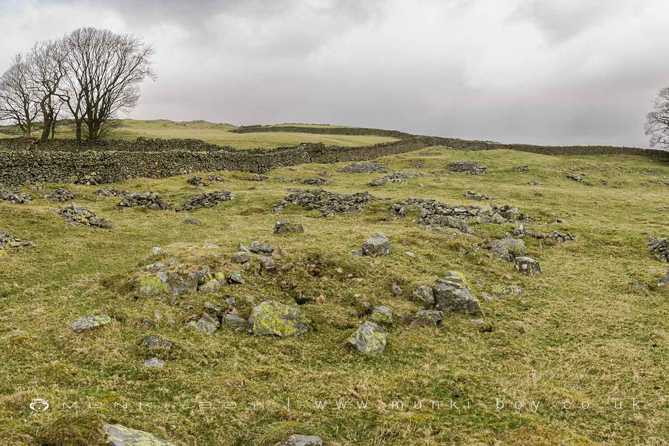
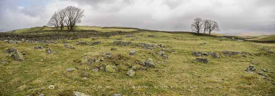
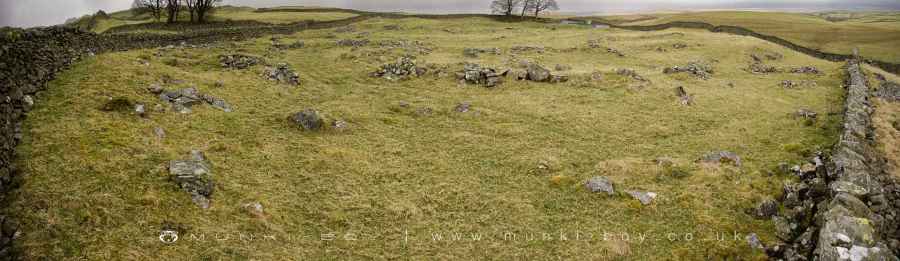
The High Borrans Romano-British Settlement, located 450 meters east of High Borrans in Cumbria, is an exemplary archaeological site, providing a vivid window into the past. This settlement is part of a broader group of native settlements in Cumbria and Northumberland that date back to the Roman period. These sites are particularly significant for their distinctive characteristics and insights into the lives of the non-Roman natives during Roman occupation.
Typically, these settlements were small, non-defensive homesteads or farms. Many, including High Borrans, were constructed of stone, although timber-built variants were not uncommon in coastal areas. The enclosures at these sites varied in shape, with curvilinear forms prevalent in the Cheviots of Northumberland and rectangular shapes more common further south. Unique to the areas near the Scottish border, some settlements featured ‘scooped’ enclosures on hillslopes.
The standard internal layout often included stone round-houses, pathways, and small enclosed yards, with the houses situated towards the rear, facing the entrance. While most homesteads had one or two houses, larger enclosures could contain up to six, and in some cases, growth led to as many as 30 houses clustered around the main enclosure. In the Cumbrian uplands, unenclosed clusters of houses of a similar age are also known.
High Borrans, with its well-preserved earthworks including banks and hut circles, is a testament to the architectural and cultural practices of the period. It offers invaluable archaeological and environmental deposits that shed light on the construction, use, and abandonment of these settlements, as well as the broader landscape usage during the Romano-British period. This site is recognized as nationally important due to its substantial intact nature.
Details of the Site
The settlement at High Borrans comprises a D-shaped enclosure, preserved as an earthwork covering approximately 0.9 hectares. This enclosure is marked by an earth and stone bank and features entrances on its west, south, and east sides. The interior is divided into compartments by low earth and stone banks, and houses a number of hut circles. These circles, varying from 3 to 8 meters in diameter, are set on levelled terraced platforms that have been cut into the slope of the hill.
A notable aspect of the site is the modern boundary wall that sits atop the majority of the outer bank of the enclosure. While the wall itself is excluded from the scheduling, the ground beneath it is included, ensuring the preservation of any underlying archaeological features.
This site not only represents a significant piece of our history but also serves as an educational and cultural resource, offering insights into the character of settlement and subsistence during the Romano-British period.
Created: 1 January 2024 Edited: 26 March 2024
High Borrans Romano-British Settlement
High Borrans Romano-British Settlement LiDAR Map
please wait...
Contains public sector information licensed under the Open Government Licence v3.0
Local History around High Borrans Romano-British Settlement
There are some historic monuments around including:
Romano-British settlement, 450m east of High BorransLow Kingate concentric stone circleRomano-British enclosed stone hut circle settlement and Romano-British farmstead north west of Tongue House Barn.Southern round cairn on north end of The Tongue, Troutbeck ParkRound cairn 15m east of Hagg GillRound cairn 80m east of Hagg GillNorthern round cairn on north end of The Tongue, Troutbeck ParkMedieval shieling 640m north of Troutbeck Park FarmSettlement on W slope of The Tongue, Troutbeck ParkTower of ruined chapel of St MargaretMedieval shieling 70m west of Trout BeckRound cairn 200m south-south-west of Bluegill FoldSlight univallate hillfort on Allen KnottRound cairn 60m east of Hagg GillMedieval shieling 100m west of Trout BeckMedieval shieling 150m west of Trout BeckRound cairn 250m south-south-west of Bluegill FoldHigh Street, Roman roadRound cairn 75m east of Hagg GillTower of ruined church of St CatherineMillrigg Romano-British enclosed hut circle settlementElfhow potash pit.


