Higger Tor
Higger Tor
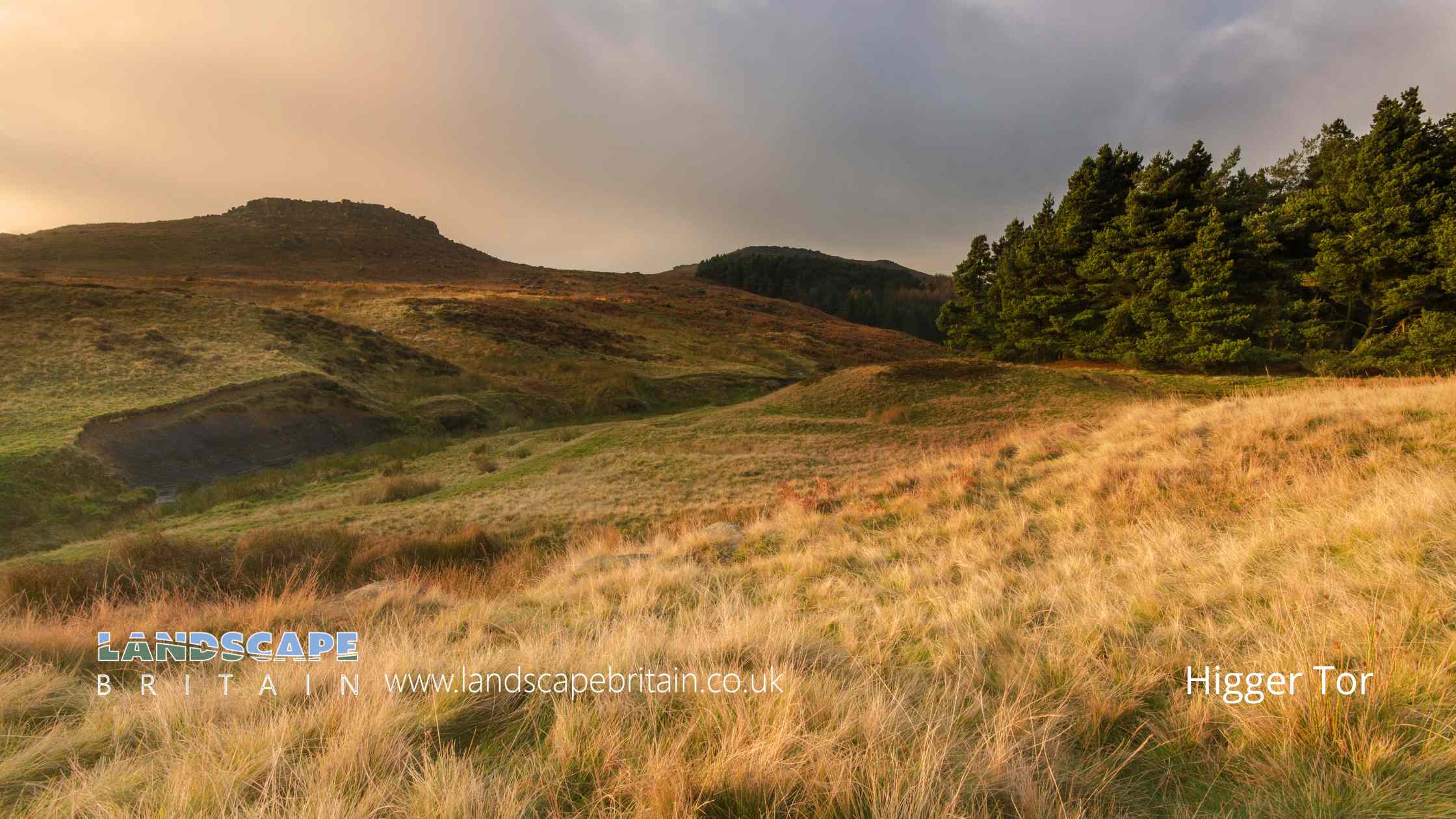
Higger Tor is a distinctive gritstone tor located near the village of Hathersage in the Peak District National Park in England.
The tor stands at a height of 434 meters and offers stunning panoramic views of the surrounding landscape, including the Hope Valley and the Dark Peak area.
The area is popular with hikers, rock climbers, and nature enthusiasts who come to explore the rugged terrain and admire the unique geological formations. Higger Tor is also steeped in history, with evidence of human activity dating back to the Bronze Age, and has been the subject of many local legends and stories over the years.
Created: 31 March 2023 Edited: 29 November 2023
Higger Tor
Higger Tor LiDAR Map
please wait...
Contains public sector information licensed under the Open Government Licence v3.0
Local History around Higger Tor
There are some historic monuments around including:
Wayside cross in Shillito WoodCallow prehistoric settlement and field system, Carr Head Moor, 300m ENE of Toothill FarmTwo ring cairns at Ciceley Low, 500m ESE of Parson House FarmCairnfield 710m and 840m south east of Ladybower InnCalver weir and water management system 200m north east of Stocking FarmRomano-British farmstead 475m east of Ladybower InnStanage Edge Roman roadCairnfield 400m north east of Ramsley LodgePrehistoric landscape on Big Moor and Ramsley MoorCairn on Bamford Moor, 850m north west of Crow ChinPrehistoric standing stone 1,030m south west of triangulation point on High NebHordron Edge stone circle, 540m south east of Cutthroat BridgeCairnfield 615m west of Moor Edge FarmWayside cross west of Saltersitch BridgeStoke Flat South prehistoric field systemWinyards Nick prehistoric field systemTwo cairns at Crow ChinCairnfield, 870m north east of Stanage HouseCairnfield 970m north west of Green's HouseCairnfield, linear clearance and ring cairn 720m north west of Moor Edge FarmRomano-British farmstead and post-medieval charcoal burning site 570m north east of Ladybower InnLead smelting site on Bole Hill, west of Bolehill LodgeFroggatt BridgeRedmires First World War Training AreaRound cairn on Curbar EdgeCairnfield, 580m ENE of Stanage HouseStone circle on Ash Cabin Flat, 560m north east of Reservoir CottagesCairnfield and quarry on Bamford Edge, 720m north of Clough HouseLead smelting site on Ramsley Moor, 600m south west of Foxlane FarmCairn on Bamford Moor, 500m east of Great TorGrindleford BridgeCairnfield 860m north east of Ramsley LodgeLead smelt mill and wood-drying kiln in Froggatt Wood, 550m south of Haywood FarmRound cairn on Curbar EdgeRing cairn, 500m north west of Burbage BridgeStone circle, 960m north east of High Lees FarmSmall stone circle and central cairn on Eyam Moor, 370m south of Fern CottageRing cairn on Bamford Moor, 900m north east of Lydgate FarmCairn at Winyards Nick 470m south east of Mitchell FieldEmbanked stone circle on Eyam Moor, 340m south of Leam Hall FarmCairnfield 470m south west of Offerton HouseCairns at Winyards Nick, 680m WSW of Carl Wark HillfortCairn, 600m north east of Stanage HouseEmbanked stone circle known as Wet Withens, and adjacent cairnStoke Flat West prehistoric field system and stone circleToad's Mouth prehistoric field systemWaymarker and clapper bridge 130m south of Barbrook BridgeMedieval enclosed field system and earlier remains at Sheffield PlantationCairnfield, 320m west of Leam Hall FarmCairnfield 600m NNE of High Lees FarmAnglian high cross in St Laurence's churchyardCairn on Bamford Moor, 975m north east of Clough HouseCairnfield and field system north of Eaglestone Flat, 450m south west of Swine StySheepwash Bank and Dennis Knoll prehistoric settlement and field systemCarl Wark slight univallate hillfortCamp Green ringworkCairn 720m north east of Lady Wash FarmRing cairn and cairn on Ramsley Moor, 850m north east of Ramsley LodgeCairnfield 180m north east of Ramsley LodgeMedieval field system and long houses at Lawrence FieldWayside cross west of Fox LaneCairnfield 600m west of Highlow HallCairnfield 320m north of Saltersitch Bridge, Eastern MoorsWayside and boundary cross known as Lady's CrossCairnfield and embanked stone circle 550m east of Barbrook ReservoirMedieval farmstead and field system 525m south of Yarncliff QuarryCairn on Bamford Edge, 570m north east of Clough HouseCairnfield and ring cairn 490m south of Offerton HallNorth Lees ChapelThe Warren Romano-British settlement, 320m north west of North Lees HallCairnfield 775m NNE of High Lees FarmCairnfield and associated settlement, 450m south west of Leam Hall FarmCairn 380m south west of Burbage BridgePadley Hall: a medieval great houseStoke Flat East prehistoric field systemCairn 880m south west of Leam Hall FarmCairnfield 630m north east of Stanage HouseCairn on Bamford Edge, 500m north east of MooredgeCairn on Bamford Moor, 960m north east of Clough HouseCairn on Bamford Moor, 680m north of High Lees Farm.


