Old Road Lost Under Haweswater by munki-boy
Haweswater Drowned Villages
Haweswater Drowned Villages is in The Lake District National Park in England.
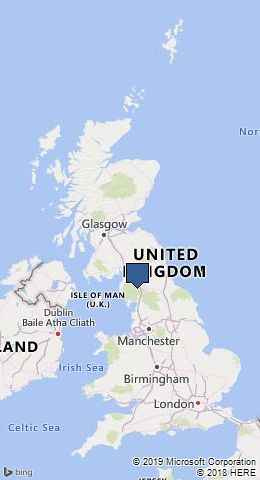
The villages of Mardale Green and Measand, several roads and other buildings were submerged when the Haweswater reservoir was created.
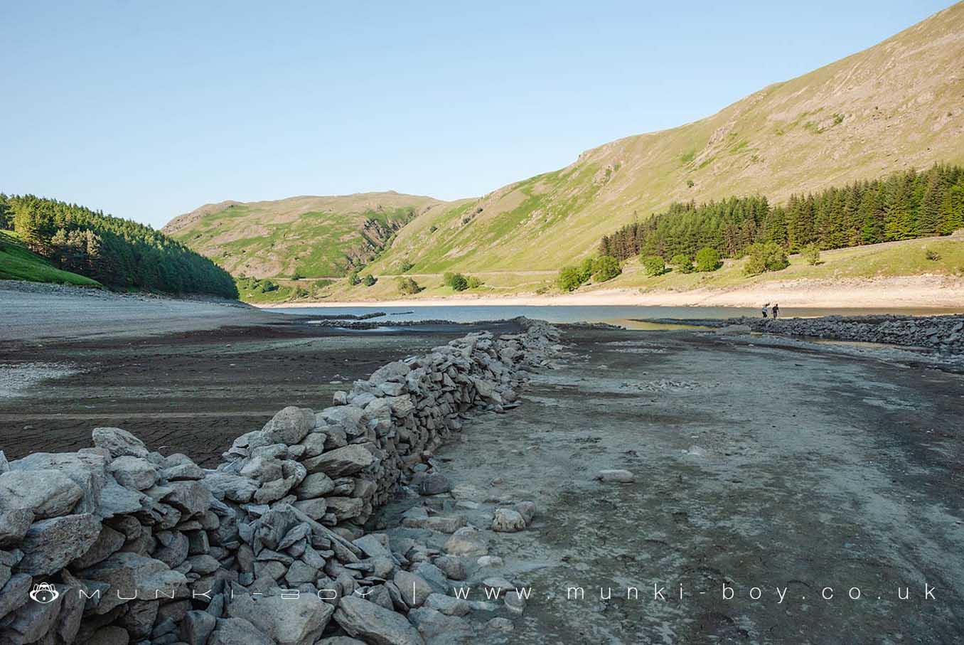
The ruins of walls and bridges can be seen today when the reservoir water is low.
Many people find the emergence of the ruins from the water incredibly interesting. Perhaps it is the fact that they are hidden from us for most of the time, for there are more impressive and historic buildings both standing and as ruins that are easily accessible on dry land, many very well preserved or still in use.
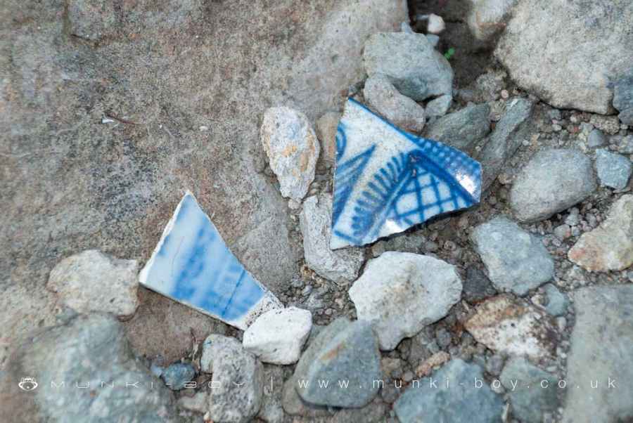
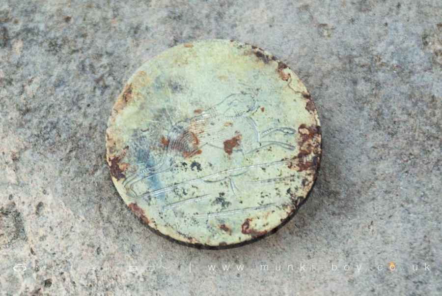
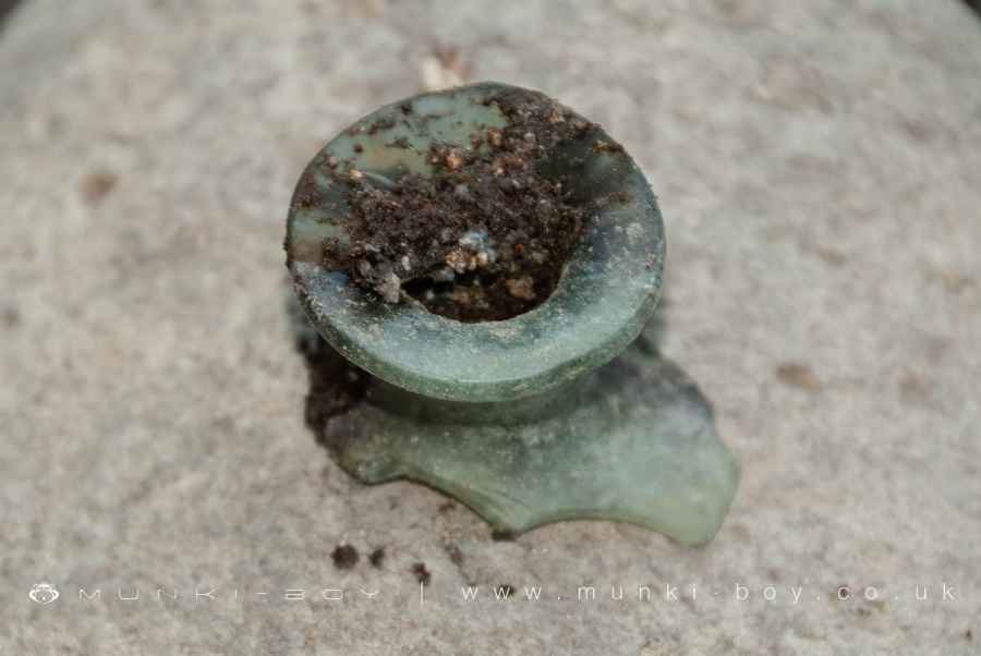
There’s plenty of old stone remains to see if the water is low enough and finding bits of old pottery and trinkets is easy once you start looking - best to take a photo and leave them for others to find next year.
Created: 27 November 2016 Edited: 29 November 2023
Haweswater Drowned Villages
Haweswater Drowned Villages LiDAR Map

Contains public sector information licensed under the Open Government Licence v3.0
Local History around Haweswater Drowned Villages
There are some historic monuments around including:
Settlement SW of Naddle BridgeRound cairn on High RaiseTwo standing stones north-west of Four Stones HillRound cairn 490m ENE of Rough Hill TarnEnclosure containing four clearance cairns and a stone bank west of Four Stones HillRound cairn on Burn BanksRomano-British farmstead at HaweswaterCastle Crag slight univallate hillfortStone bridge, Cawdale BeckHigh Street, Roman roadSmall stone circle on Swarth FellRound cairn north of Four Stones HillRomano-British enclosed stone hut circle settlement and Romano-British farmstead north west of Tongue House Barn.Towtop Kirk early Christian enclosureRound cairn west of enclosure on Four Stones HillRomano-British farmstead 800m north-east of High HouseSelside Pike round cairn.