Hameldon Hill by munki-boy
Hameldon Hill
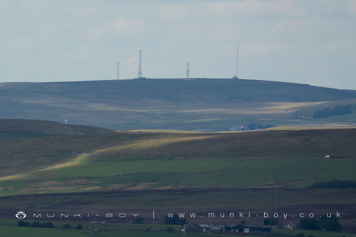
Hameldon Hill is a prominent hill in Lancashire, located between Burnley and Accrington. It rises to an elevation of 409 metres (1,343 feet) and is classified as a HuMP (Hundred Metre Prominence), with its parent peak being Freeholds Top. The hill is a familiar feature of the local landscape and offers wide views across the surrounding countryside.
Geologically, Hameldon Hill is composed of Carboniferous sandstone, including types like millstone grit, Dyneley Knott flags, and Dandy Mine Rock. It sits above coal measures from the Lower Westphalian period, and the surface is covered with glacial till. The resulting soil is often poorly drained, leading to grassland that can be boggy and reed-covered in places.
The hill also has historical significance. Mesolithic flint tools have been found on the summit, and a nearby mound called Little Hameldon is thought to be the remains of a chambered long barrow, dating from the early Neolithic to early Bronze Age. This suggests the area was in use by humans many thousands of years ago.
During the Second World War, Hameldon Hill played a strategic role as the site of a bombing decoy installation. This decoy was designed to mislead enemy bombers by mimicking the appearance of lit-up urban areas, such as Accrington, under attack. The decoy site near Heights Farm is one of only three surviving combined Starfish and QL decoy sites in England.
In modern times, the hill has also become a site for renewable energy. The Hameldon Hill Wind Farm began operation in 2007, initially with three turbines. A further three were added in the following years. The wind farm is visible from many points across East Lancashire.
Hameldon Hill is popular with walkers and forms part of the route of the Burnley Way, a long-distance footpath that takes in many scenic spots in the area. Its combination of natural beauty, archaeological interest, and industrial heritage make it an important and distinctive feature of the Lancashire landscape.
Created: 10 July 2021 Edited: 12 April 2025
Hameldon Hill Details
Hameldon Hill is a 399 metre high hill in Lancashire.
Hameldon Hill
Hameldon Hill LiDAR Map

Contains public sector information licensed under the Open Government Licence v3.0
Local History around Hameldon Hill
There are some historic monuments around including:
Higher Mill, HelmshoreIghtenhill Manor (site of)Hameldon Hill World War II bombing decoy, 390m north of Heights FarmSpigot mortar (Blacker Bombard) positionHapton CastleOakmount Mill engine and engine house, Wiseman Street.


