Barford Bridge
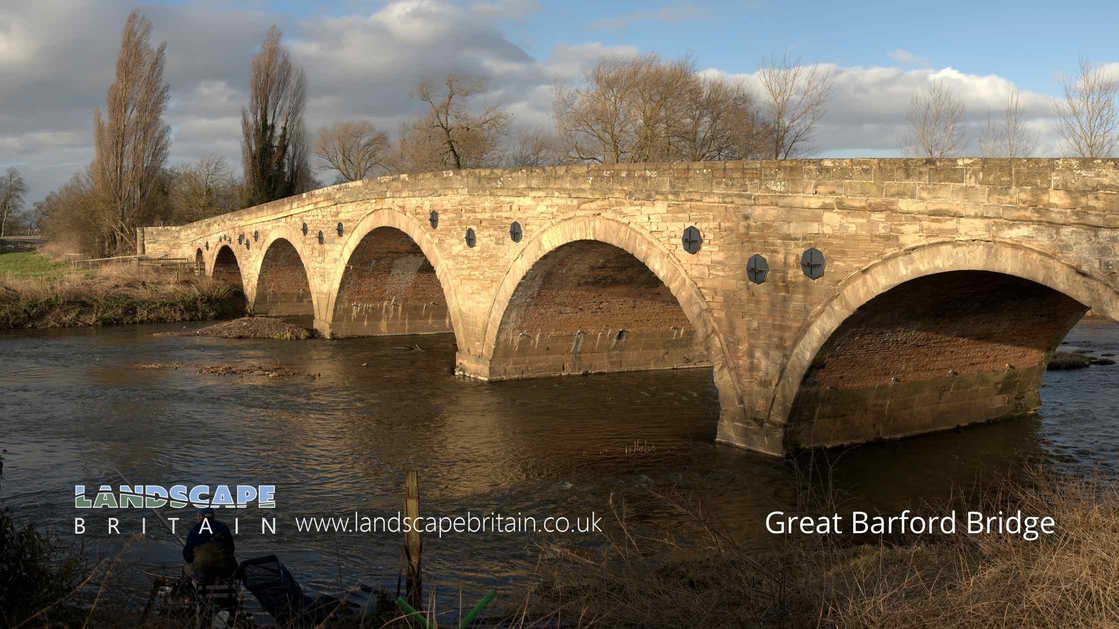
Great Barford Bridge
Grade I listed Barford Bridge and Causeway on the River Great Ouse at Great Barford dates from the 15th to 19th Centuries and was orginally constructed from sandstone and limestone. The bridge was widened in 1874 with additional red brick.
The structure is a fine example of medieval engineering and is particularly notable for its high arches.
Created: 31 October 2022 Edited: 29 November 2023
Great Barford Bridge
River Great Ouse Details
River Great Ouse
River Great Ouse is a river in Bedfordshire
River Great Ouse is 230 Km long and has been heavily modified by industry in the past.
Local History around Great Barford Bridge
There are some historic monuments around including:
Palaceyard Wood medieval moated enclosure and associated enclosures, woodland bank and cultivation earthworksChawston Manor moated site and associated fishpondBowl barrow 550m south-east of Dairy FarmGannocks Castle moated siteSite discovered by aerial photography S of villageMortuary enclosure 900m NNW of Octagon Farm: part of a Neolithic and Bronze Age mortuary complex'The Docks' moated site and dock, WillingtonTwo bowl barrows 330m south of Dairy FarmThe Hillings, Castle Hills: a ringwork castle associated with a Saxon vill, shifted medieval village and a windmill moundA barrow 400m north of Octagon Farm: part of a Neolithic and Bronze Age mortuary complexBiggin Wood moated enclosure, TempsfordWillington dovecotMedieval fishery and warren in Home WoodNeolithic and Bronze Age mortuary complex 600m NW of Octagon FarmManor Farm moated enclosure, fishponds and fowling earthworksBowl barrow, known as the `Round Hill', 440m WNW of College FarmThree barrows and a rectilinear enclosure 1000m NNW of Octagon Farm: part of a Neotlithic and Bronze Age mortuary complexManor Farm moated siteTempsford BridgeBarford BridgeHowbury ringwork and medieval trackwayWillington stablesQuince Hill ringwork, Old WardenHengi-form monument 480m south of Dairy FarmA barrow 1000m NW of Octagon Farm: part of a Neolithic and Bronze Age mortuary complexMoated site, near Hill House, Old WardenHenge, henge type monument and bowl barrow 500m south-east of Dairy FarmMotte castle in Exeter Wood, 780m south east of Wood FarmBlunham BridgeBirchfield Farm moated site and associated fishponds and leatsTwo barrows 500m NE of Octagon Farm: part of a Neolithic and Bronze Age mortuary complexSettlement site N of Chapel End FarmMoated enclosure and associated building platforms, The Lane, Wyboston..


