Gordale Scar Waterfall by munki-boy
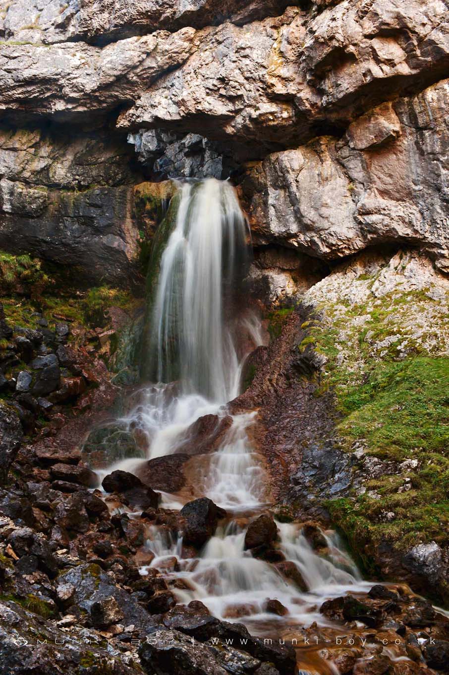
Gordale Scar Upper Waterfall
Gordale Scar Upper Waterfall is in The Yorkshire Dales National Park in England.
The excellent upper waterfall at Gordale Scar emerges from a rock arch that is formed from a collapsed cave. The watefall looks a bit weird because at the same time as eroding the limestone into this massive gorge, the water is depositing calcite as it falls forming the large column of rock just behind the water.
It is possible to climb round to look out through the arch but be careful!
Created: 27 November 2016 Edited: 29 November 2023
Malham Tarn Estate Information
Malham Tarn Estate Address
Yorkshire Dales Estate Office, Pennine Way, Settle BD24 9PT, UK
BD24 9PT
Website: https://www.nationaltrust.org.uk/malham-tarn-estate
Get directionsGordale Beck from Source to Malham Beck Details
Gordale Beck from Source to Malham Beck
Gordale Beck from Source to Malham Beck is a river in West Yorkshire
Gordale Beck from Source to Malham Beck takes in water from an area around 12.61 km2 in size and is part of the Aire Upper catchment area.
Gordale Beck from Source to Malham Beck is 7.225 km long and is not designated artificial or heavily modified.
Gordale Scar Upper Waterfall LiDAR Map

Contains public sector information licensed under the Open Government Licence v3.0
Local History around Gordale Scar Upper Waterfall
There are some historic monuments around including:
Settlement SE of Druid's AltarPillow mounds east of Friars Head, known as Giants' GravesSettlement sites on Jorden ScarSettlement on Blue ScarCairn 80m north of Pikedaw HillSeaty Hill round cairnSheriff Hill round cairnDruid's Altar four poster stone circleMedieval monastic wayside cross baseEnclosed prehistoric settlement east of Malham CoveSettlement at Dew BottomsEnclosure E of Malham LingsLime kiln and associated quarry 75m south of High Scarth BarnCairn on Great Close HillField system S of Malham CoveMedieval monastic wayside cross baseRing cairn north west of Ewe MoorRound cairn south east of Broad FlatsCup marked rock in wall east of Scarnber Wood, 500m north east of Bark Laithe, WinterburnHut circle on Comb ScarSettlement on Prior RakesPikedaw Hill southern cairnCrane Field round barrowRound barrow 400m south west of Crane Field LaitheHut circles, enclosures and fields N of Shorkley Hill'Douky Bottom Cave' Hawkswick Clowder, near KilnseyKilnsey Moor settlementSettlement 500ft (150m) NW of Ing Scar CragSettlement N of Stridebut EdgeSettlement on Cow Bank 1/4 mile (400m) NW of DarnbrookMedieval settlements and lynchets extending NW from Town HeadRoman temporary camp and medieval monastic cross base, Mastiles Lane.Medieval monastic wayside cross base, Water Sinks GateFarm sites and field systems on Malham LingsCairn on Blue Scar 460m NW of Springs CaveRound barrow north of Moor Syke, Crane FieldTwo rectangular house sites on Malham LingsEnclosure and hut circles on Prior RakesSettlement on Ing ScarSettlement 1250yds (1140m) NE of Malham Tarn HouseRound barrow 550m south west of Park HillLower Colgarth Hill round cairnLynchets N of Malham villageFarmhouse sites on Highfolds ScarSettlement 1/3 mile (540m) NW of Langscar GateRound cairn on Broad Flats.