Gordale Scar by munki-boy
Gordale Scar
Gordale Scar is in The Yorkshire Dales National Park in England.
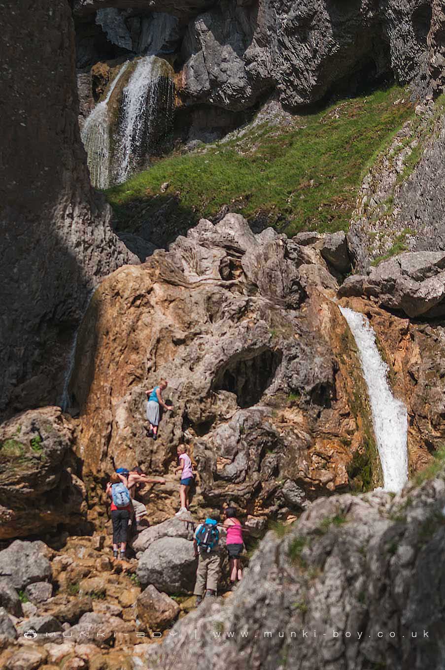
Gordale Scar is an impressively deep, limestone gorge featuring large rocky waterfalls.
Popular with tourists and ramblers, there are good footpaths from Malham continuing past the waterfalls for those who are willing to climb.
Created: 27 November 2016 Edited: 29 November 2023
Malham Tarn Estate Information
Malham Tarn Estate Address
Yorkshire Dales Estate Office, Pennine Way, Settle BD24 9PT, UK
BD24 9PT
Website: https://www.nationaltrust.org.uk/malham-tarn-estate
Get directionsGordale Beck from Source to Malham Beck Details
Gordale Beck from Source to Malham Beck
Gordale Beck from Source to Malham Beck is a river in West Yorkshire
Gordale Beck from Source to Malham Beck takes in water from an area around 12.61 km2 in size and is part of the Aire Upper catchment area.
Gordale Beck from Source to Malham Beck is 7.225 km long and is not designated artificial or heavily modified.

Gordale Scar LiDAR Map
please wait...
Contains public sector information licensed under the Open Government Licence v3.0
Local History around Gordale Scar
There are some historic monuments around including:
Settlement SE of Druid's AltarHut circles, enclosures and fields N of Shorkley HillEnclosed prehistoric settlement east of Malham CoveCup marked rock in wall east of Scarnber Wood, 500m north east of Bark Laithe, WinterburnMedieval monastic wayside cross baseSettlement 1250yds (1140m) NE of Malham Tarn HouseRoman temporary camp and medieval monastic cross base, Mastiles Lane.Round cairn south east of Broad FlatsRing cairn north west of Ewe MoorDruid's Altar four poster stone circleCairn on Great Close HillMedieval monastic wayside cross baseSettlement on Cow Bank 1/4 mile (400m) NW of DarnbrookCrane Field round barrowLime kiln and associated quarry 75m south of High Scarth BarnField system S of Malham CoveKilnsey Moor settlementEnclosure and hut circles on Prior RakesFarmhouse sites on Highfolds ScarRound barrow 550m south west of Park HillSettlement on Ing ScarRound barrow north of Moor Syke, Crane FieldMedieval settlements and lynchets extending NW from Town HeadSettlement 500ft (150m) NW of Ing Scar CragSettlement N of Stridebut EdgeHut circle on Comb ScarCairn 80m north of Pikedaw HillFarm sites and field systems on Malham LingsSheriff Hill round cairnEnclosure E of Malham LingsRound cairn on Broad FlatsTwo rectangular house sites on Malham LingsCairn on Blue Scar 460m NW of Springs CaveMedieval monastic wayside cross base, Water Sinks GateSettlement 1/3 mile (540m) NW of Langscar GateSettlement at Dew BottomsSeaty Hill round cairnLower Colgarth Hill round cairnSettlement on Prior RakesLynchets N of Malham villageSettlement sites on Jorden ScarRound barrow 400m south west of Crane Field LaithePillow mounds east of Friars Head, known as Giants' GravesSettlement on Blue Scar'Douky Bottom Cave' Hawkswick Clowder, near KilnseyPikedaw Hill southern cairn.