Force Jumb by munki-boy
Force Jumb
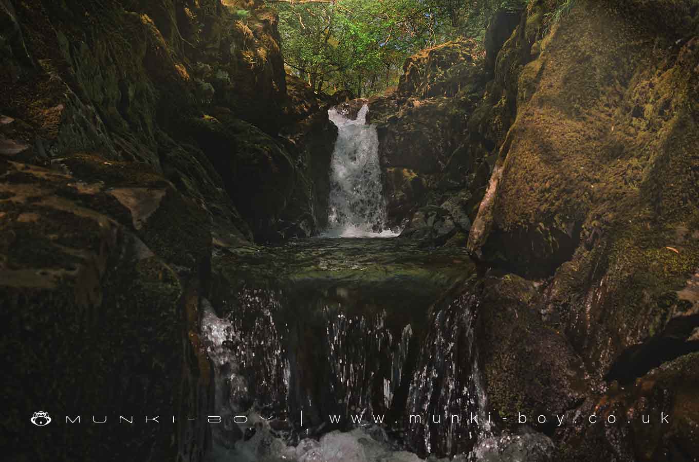
Force Jumb is in The Lake District National Park in England.
A small waterfall in a very narrow rock gorge on the River Kent at Kentmere. No proper access as the public footpath crosses a bridge higher upstream.
This waterfall has been renamed ‘Force Jump’ on the recent OS maps but the old name is Force Jumb which may relate to the narrow squeeze through which the water flows. (A possible root of Jam (tight) is chamb or cham (bite). It’s a fairly small waterfall and not much of a ‘jump’.
Created: 6 March 2021 Edited: 29 November 2023
Force Jumb
Kent - headwaters to confluence with Gowan Details
Kent - headwaters to confluence with Gowan
Kent - headwaters to confluence with Gowan is a river in Cumbria
Kent - headwaters to confluence with Gowan takes in water from an area around 40.276 km2 in size and is part of the Kent catchment area.
Kent - headwaters to confluence with Gowan is 12.571 km long and is not designated artificial or heavily modified.
Force Jumb LiDAR Map

Contains public sector information licensed under the Open Government Licence v3.0
Local History around Force Jumb
There are some historic monuments around including:
Slight univallate hillfort on Allen KnottTower of ruined chapel of St MargaretSelside Pike round cairnMedieval shieling 100m west of Trout BeckRound cairn 15m east of Hagg GillSouthern round cairn on north end of The Tongue, Troutbeck ParkRomano-British settlement, 450m east of High BorransMedieval shieling 150m west of Trout BeckRound cairn 75m east of Hagg GillElfhow potash pitMedieval shieling 70m west of Trout BeckMillrigg Romano-British enclosed hut circle settlementSettlement on W slope of The Tongue, Troutbeck ParkRound cairn 250m south-south-west of Bluegill FoldHigh Street, Roman roadRound cairn 80m east of Hagg GillNorthern round cairn on north end of The Tongue, Troutbeck ParkMedieval shieling 640m north of Troutbeck Park FarmRound cairn 200m south-south-west of Bluegill FoldRomano-British enclosed stone hut circle settlement and Romano-British farmstead north west of Tongue House Barn.Low Kingate concentric stone circleRound cairn 60m east of Hagg Gill.


