Fairy Hole by munki-boy
Fairy Hole
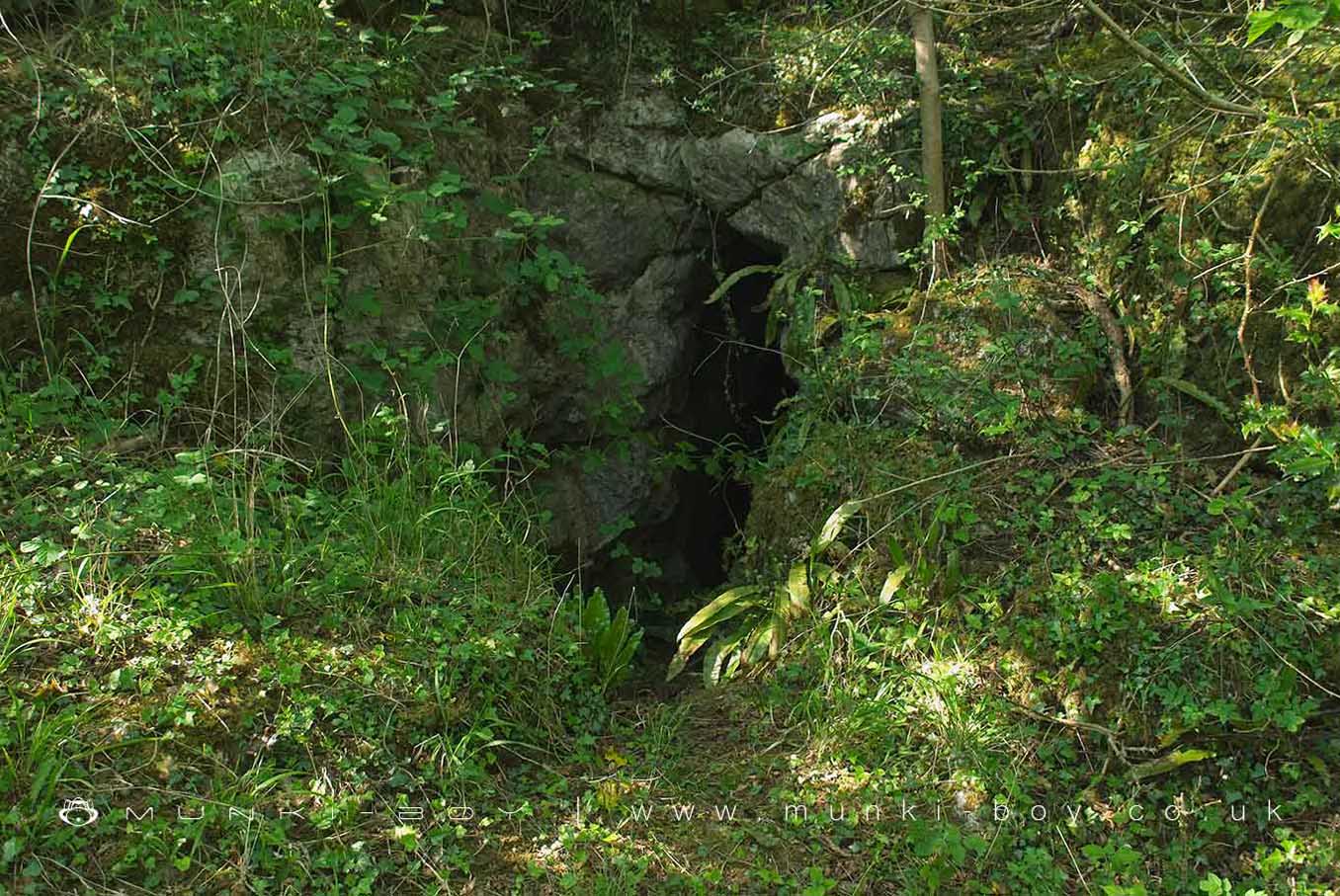
An interesting looking entrance to a partially dug out pothole at Warton Crag. Nothing much to see for the casual visitor.
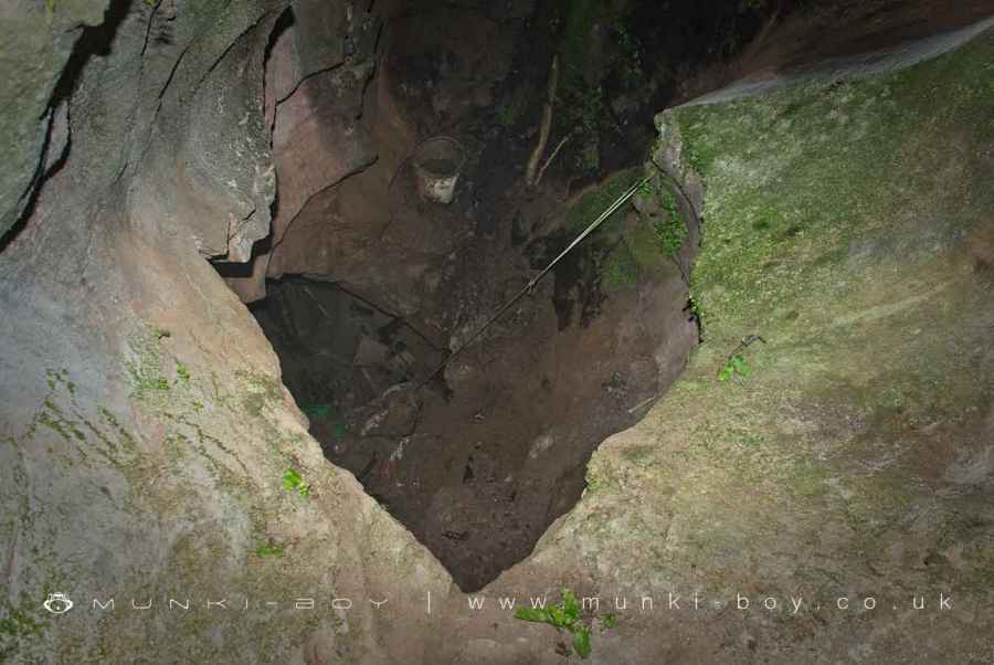
Fairy Hole consists of a chamber with a maximum width of c.5m and a depth of c.15m. A number of small joints are visible, and there is a passage heading southwards beneath the entrance (Ashmead, 1973, 1974). Most of the present cave has been uncovered as a result of early archaeological work and extensive later excavations by local cavers. The cave was excavated archaeologically before the First World War producing remains of at least two human skeletons, flint flakes, pottery, iron artefacts, and animal bones (Jackson, 1910).Extensive excavations were carried out by local cavers over a nine year period ending during the severe winter of 1962–63 and not resumed until the late 1990s. The dig completely cleared out the fill to an estimated depth of 10m, uncovering the passage beneath the entrance (Ashmead, 1973). The fill was dumped outside the entrance where it now forms a prominent vegetated spoil heap. Unfortunately, no detailed record was made of the sedimentary sequence but it is reported that two layers of boulder clay separated by a sandy layer were exposed (Holland, 1967, p.86). Fragments of “limestone, Silurian and Borrowdale volcanics” lithologies were included in the fill. The presence of a calcareous sand layer occurring beneath boulder clay was also reported by Ashmead (1974a). There is no significant in situ speleothem exposed in Fairy Hole, but numerous broken pieces of dripstone were found at a considerable depth in the fill during the excavations. The specimens are an average of 3–4cm thick and composed of closely-packed acicular crystals. They show three (in some cases four) brown-stained horizons, marking interruptions in deposition of calcite, with the present surface being stained in the same way and showing evidence of re-solution (Anon, 1963). The specimens are angular but with some rounding suggesting a degree of mechanical abrasion following breakage.Further caver activity in the late 1990s resulted in a deepening of the site to its present depth with the previously discovered passage being filled with plastic bags of dig spoil. This was presumably intended to conceal evidence of digging, asprior activity in the nearby Harry Hest Hole (Holland, 1967, p.84 – no corresponding entry in Brook et al., 1994) had come to the attention of the authorities (Fig.3). Scalloping on the walls of the excavated shaft shows it was a phreatic riser, i.e., water moved up the shaft towards the present cave entrance (Fig.4). Amongst the fill at the base of the shaft are pebbles and cobbles of high sphericity, of which many are from chlorite-bearing rocks within the Windermere Supergroup (the “Silurian” of Holland, 1967). The occurrence of similar high sphericity pebbles and cobbles has been recorded previously at and near the base of active phreatic risers (Murphy and Cordingley, 2013). Intriguingly, broken mineral-vein material consisting of calcite and hematite is included in the digging debris now slumping down the excavated shaft. There is evidence of hematite mineralization in the vicinity of Fairy Hole. A square infilled shaft in hematite-stained limestone at SD 49697295 (referred to as Fairy Hole Mine by Moseley, 1969) is probably an unsuccessful trial pit. There are traces of two more shafts on a parallel fault to the northeast at about SD 497729 and another infilled shaft on a minor fault at aboutSD 495734 (Moseley, 2010).
[Preliminary uranium-series ages and stable-isotopesfrom Fairy Hole, Warton Crag, Lancashire, UK:implications for speleogenesis and palaeoclimate - Murphy, P J 1, Moseley, G E 2, Moseley, M 3 and Edwards R L 4]
Fairy Hole is in Arnside & Silverdale AONB, a designated Area of Outstanding Natural Beauty.
Created: 13 March 2021 Edited: 29 November 2023
Fairy Hole
Local History around Fairy Hole
There are some historic monuments around including:
Arnside TowerMoated site and fishponds E of Upp Hall Farm.Badger Hole, Warton CragWarton Old RectoryBeetham Hall (curtain wall and uninhabited portion)Dog Holes CaveStone circle on Summerhouse HillHazelslack TowerCappleside Hall medieval lordly residence 600m north east of Beetham HouseWarton Crag small multivallate hillfortRound cairn on Summerhouse HillRound cairn 230m east of Manor Farm.


