Eggardon Hill
Eggardon Hill
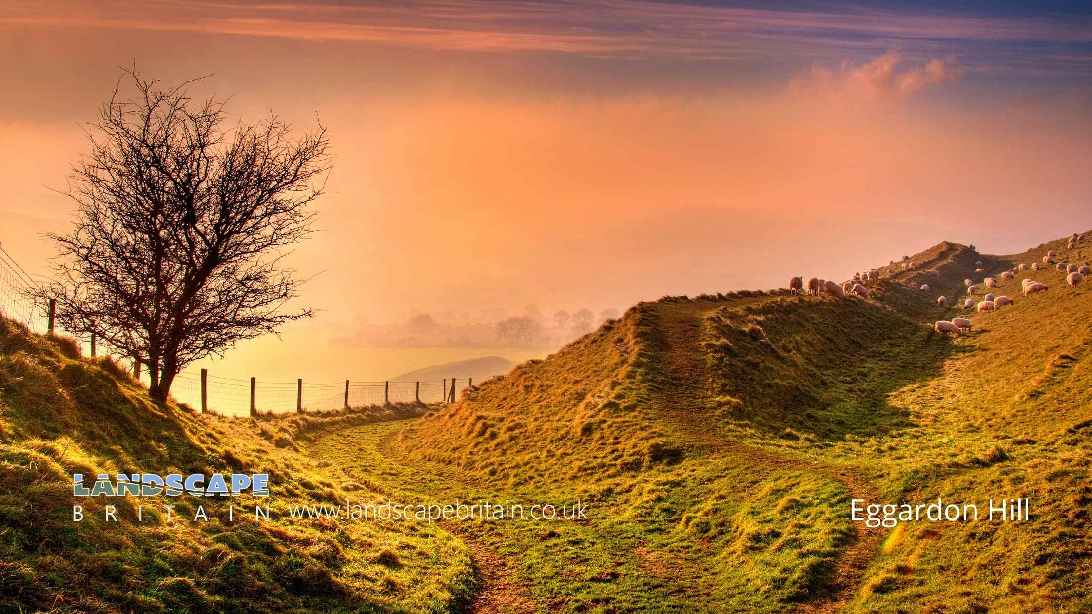
Eggardon Hill is the site of an Iron Age Hillfort located in the county of Dorset in southern England. The hillfort is situated on a chalk ridge overlooking the English Channel. It is one of a number of hillforts located in the area known as the Wessex Downs.
Eggardon Hill covers an area of approximately 21 hectares and is surrounded by a system of ditches and banks. The main defensive earthworks are located on the north and west sides of the site. There is also an inner ditch which may have served as a second line of defence. The entrances to the hillfort are located on the east and south sides.
The hillfort was probably built around 500 BC and was occupied until around AD 43. It is thought that it was abandoned after the Roman conquest of Britain.
Eggardon Hill is one of the best preserved hillforts in Britain and is a scheduled monument. It is also a Site of Special Scientific Interest due to its chalk grassland habitat.
The site is open to the public and can be accessed via a public footpath from the nearby village of Burton Bradstock. There is a small car park and an information board at the start of the footpath.
Eggardon Hill is a large multivallate hillfort, situated on the summit of the hill and enclosed by three ramparts on three sides. On the north side there are extra, outer banks and ditches.
The hillfort also encloses two bowl barrows.
There are a number of mounds and depressions on the enclosed area of the fort which represent contemporary buildings. In 1900 five of the circular hollows were excavated and found to contain a flint knife, saw, scrapers and numerous flakes and a broken quern.
There are also the remains of two, linear earthworks which are older than the fort and have been dated to the Bronze Age due to pottery found during excavations which began in 1963.
Eggardon Hill is in Dorset AONB, a designated Area of Outstanding Natural Beauty.
Created: 12 September 2022 Edited: 29 November 2023
Eggardon Hill Details
Eggardon Hill is a 252 metre high hill in Dorset.
Eggardon Hill Information
Eggardon Hill Address
Eggardon Hill, Bridport DT6 3ST, UK
DT6 3ST
Eggardon Hill LiDAR Map
please wait...
Contains public sector information licensed under the Open Government Licence v3.0
Local History around Eggardon Hill
There are some historic monuments around including:
Two barrows on Chilcombe HillOld Warren earthworkBowl barrow 660m south west of ChilstockBowl barrow 800m NNE of Whatcombe House, forming part of the round barrow cemetery on the south western part of Black DownBind BarrowBowl barrow 550m north east of Pitcombe Farm, part of the Black Down round barrow cemeteryBowl barrow 360m south of Compton BarnDyke SE of Eggardon Hill campBowl barrow 770m north of Whatcombe House, forming part of the round barrow cemetery on the south western part of Black DownBowl barrow and disc barrow 730m south of Kingston Russell Farm, forming part of the round barrow cemetery on the south western part of Black DownPart of a Later Prehistoric or Romano-British field system 250m north of Eggardon Hill FarmBowl barrow 605m south west of Long Barrow FarmEggardon Hill disc barrowBowl barrow 1km south west of Manor FarmTwo long barrows and round barrows on Long Barrow HillEarthworks on Askerswell DownLarge multivallate hillfort containing two bowl barrows 855m north east of North Eggardon FarmBowl barrow on Hammiton Hill 220m south west of Hammiton FarmDyke on Long Barrow HillBowl barrow 680m north east of Whatcombe House, forming part of the round barrow cemetery on the south western part of Black DownBronze Age enclosure, associated linear earthworks and field system, and a later dewpond on Tenants HillBowl barrow 620m south west of Eggardon Hill FarmBowl barrow 140m south east of Broadwater CottageBowl barrow 700m east of South Eggardon FarmBowl barrow 850m north west of Barrowland FarmBowl barrow 750m SSE of Lower Kingston Russell FarmRound barrow on Knight's HillThree bowl barrows on The Knoll 450m north west of TreetopsPart of a Later Iron Age or Romano-British settlement 590m north west of Compton BarnSettlement E of Brow CopseTwo bowl barrows 310m north east of Lancombe FarmCamp on Chilcombe HillBowl barrow 400m north east of Look FarmLong mound and three bowl barrows forming part of a round barrow cemetery 760m NNE of Whatcombe House on the south western part of Black DownBowl barrow on Limekiln Hill 650m south east of Green LeazeBowl barrow 645m south west of North Barn FarmBowl barrow 320m north west of Coombefield FarmMotte and bailey castle 160m north of Castle Mill FarmPenannular ditched enclosure, 150m south of Turner's Farm BarnWynford Wood boundary bankGroup of three round barrows W of Two GatesStanding stone 700m south east of North Barn FarmBowl barrow 550m north west of Cogden FarmChambered tomb 900m south west of Manor FarmBarrow 650yds (600m) N of North Barn FarmCross dyke 600m north of Pitcombe FarmEarthwork 80yds (70m) long NW of Coombe BottomBarrow beside Shotcombe LaneChambered tomb called The Grey Mare and her ColtsGroup of three round barrows on Eggardon HillBowl barrow 800m south of Kingston Russell Farm, forming part of the round barrow cemetery on the south western part of Black DownBowl barrow 800m north east of Gorwell FarmBowl Barrow, 710m south-west of Woolcombe FarmDyke on Haydon DownEarthwork on Shipton HillLong barrow NE of AshleyHillfort N of Burcombe WoodThe Kingston Russell stone circle 750m north east of Gorwell FarmBowl barrow 550m WNW of Dowerfield HousePark pale in Rampisham parkLong mound 860m NNE of Whatcombe House, associated with the round barrow cemetery on the south western part of Black DownRound barrow E of Two GatesTwo round barrows at crossroads N of villageBowl barrow 810m NNE of Whatcombe House, forming part of the round barrow cemetery on the south western part of Black DownSt Mary's Church, West MiltonBarrow 300yds (280m) SW of Kingston Farm.


