Dalcairnie Linn
Dalcairnie Linn
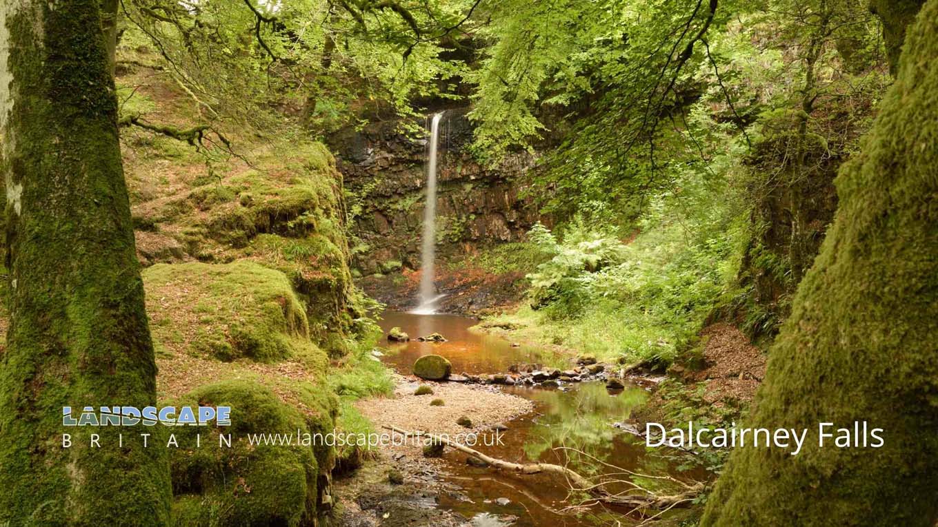
The popular falls at Dalcairney near Doon Bridge on the Dalcairnie Burn to the west of the town of Bellbank.
Created: 27 November 2021 Edited: 29 November 2023
Dalcairnie Linn
Dalcairnie Linn LiDAR Map

Contains public sector information licensed under the Open Government Licence v3.0
Local History around Dalcairnie Linn
There are some historic monuments around including:
Knockdon, enclosure 700m NE of Prehistoric domestic and defensive: enclosure (domestic or defensive) SM7491Donald's Isle, Loch Doon, settlement 750m SSW of Lamdoughty Farm Secular: settlement, including deserted, depopulated and townships SM8616Laight Castle Secular: castle SM7690Dalmellington,motte Secular: motte SM3009Waterside, Dalmellington Ironworks Industrial: mines, quarries SM4345Waterside, miners' villages & mineral railways N of Industrial: rail SM7863Bogton Loch airfield, 175m SSE of Buchan's Bridge, Dalmellington 20th Century Military and Related: Military airfield SM13693Waterside Bing, iron slag bing, Dalmellington Ironworks Industrial: tip, bing, dump SM7544Dalnean Hill, farmstead and field system Secular: farmstead SM4390Munteoch, settlement and field systems Secular: settlement, including deserted, depopulated and townships SM5200.


