Culloden Tower by Ian
Culloden Tower
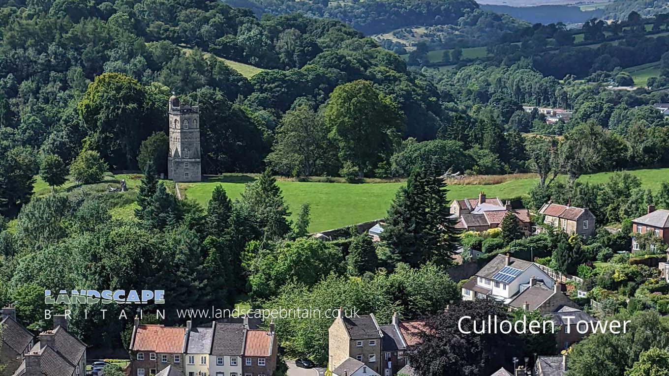
Culloden Tower was designed around 1746 by Daniel Garrett, an architect from Inverness. The tower was built as a monument to the Battle of Culloden.
The present structure, originally known as the Cumberland Temple, was erected by John Yorke as a monument to commemorate the Duke of Cumberland’s army’s victory over Bonnie Prince Charlie near Inverness in April 1746.
In 1981, Culloden Tower was in a dilapidated condition; the leaking roof had caused rot in the timbers, the interior had been damaged, and the basement area had been converted into a cattle shed and hay loft.
In the early 1980s, the tower was restored by County Council workers - a new roof and windows were added - and then gifted to the National Trust for Scotland.
Today, Culloden Tower is a Historic Scotland property open to visitors from April through October. The tower boasts a unique circular viewing platform at the top of an internal stair leading
Created: 7 November 2021 Edited: 29 November 2023
Culloden Tower Information
Culloden Tower Address
1 Cravengate, Richmond
DL10 4RF
Website: https://www.landmarktrust.org.uk/search-and-book/properties/culloden-tower-5579
Get directionsLocal History around Culloden Tower
There are some historic monuments around including:
Section of the Scots Dyke linear boundary 225m south of St Martin's PriorySection of Scots Dike linear boundary south of Kirklands FarmSt Giles medieval hospital, post-medieval farmstead and Iron Age occupation site immediately north of St Giles FarmSection of Scots Dyke linear boundary running south from Olliver East for 550mRoman fort and prehistoric enclosed settlement 400m west of Carkin Moor FarmWest Hauxwell churchyard crossFranciscan friarySection of Scots Dyke linear boundary 75m south west of Sandford HouseSection of Scots Dike linear boundary north west of High MerrybentSt Martin's Benedictine Priory, RichmondSection of Scots Dike linear boundary north of Kirklands FarmRomano-British enclosed settlement 340m north east of East Applegarth at Whitcliffe ScarSection of Scots Dyke linear boundary 150m ENE of OlliverRichmond BridgeSection of the Scots Dyke linear boundary 250m south east of St Martin's PrioryMedieval cross base known as Plague Stone, 750m WSW of High ScalesSection of Scots Dyke linear boundary and portion of field system 100m east of Whitefields FarmThe Bargate, medieval gatewayRavensworth motte and bailey castle, water defence features, park pale and shrunken medieval village18th century copper mill 80m north west of Copper Mill BridgeRichmond Castle: eleventh to fourteenth century enclosure castleEasby Abbey Premonstratensian monastery: monastic precinct, cultivation terraces, water-management features and ancillary buildings.


