Cross Roads by halbergman
Cross Roads
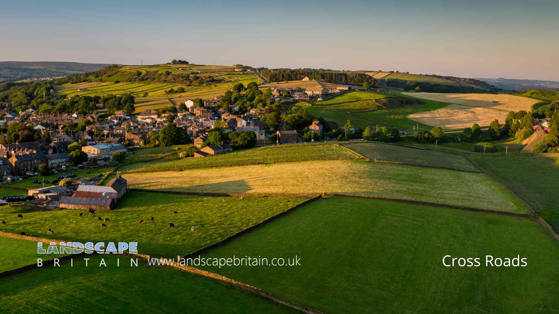
Cross Roads is a small village situated near Keighley, in the heart of West Yorkshire, England. Nestled amidst the rolling hills and verdant landscapes of the Brontë country, this charming locale is known for its rich history and tight-knit community. Keighley itself has been a significant market town since the Middle Ages, and the nearby hamlets, including Cross Roads, have benefited from this prominence.
The name “Cross Roads” is quite descriptive, as the village historically served as a convergence point for various routes through the countryside. Over the years, it has witnessed countless travelers, merchants, and settlers passing through, each leaving their unique imprint on the village’s tapestry. Architecturally, Cross Roads boasts a delightful mix of traditional stone-built houses and more modern constructions, reflecting its evolution over centuries. The village, while retaining its tranquil and bucolic charm, has always managed to keep pace with the changing times, making it a unique blend of the old and the new. A walk through its meandering lanes offers a glimpse into a bygone era, while also showcasing the dynamism of a community looking towards the future.
Created: 26 August 2023 Edited: 29 November 2023
Cross Roads
Local History around Cross Roads
There are some historic monuments around including:
Two cup and ring marked rocks in conifer plantation on RivockCairn 290m north of Woodhead on Harden MoorFive carved rocks near the edge of Rivock outcropSplit and hewn cup-marked rock north of a wall junction on RivockCup marked rock 14m from the wall on the unforested plateau at RivockOre hearth smeltmill and wood drying kiln in Lumb Clough Wood, 350m south east of Bank FootLarge cup and ring marked rock in forestry furrows on RivockCup marked rock 47m south east of Rivock Edge triangulation pillarCup marked rock on north side of barn, 100m north west of the Grey Stones FarmCairn 330m north of Woodhead on Harden MoorCup marked rock 1m from wall on unforested plateau at RivockCup and ring marked rock 42m east of Rivock Edge triangulation pillarRing cairn 310m north of Woodhead on Harden MoorCup marked rock in forestry furrow on RivockLate prehistoric enclosed settlement known as Castle Stead RingCup marked rock 19m above forestry track in Rivock conifer plantationCup marked rock near wall below Rivock EdgeLarge carved rock at hill top, north east of line of stone grouse butts on RivockLate prehistoric enclosed settlement known as Catstones Ring on Catstones HillLarge carved rock in the wall between grouse moor and forestry plantation on RivockLow rock with one cup on unforested plateau at RivockCup marked rock just within afforested area north east of wall on RivockSix carved rocks in field west of Riddlesden Golf CourseRock with at least six cups 170m north west of Grey Stones FarmCup and groove-marked rock on Rivock, west of a deep channelCup and ring-marked rock north east of a wall junction on the southern flank of Rivock.


