Croshaw Wood Waterfall by munki-boy
Croshaw Wood Waterfall
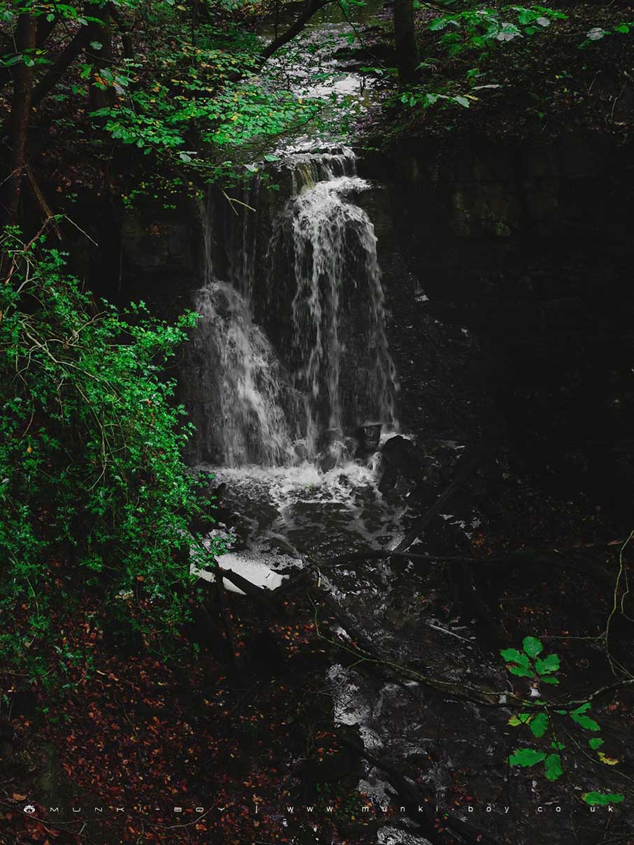
The waterfall at Croshaw Wood can be great after rain and in the right light, at other times it is almost dry and the shady ravine in which it hides is awkward.
On good days the rocky shelf formed due to a geological fault creating a shelf with softer sediment below is just perfect with a decent cascade of water coming over the lip.
The small brook that goes over the fall must have once had more volume of water but today it is very small. The waterfall actually gets wet when the Leeds and Liverpool Canal up the slope has too much water, and an overflow system leading down into the brook supplies extra water.
The ravine in which the waterfall sits is quite steep and slippery with leaf-mulch and falled leaves, the waterfall is best viewed from above on the North side of the brook but decent is too steep here.
Created: 23 October 2019 Edited: 29 November 2023
Croshaw Wood Waterfall
Croshaw Wood Waterfall LiDAR Map
Contains public sector information licensed under the Open Government Licence v3.0
Local History around Croshaw Wood Waterfall
There are some historic monuments around including:
Cross base on Standish Wood Lane 700m south east of Standish HallMoated site at Arley Hall, Haigh near WiganMarket cross in the marketplace to the west of St Wilfrid's Church, StandishMabs Cross on Standishgate, 20m west of Mabs Cross School buildingHaigh Sough mine drainage portal, 310m west of Park HouseCross base on Green Lane 300m north of Strickland House Farm, StandishThe Moat House moated site 600m WNW of St David's ChurchRound Loaf bowl barrow on Anglezarke MoorHeadless Cross, GrimefordCross base at the junction of Standish Green Lane, Standish Wood Lane and Beech Walk, 200m NNW of Strickland House Farm, StandishGidlow Hall moated site, Aspull, 560m NNE of Pennington HallBretters Farm moated site and two fishpondsPike Stones chambered long cairn.


