Cracoe by munki-boy
Cracoe
Cracoe is in The Yorkshire Dales National Park in England.
Cracoe is a village in North Yorkshire, situated a few miles south-west of Grassington and close to Rylstone. It lies within the Craven district and is surrounded by the characteristic limestone scenery of the southern Yorkshire Dales. The village is set along a single main road, with houses and farms lining both sides, and it retains a peaceful rural atmosphere.
The area around Cracoe has long been associated with agriculture, particularly sheep and cattle farming, and dry stone walls divide the surrounding fields. The land rises to the west towards Cracoe Fell, a prominent ridge that forms part of Barden Moor. Near the summit stands the Cracoe War Memorial, a tall stone obelisk visible for miles around. It commemorates local men who died during the First and Second World Wars and is a well-known feature in the landscape.
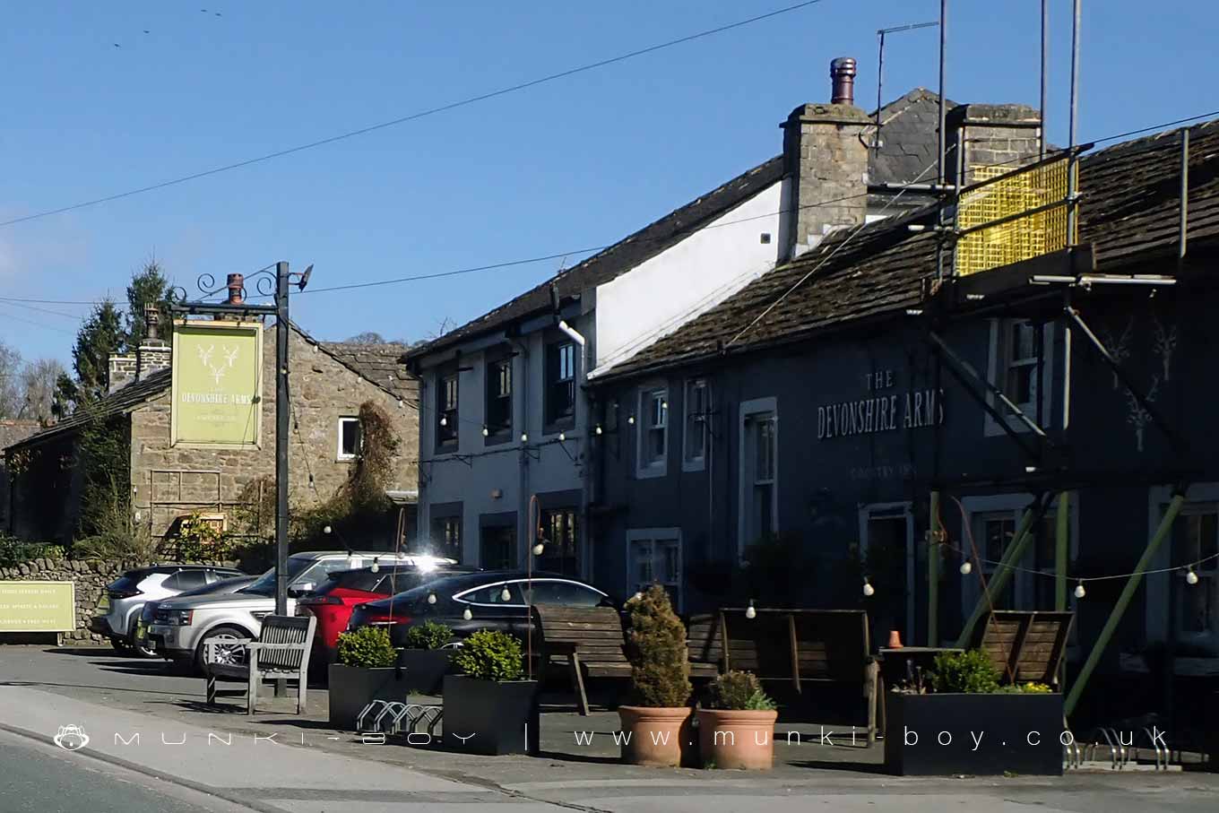
Cracoe has a small number of local services including a pub, The Devonshire Arms, and a village hall that hosts events and community gatherings. There is also a café and a farm shop nearby, popular with both locals and visitors. The village church, St Peter’s, serves both Cracoe and Rylstone, and sits just outside the main village area.
Historically, Cracoe was involved in lead mining, like many settlements in the Dales, though little now remains of that industry. The village is also connected to the story of the Rylstone Women’s Institute and the “Calendar Girls,” several of whom lived in or near Cracoe.
Today, Cracoe remains a quiet and attractive place, appreciated for its walking routes and open views. Footpaths lead up to the moor and the war memorial, and the area draws visitors looking for a more peaceful corner of the Dales.
Created: 3 April 2025 Edited: 2 May 2025
Cracoe
Local History around Cracoe
There are some historic monuments around including:
Fields and hut circles SE of Scot Gate LaneDruid's Altar four poster stone circleCairn on Old Pasture, 820m south east of Bull ScarHydro-electric power house and associated weir 250m north west of Tin BridgeGrassington enclosuresScale Hill round cairnRoman villa at Kirk SinkSettlement at Chapel House WoodTwo settlements in Grass WoodEnclosures on Old PastureCalton Gill round cairnRedmayne packhorse bridgeCup marked rock in wall east of Scarnber Wood, 500m north east of Bark Laithe, WinterburnCairn in Brazen Gate Woods 260m NNE of Long AshesKilnsey Moor settlementYarnbury henge monumentLinton churchyard cross and sundialPark Hill earthworkPillow mounds east of Friars Head, known as Giants' GravesEnclosure S of Bull ScarCairn on Old Pasture 885m NE of Little LatheSettlement SE of Druid's AltarEnclosures 600yds (550m) SE of Wassa HillCairn on Haw HillHigh Wood bowl barrowMedieval farmstead and field system, 530m south east of The GrangePrehistoric unenclosed hut circle settlement and associated field system at Little WoodCairns and settlements on Lea Green.


