Coate Water
Coate Water
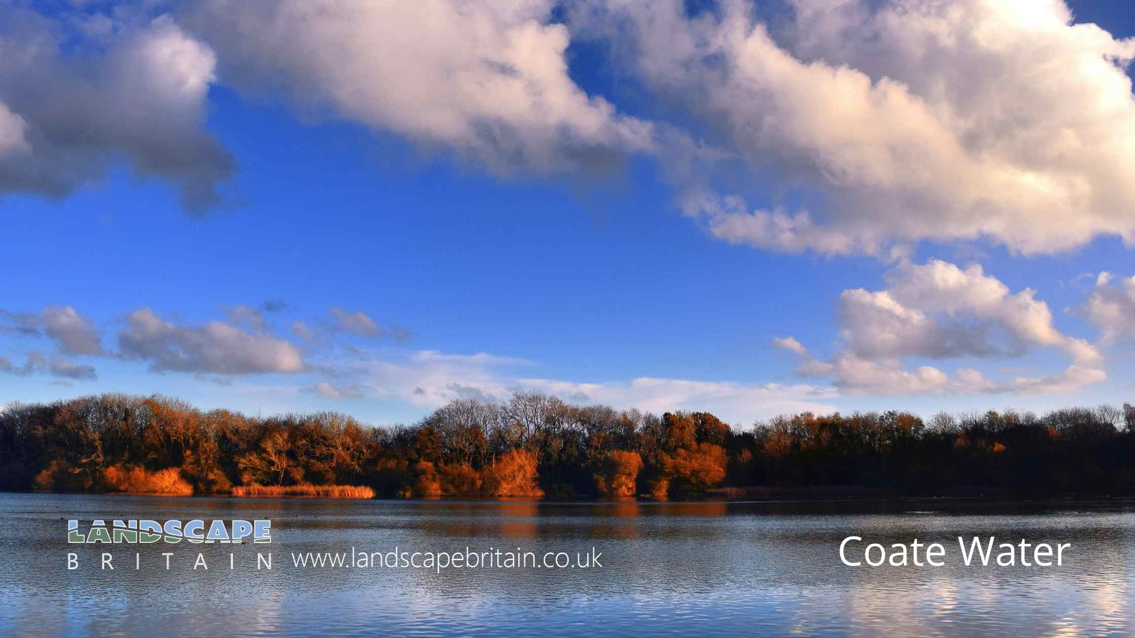
Coate Water is a former reservoir that was created to provide water for the Wiltshire and Berkshire Canal.
The reservoir, which is now a 70 acre lake, was built in 1822 by diverting the River Cole.
Created: 6 August 2022 Edited: 29 November 2023
Coate Water Details
Coate Water is a small freshwater lake in Wiltshire, situated at an altitude of around 113 meters and is very shallow.
The shoreline of Coate Water is approximately 4.393 Kilometers all the way round.
- Altitude: 113 m
- Shoreline: 4.393 Km
- Depth: very shallow
Coate Water
Local History around Coate Water
There are some historic monuments around including:
Medieval settlement and associated ridge and furrow, West LeazeBanjo enclosure 480m south west of CheldeneEarthwork enclosure and dewpond 490m north of Barbury CastleWhitefield Hill ditchBowl barrow 210m north east of Rushy Platt FarmStone circle immediately north east of Day House, CoateSite of Roman town, W of Wanborough HouseThree bowl barrows: part of a barrow cemetery west of Barbury CastleTwo enclosures on Winterbourne DownLinear boundary earthwork west of Liddington CastleRemains of Holy Rood Church, The Lawn, Old TownSite of watermill 290m south east of West LeazeBowl barrow 750m south-east of Barbury Castle FarmRoman rural sanctuary on Groundwell Ridge, east of Lady LaneBowl barrow 800m south-east of Barbury BarnDisc barrow on Burderop Down, 1km north-east of Upper Herdswick FarmBarrow on Coombe Down, 930yds (830m) WSW of St George's ChurchBarbury Castle Farm deserted Medieval villageBowl barrow 1450m south of Barbury Castle FarmPreshute Down field systemField system and earthwork enclosure on Burderop DownBarrow 350yds (320m) E of Smeathe's Plantation, Ogbourne DownHall PlaceLiddington CastleSharpridge earthworksBarrow on Smeathe's RidgeBarbury Castle: a hillfort and bowl barrowBell barrow 350m south-west of Barbury BarnBowl barrow 85m north east of Day House CottagesSaucer barrow: part of a barrow cemetery west of Barbury CastleRound barrow 750yds (690m) SE of Smeathe's PlantationBowl barrow 880m north east of Lower Upham FarmTwo bowl barrows 680m north of Upper Herdswick Farm, Barbury DownCross in the churchyard of St John the Baptist and St HelenBowl barrow 1km west of Sheppard's Farm DairyMedieval settlement remains at OvertownChurch Hill earthworkSharpridge field systemBowl barrow 300m south-east of Walker's PlantationTwo earthwork enclosures and a linear earthwork 625m north of Barbury Castle.Where to Eat in coate-water
Wildlife in and around Coate Water
Coate Water Birds
There are 88 species of birds recorded as found near Coate Water.
| Barnacle Goose (Branta leucopsis) |
| Blackbird (Turdus merula) |
| Blue Tit (Cyanistes caeruleus) |
| Buzzard (Buteo buteo) |
| Carrion Crow (Corvus corone) |
| Black-Headed Gull (Chroicocephalus ridibundus) |
| Blackcap (Sylvia atricapilla) |
| Bullfinch (Pyrrhula pyrrhula) |
| Canada Goose (Branta canadensis) |
| Cetti's Warbler (Cettia cetti) |
Tap here for more wildlife found near Coate Water lake


