Clun Castle by Arthur S
Clun Castle
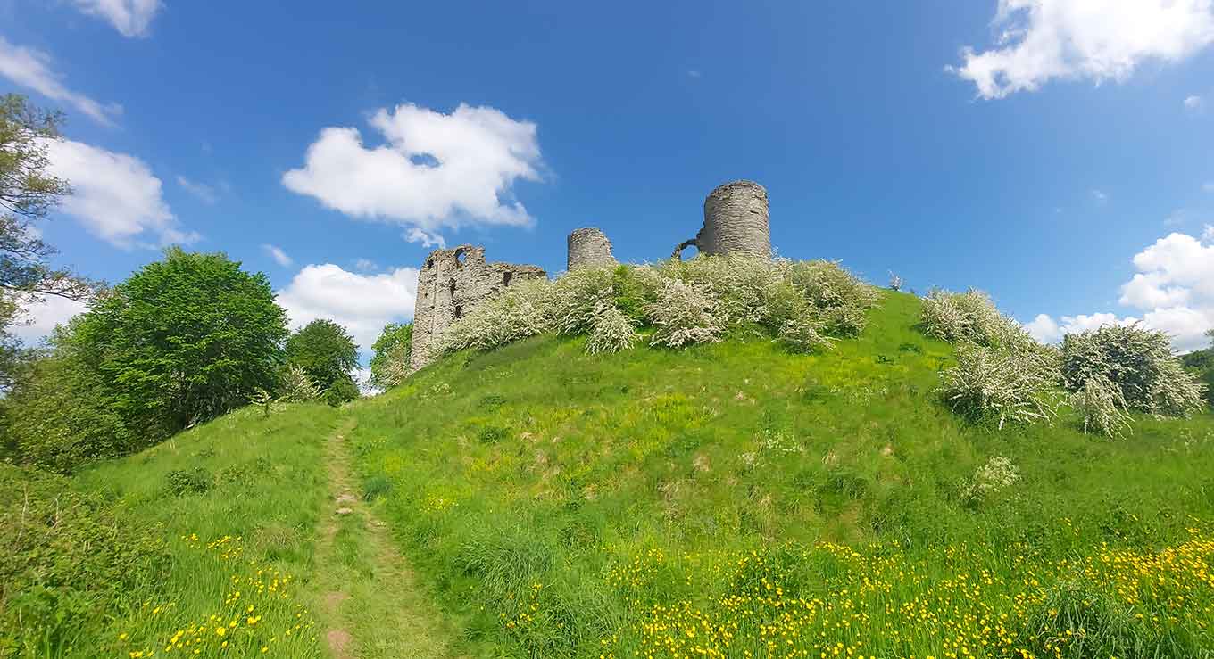
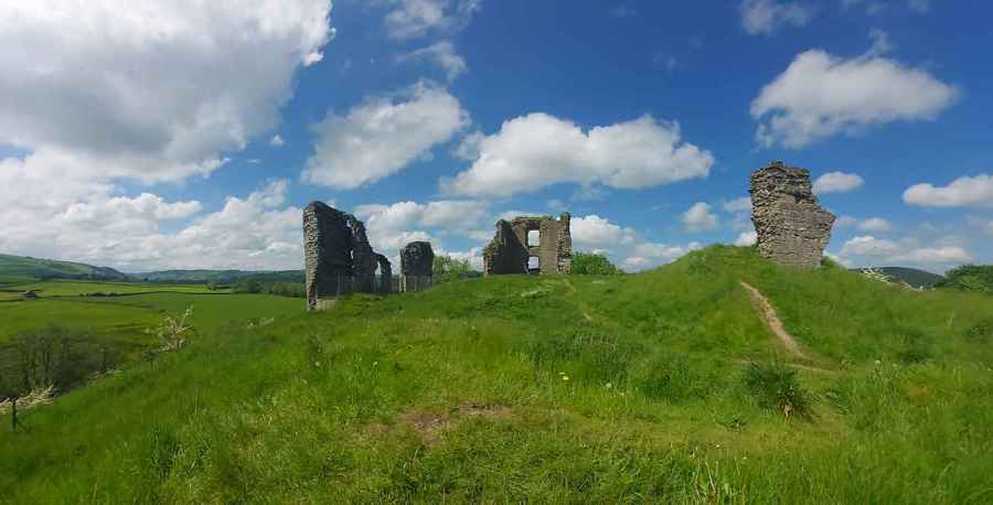
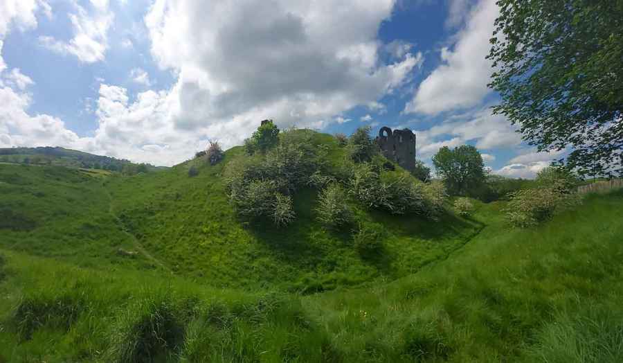
Clun Castle was built in the years following the Norman Conquest by Picot de Say, a follower of William the Conqueror. Comprising a central mound and two baileys, its buildings were originally constructed of timber. In the 13th century the Fitzalan lords of the castle built the great tower, which survives today as a ruin, as well as expanding the defences of Clun town, founded a century earlier. From the 14th century the castle was used as a hunting lodge, though by the 16th century it was described as ruined.Display panels explain the history, and provide a guide to the castle.
Clun castle was built in the late 11th century to proclaim Norman dominance over this part of the Welsh Marches. It later became home to the Fitzalans, an important ruling family.
After the Norman Conquest in 1066, the border between Wales and England remained an unsettled area. William the Conqueror granted lands here to his followers to defend the border. These men became powerful marcher lords, ruling their lands independently of royal control.
One of them, Picot de Say, is thought to have built the castle, high on a natural spur guarding the Clun valley. In 1155, the castle passed by marriage of Isabella de Say to William Fitzalan, and was owned by the powerful Fitzalan family for the next 400 years.
Clun was at the centre of a vast lordship known as the honour of Clun, over which the Fitzalans exercised unlimited authority, administering a mixture of Welsh and English law.
Clun Castle is in Shropshire Hills AONB, a designated Area of Outstanding Natural Beauty.
Created: 10 June 2021 Edited: 29 November 2023
Clun Castle Information
Clun Castle Address
Newport St, Clun, Craven Arms
SY7 8JT
Website: http://www.english-heritage.org.uk/visit/places/clun-castle/
Get directionsClun Castle LiDAR Map
please wait...
Contains public sector information licensed under the Open Government Licence v3.0
Local History around Clun Castle
There are some historic monuments around including:
Motte castle at Colebatch, 100m north of LagdenBowl barrow 500m north of The Oak FarmOffa's Dyke: section 1600yds (1460m) long, N from St John the Baptist's Church to River UnkOffa's Dyke: section 430m north east of Middle Knuck FarmCaer Caradoc: a small multivallate hillfortOffa's Dyke: section 400m north and 170m east of Selley HallBicton DitchesBury Ditches, a small multivallate hillfort on the summit of SunnyhillOffa's Dyke: section 475m north east of Nether SkyborryBowl barrow on Acton Bank, 170m north of Acton HouseBowl barrow 610m south west of Springhill CottageSmall enclosed settlement in Knuck WoodSmall enclosed Iron Age or Romano-British settlement and adjacent cultivation remains, 450m north west of Cwm FarmRockhill EarthworkOffa's Dyke: section 650m east of Cwm-sanahamStanding stone 350yds (320m) SE of Whitcott KeysettMotte castle and associated settlement remains 150m NNW of Lower Down FarmRing cairn on the summit of Pen-y-wern HillRadnor Wood CampSmall enclosed settlement on Fron, 340m west of St John's ChurchOffa's Dyke: section 400m south west of Springhill FarmOffa's Dyke: section on the western slope of Llanfair Hill, 1.4km south west of BurfieldBowl barrow 390m south east of Stanley CottageOffa's Dyke: section 175m east of Cefn BronyddRecumbent standing stone on Pen-y-wern Hill, 150m south east of a ring cairnColstey Bank Iron Age enclosureOffa's Dyke: section 575m north west of MyndtownBowl barrow 300m south of SkyborryBicton motte and bailey castleOffa's Dyke: section 90m south of BrynorganClun Castle: a motte and bailey castle and formal garden earthworksCamp on Llanfair HillCnwclas Castle Offa's Dyke: section 400m east of Cwm FarmOffa's Dyke: section 890m north west and 320m west of Little SelleyOffa's Dyke: section 730m south east of The Yew TreeBowl barrow on Hergan Hill, 530m north west of Myndtown.


