Chevin Forest Park
Chevin Forest Park
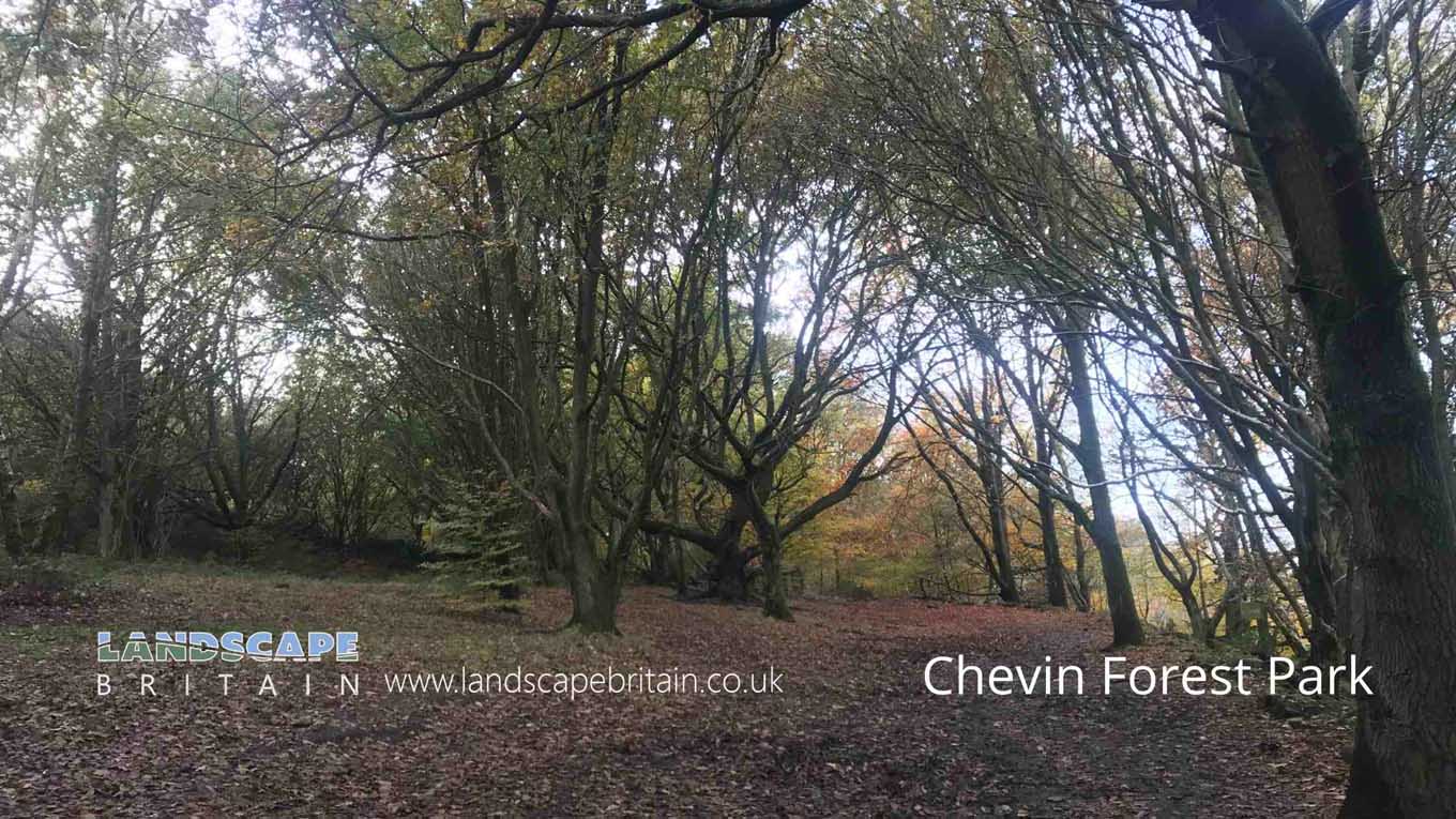
Otley Chevin Forest Park is home to some very rare plants and animals. It can be found on the steep slopes by the crags at the top of the chevin.
The chevin has long been home to rare plants and animals. There are many types of trees in Cranwell Woods, including oak, ash, birch, rowan and yew. Other wildlife includes woodpeckers. Otley Chevin is also home to several species of bat that have their homes in the cracks within the crags on top of the chevin.
Otley chevin forest park is a great place for walking with some stunning views. The chevin extends some five miles (8km) from Bramhope to Pool-in-Wharfedale over high ground with some steep sides and deep river valleys containing some basalt outcrops.
Created: 13 January 2022 Edited: 29 November 2023
Chevin Country Park Information
Chevin Country Park Address
Chevin Country Park, York Gate, Guiseley, Otley LS21 3NU, UK
LS21 3NU
Chevin Forest Park Woodland
Chevin Forest Park is a 176.89 hectare, woodland area in West Yorkshire, managed by Leeds City Council.Local History around Chevin Forest Park
There are some historic monuments around including:
Cup and groove marked rock, 700m north east of Whin Hill Farm, Askwith MoorRock with single cup mark near south east edge of gas pipeline, Snowden Carr, 430m SSE of Crag House, Askwith MoorCup and ring marked rock 40m south east of Hillcourt, RawdonCarved rock near north east corner of the plantation on Weston Moor 550m north west of Weston Moor CottageCup and ring marked rock on ridge 520m south of triangulation pillar on Shooting House Hill, Askwith MoorRock with one cup mark, 290m S of Crag House, Askwith MoorCarved rock in Hawksworth SpringCup and ring marked rock in Wharfemeadows Park, 280m west of Newall HallRock with one or two cup marks near derelict walling below outcrop in enclosed pasture on Snowden Carr, 350m west of Carr FarmCup marked rock near gate in enclosed pasture on Snowden Carr, 460m south west of Washburn FarmRoman period native settlement in Poolscar Wood, 350m south of Stubbings FarmRock with at least 33 cup marks, some enclosed by grooves, at top of slope between fence and Snowden Beck in Ellers Wood, Dob Park, 600m NE of Midge HallCup, ring and groove marked rock south of track on Weston Moor 500m WNW of Weston Moor CottageRock with cup marks, rings and grooves near derelict grouse butt, 440m SE of triangulation pillar on Shooting House Hill, Askwith MoorGritstone pillar with three cup marks in the north pavement of the A65 at Horsforth, 440m south east of the roundabout at Low FoldRock with cup marks and grooves near boundary between Askwith Moor and Denton Moor, 600m east of DunkirkCup marked rock in boulder walling between Southpiece Cottage and Bleach MillCairnfield, enclosures, boulder walling, hollow way and carved rocks towards edge of Snowden Carr centred at 370m south east of Crag HouseSmall cairnfield with carved rocks north of the plantation on Weston Moor centred 730m north west of Weston Moor CottageCarved rock below Snowden Crags on Snowden Carr, 100m south of Crag HouseTwo cup marked rocks near track, 180m east of triangulation pillar on Shooting House Hill, Askwith MoorCup marked rock 42m west of gate near Dob Park Bridge, adjacent to track on south bank of River WashburnA 17th century park lodge known as Dobpark Lodge in Dob Park, near OtleyRock with one cup mark near boundary between Askwith Moor and Denton Moor, 590m ESE of DunkirkCairnfield and carved rocks on Snowden Carr 670m south west of Low Hall FarmThree carved fragments of gritstone outcrop in enclosed pasture on Snowden Carr, 500m south west of Washburn FarmRock with at least eight cups south of track on Weston Moor 480m WNW of Weston Moor CottageCup, ring and groove marked rock 2m south of north wall of Gab Wood 330m E of Moseley Farm, CookridgeCairn 7m in diameter north of track east of plantation on Weston Moor 450m WNW of Weston Moor CottageRock with one cup mark and two short grooves, south of Snowden Beck in Ellers Wood, Dob Park, 570m south east of Carr FarmCup, ring and groove marked rock near gate in enclosed pasture on Snowden Carr, 350m south of Low Hill FarmRock with cup marks enclosed by grooves at north east end of ridge, south of Snowden Beck in Ellers Wood, Dob Park, 420m north of Low ParkRock with one cup mark east of the plantation on Weston Moor 380m north west of Weston Moor CottageCup and grooved marked rock in tree line between New Close Quarry and Poppling Well Beck, 280m south west of Whitbeck ManorCup and ring marked rock at Hoyle Court Drive, CharlestownCup and groove marked rock east of New Close Quarry, 300m south west of Whitbeck ManorRock with five or more cups south of track on Weston Moor 300m WNW of Weston Moor CottageCup and ring marked rock on Little Alms CliffOtley BridgeCarved rock on Pelstone Crag 530m west of Danefield HouseAnti-aircraft gunsite 280m east of Carlton HallRock with at least two cup marks south east of cairnfield on Snowden Carr, 720m SSE of Crag HouseCup, ring and groove marked rock 15m from south wall of Gab Wood 300m east of Moseley Farm, CookridgeCup and groove marked rock in boulder walling between Southpiece Cottage and Bleach MillCup, ring and groove marked rock, 400m west of Carr FarmCup, ring and groove marked rock in enclosed pasture on Snowden Carr, 500m south east of Crag HouseCup marked rock in Calverley Wood, 200m north east of junction of Calverley Cutting and Thornhill DrivePrehistoric enclosure, carved rocks and orthostat wall, Buck Wood, 195m west of football groundRock with large oval cup east of plantation on Weston Moor 830m WSW of Dob Park House FarmRock with at least two cups and a groove east of the plantation on Weston Moor 450m north west of Weston Moor CottageRock with one large cup mark, 230m east of the triangulation pillar on Shooting House Hill, 610m SSW of Crag HouseCup and ring marked rock known as the Knotties Stone on Otley Chevin, 270m north east of The Royalty public houseRock with at least 30 cup marks and some grooves near north east end of ridge, south of Snowden Beck in Ellers Wood, Dob Park, 400m north of Low ParkRoman period native settlement in Danefield Wood, 490m south west of Stubbings FarmTwo carved rocks south of Snowden Beck in Ellers Wood, Dob Park, 570m south east of Carr FarmCairn 6m in diameter south of track east of plantation on Weston Moor 300m WNW of Weston Moor CottageRock with at least seven cup marks at edge of track on Stoop Hill, 890m SSE of triangulation point on Shooting House Hill, Askwith MoorTwo carved rocks south of derelict grouse butt, 840m SSW of Crag HouseRock with at least two cup marks on Hollin Tree Hill, 840m NNE of Whin Hill Farm, Askwith MoorCup marked rock 640m north east of Whin Hill Farm, Askwith Moor.


