Chester Roman Amphitheatre
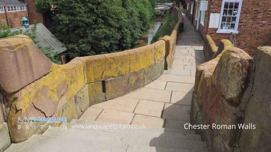
Chester Roman Amphitheatre and Roman Walls
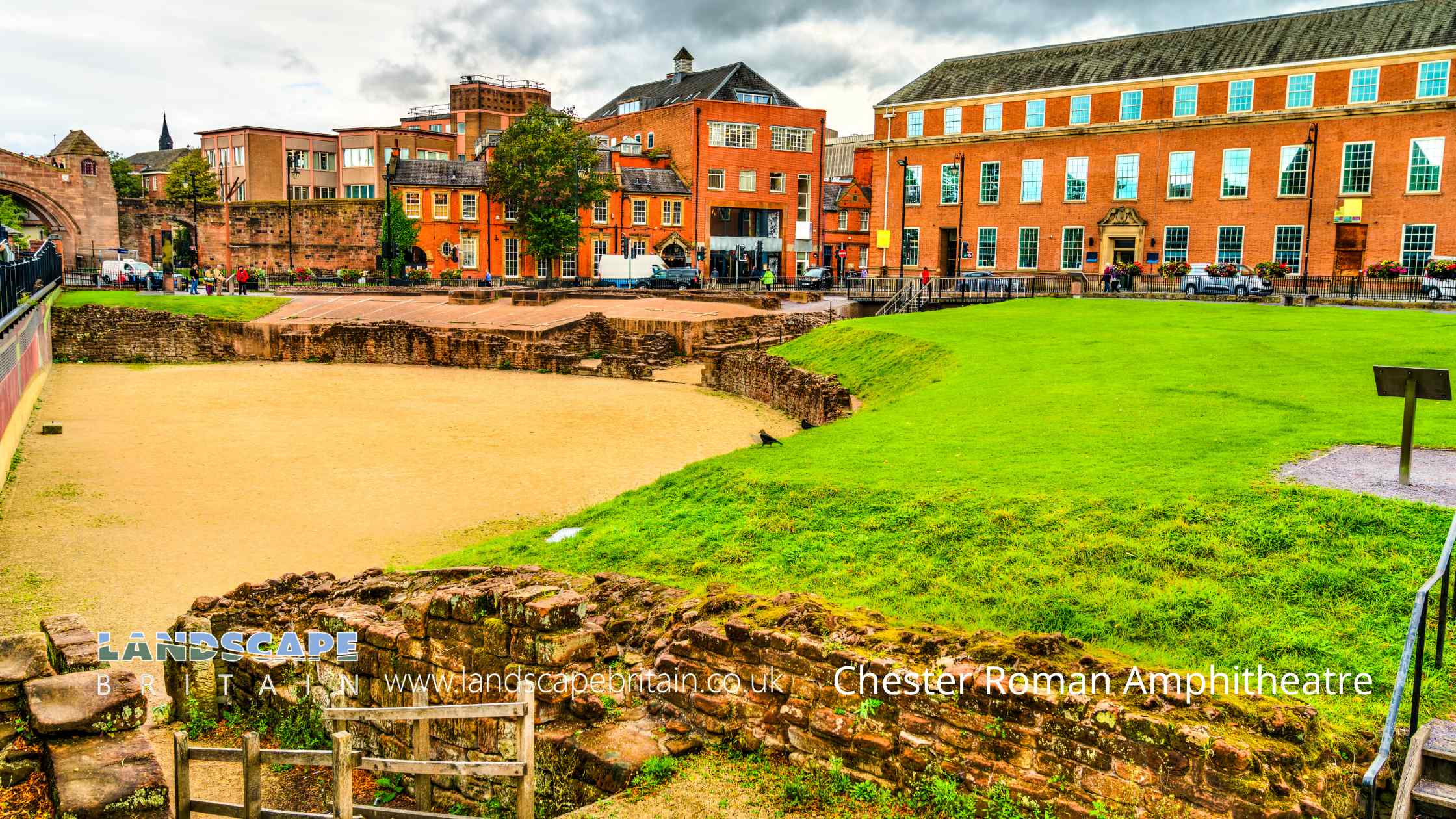
The Roman Amphitheatre in Chester, also known as the Chester Roman Amphitheatre, is a historical landmark that dates back to the 1st century AD. It was built by the Romans during their occupation of Britain and was used for various events, including gladiator fights and animal hunts.
Today, the amphitheatre is open to visitors who are interested in exploring the ruins and learning more about the history of the Romans in Britain. Here’s a brief visitor guide to help you make the most of your visit:
Location:
The Roman Amphitheatre is located in the heart of Chester, in the north-west of England. It’s just a short walk from the city centre and is easily accessible by car or public transport.
Opening hours:
The amphitheatre is open to visitors daily, from 10 am to 5 pm, except for Christmas Day, Boxing Day, and New Year’s Day.
Admission:
There is no admission fee to visit the amphitheatre, and visitors can explore the site at their own pace.
What to expect:
The amphitheatre is a partially reconstructed site, which means that some parts of the ruins have been restored to their original condition. Visitors can walk around the arena, sit on the stone benches, and explore the underground tunnels where gladiators and animals were kept before the events. There is also a museum on-site that provides additional information about the history of the amphitheatre and the Romans in Britain.
Overall, the Roman Amphitheatre in Chester is an impressive historical site that offers a glimpse into the past. It’s a must-visit destination for anyone interested in Roman history and architecture.
Created: 20 April 2023 Edited: 29 November 2023
Chester Roman Amphitheatre Information
Chester Roman Amphitheatre Address
Roman Amphitheatre, Little St John St, Chester
CH1 1RE
Website: http://www.english-heritage.org.uk/visit/places/chester-roman-amphitheatre/
Get directionsChester Roman Amphitheatre and Roman Walls LiDAR Map

Contains public sector information licensed under the Open Government Licence v3.0
Local History around Chester Roman Amphitheatre and Roman Walls
There are some historic monuments around including:
Roman camp at Upton, 400m east of the water tower north of Long LanePart of a Roman camp at Hoole 200m south of Hoole HallRoman camp at Upton, 350m north east of the water tower north of Long LaneRoman camp on Fox Covert Lane 650m north west of Picton GorseMoated site 180m W of Fir Tree FarmSt Nicholas' ChapelMoated site at Upton Grange, UptonMotte and associated earthworks east of Old RectoryThe Little Abbey Gateway, Northgate StreetStanding cross in St Mary's churchyardStanding cross in St Lawrence's churchyard, StoakHuntington Hall moated siteMoated site of Lea Hall, 80m east of Leahall FarmThe walls, towers, gates and posterns of the City of ChesterChapel at Chapel House Farm 200m west of Wervin Old HallChester Castle (part)Roman camp at Upton Heath, beside the water tower north of Long LaneAldford motte and bailey and shell keep castleBretton Hall Moated Site Pulford motte and bailey castleDodleston motte and bailey castleSt John's Church (ruined portions)Heronbridge Roman siteDodleston Hall moated siteDee BridgeAbbey Green Roman siteRoman amphitheatre (southern part)Roman camp 50m south of Elm BankBruera moated site and adjacent field systemBelgrave moated site and medieval gardenMoated site and fishpond S of Huntington HallMoated site north-west of Mill Hill House FarmRoman quarry including Edgar's Cave and the rock-cut figure of Minerva on Edgar's Field, 150m south west of Dee BridgeRoman camp 300m west of Upton Grange Farm.


