

Cheddar
Cheddar
Cheddar, situated in the heart of Somerset, is a charming village that carries with it a rich tapestry of history and cultural significance. Nestled close to the Mendip Hills, an Area of Outstanding Natural Beauty, Cheddar provides a picturesque setting that has captured the hearts of both residents and visitors for generations. The village, with its quaint streets and traditional architecture, offers a glimpse into England’s rural heritage.
Beyond its scenic beauty, Cheddar is internationally renowned for its cheese. Cheddar cheese, one of the most popular cheeses globally, traces its origins back to this village. For centuries, the unique aging and maturation process of this cheese, often within the region’s caves, has made it distinctive and sought after. While the Cheddar Gorge and its caves are significant attractions in their own right, the village itself stands as a testament to the enduring traditions of English countryside life and the rich culinary history of the region. Whether it’s for the taste of authentic Cheddar cheese or the tranquillity of its setting, Cheddar beckons to those seeking an authentic English experience.
Cheddar is in Mendip Hills AONB, a designated Area of Outstanding Natural Beauty.
Created: 11 August 2023 Edited: 29 November 2023
Cheddar
Local History around Cheddar
There are some historic monuments around including:
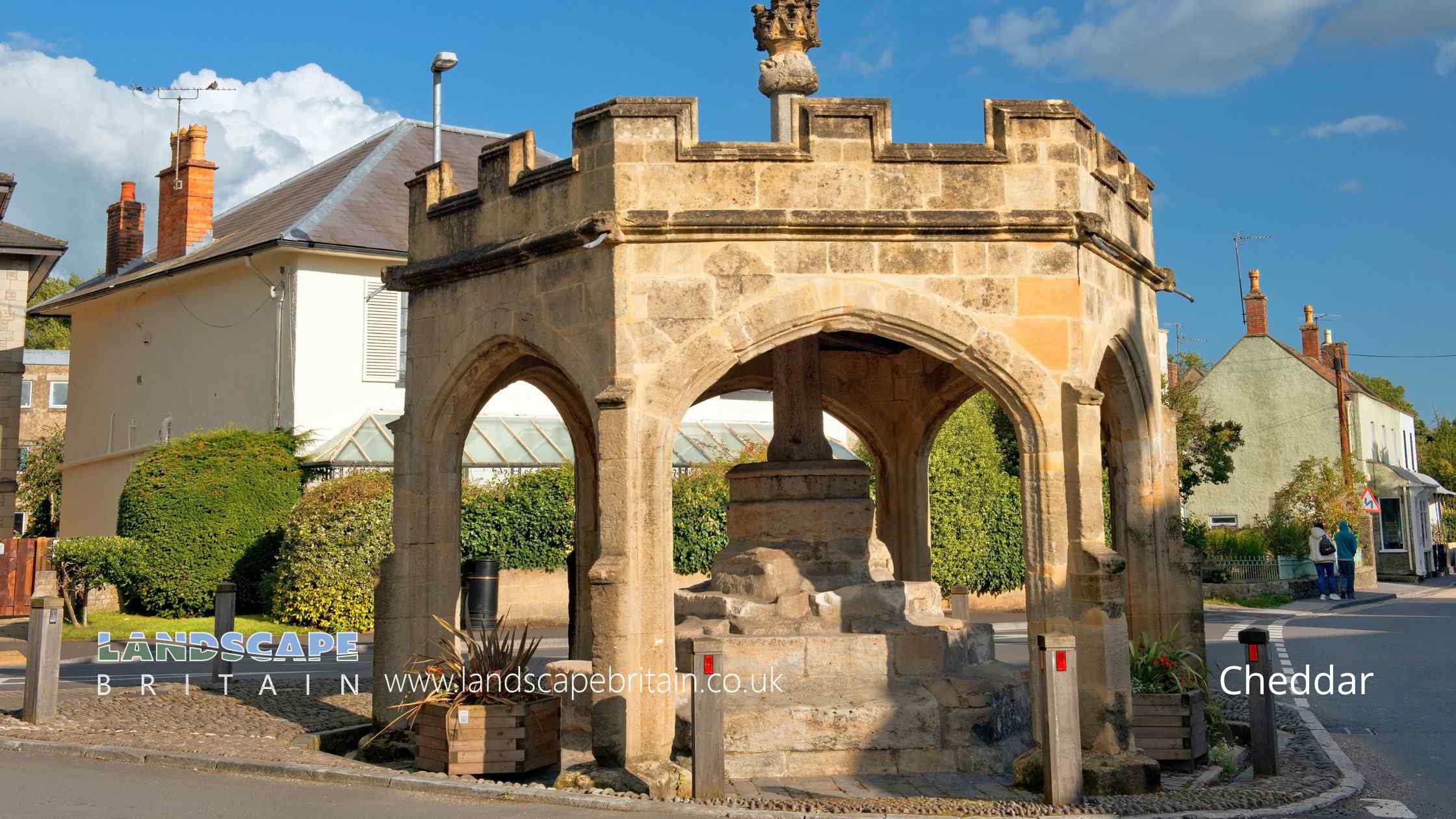
Market cross at the junction of Bath Street, Union Street and Church StreetGreat Oone's HoleEarly Christian settlement and monastic site at Marchey FarmBowl barrow 870m southwest of Charterhouse Warren FarmBowl barrow 91m south of Piney Sleight FarmBowl barrow 330m north of Stoke WoodsBowl barrow 300m north east of Tyning's FarmDuck decoy, west of Nyland HillRoman settlement site, Anglo-Saxon and Norman royal palace, and St Columbanus' ChapelGorsey Bigbury earth circle and round barrow near LongwoodBlackford Manor House MoatSlight univallate hillfort and associated earthworks on Burrington HamGough's Cave, Cheddar GorgeSun Hole, Cheddar GorgeDuck decoy 175m south west of Parson's FarmSoldier's Hole, Cheddar GorgeBowl barrow 350m east of Batts Coombe QuarryDeserted medieval farmstead 420m south of Gout House FarmGroup of three bowl barrows 180m south of Tyning's Farm: part of the Tyning's Farm round barrow cemeteryRowberrow Cavern, Mendip ForestWayside cross at Stoughton CrossBowl barrow 420m north of Stoke WoodsRomano-British villa, BanwellBowl barrow 330m east of Batts Coombe QuarryDuck decoy east of Barrow Wood LaneLongbottom Farm earthworkBowl barrow 300m east of Batts Coombe QuarryBowl barrow 340m north-east of Wellington FarmDeserted medieval hamlet E of DraycottRomano-British settlement on Stoke MoorPicken's HoleBowl barrow 190m south west of Tyning's Farm: part of the Tyning's Farm round barrow cemeteryRowberrow Camp: an Iron Age defended settlement north west of Tynings FarmWimblestone standing stoneCalamine mining remains, south of Glovers FieldRound barrows 600yds (550m) NW of Longbottom FarmWestbury Camp, slight univallate hillfort, 750m north of Stokewood CottageBowl barrow 250m south west of Ashridge FarmWorld War II bombing decoy complex, anti-aircraft obstructions and Beacon Batch round barrow cemetery on Black DownBowl barrow 75m south west of Long House BarnSaye's Hole, Cheddar GorgeVillage crossBanwell Camp: a large multivallate hillfort on Banwell PlainDolebury Camp: a large univallate hillfort and associated and later earthworks on Dolebury WarrenMedieval estate boundary earthwork on Shute Shelve HillGough's Old CaveWorld War II anti-aircraft rocket battery and bombing decoy control building 265m north east of Ashridge FarmRoman settlement and associated industrial remains and field system north-east of Winthill FarmA Roman Camp in Banwell WoodsAveline's Hole, Burrington CombeStar Roman villa, 275m north east of WimblestoneTwin round barrows 750yds (696m) N of Bowpit FarmBowl barrow 250m south east of Tyning's Farm: part of the Tyning's Farm round barrow cemetery.


