Chalice Well
Chalice Well
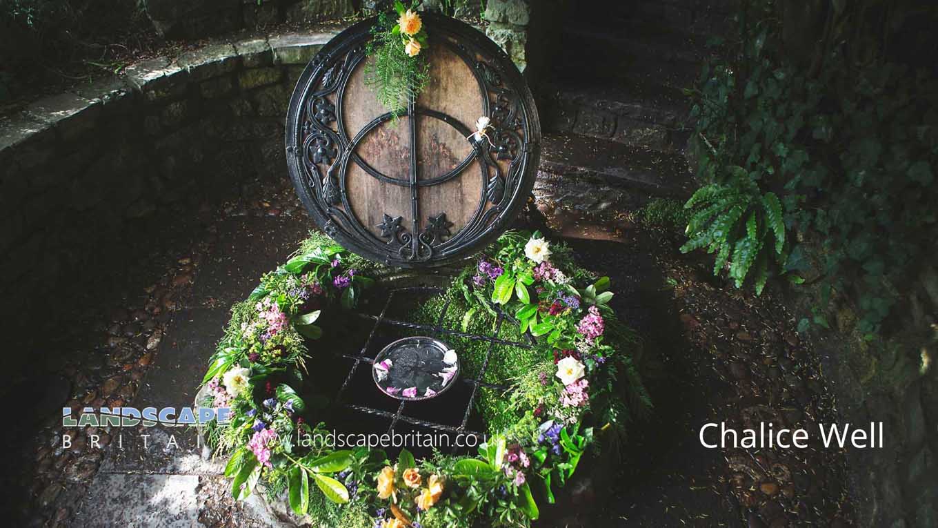
A possibly ancient spring that is still ‘dressed’ in the Pagan tradition. But, its name is said to indicate it is the resting place of the Holy Grail or chalice and that is was brought here in biblical times by Joseph of Arimathea while on a trading voyage. Altogether now, ‘and did those feeeeeet…’.
It is true to say there is evidence of trade of goods and materials across such distances historically.
The well itself, or the source of the spring that feeds it may well have been of significance since long before.
Created: 1 May 2022 Edited: 29 November 2023
Chalice Well
Chalice Well LiDAR Map
please wait...
Contains public sector information licensed under the Open Government Licence v3.0
Local History around Chalice Well
There are some historic monuments around including:
Fenny Castle: a motte and bailey castleDuck decoy, 590m south west of Rice FarmSection of medieval road, south of Pomparles Bridge, north of StreetCentral of three duck decoys on Walton Moor, south of Lord Bath's DroveCompton Dundon hillfort with Dundon Beacon, east of DundonDuck decoy in Sharpham Park, 600m south west of Avalon FarmRoman villa NW of Two Acre PlantationThe Abbey Barn at Abbey FarmBeckery Chapel and cemetery (site of)Linear earthwork in Butleigh WoodBrowne's GateThe TribunalSt Michael's Church, monastic remains, and other settlement remains on Glastonbury TorGlastonbury lake villageBishop's palaceThe Abbot's Fish House and fishpondsDuck decoy 1km south east of Manor FarmPart of the Hospital of St Mary Magdalene, Magdalene StreetMedieval farmstead, E of Butleigh WoodBishop's Palace ruined portions, walls and well houseGlastonbury AbbeyThe easternmost of three duck decoys on Walton MoorFenny Castle Cross: a medieval wayside cross 20m north west of Castle Farm, CastlePonter's Ball linear earthworkTinney's trackways, west of Sharpham BridgeBishop's tithe barn.


