Castlesteads (Prehistoric Enclosure) by munki-boy
Castlesteads (Prehistoric Enclosure)
Castlesteads (Prehistoric Enclosure) is in The Lake District National Park in England.
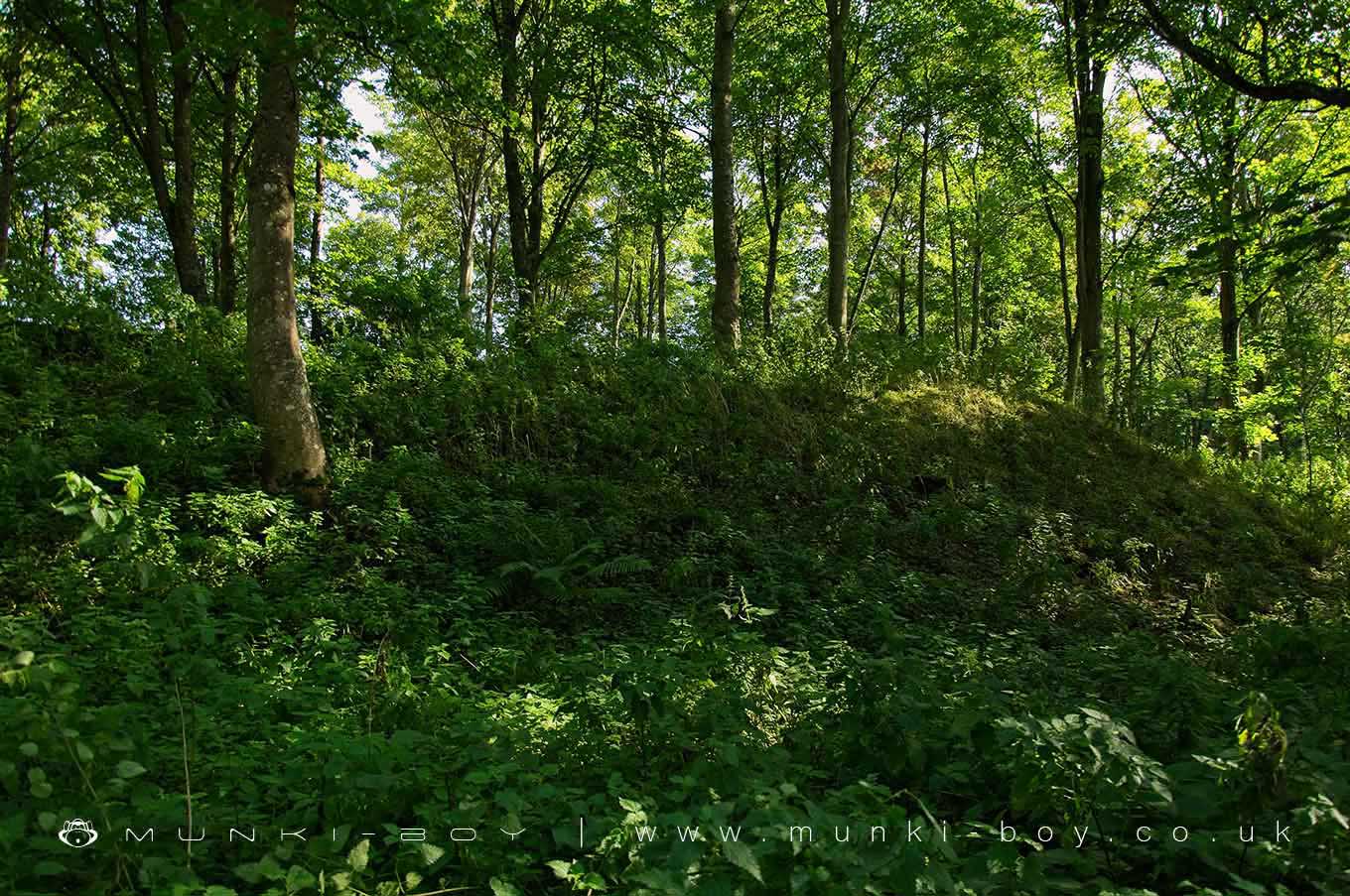
The monument includes Castlesteads multivallate prehistoric defended enclosure. It is located on a slight knoll in Yanwath Wood overlooking a bend in the River Lowther to the south and east, and includes a roughly circular enclosure partially defended by three ramparts and two ditches. The enclosure measures approximately 53m in diameter and contains internal features which include a cross wall running east-west which virtually divides the interior into two equal halves. In the northern half there are faint traces of other walls together with some shallow circular depressions thought to have been the sites of hut circles. The enclosure has two entrances, one on the northern side, the other directly opposite. Defending the enclosure on its western and much of its southern sides are three earthen ramparts and two ditches; the outer rampart measures c.10m wide by 2m high, the middle rampart measures c.9m wide by 2.5m high, and the inner rampart measures c.6.5m wide by 1.5m high. On the eastern and northern sides a path and a forestry track have partially obliterated the outer and middle ramparts.
During the mid-prehistoric period (seventh to fifth centuries BC) a variety of different types of defensive settlements began to be constructed and occupied in the northern uplands of England. The most obvious sites were hillforts built in prominent locations. In addition to these a range of smaller sites, sometimes with an enclosed area of less than 1ha and defined as defended settlements, were also constructed. Some of these were located on hilltops, others are found in less prominent positions. The enclosing defences were of earthen construction, some sites having a single bank and ditch (univallate), others having more than one (multivallate). At some sites these earthen ramparts represent a second phase of defence, the first having been a timber fence or palisade. Within the enclosure a number of stone or timber-built round houses were occupied by the inhabitants. Stock may also have been kept in these houses, especially during the cold winter months, or in enclosed yards outside them. The communities occupying these sites were probably single family groups, the defended settlements being used as farmsteads. Construction and use of this type of site extended over several centuries, possibly through to the early Romano-British period (mid to late first century AD). Defended settlements are a rare monument type. They were an important element of the later prehistoric settlement pattern of the northern uplands and are important for any study of the developing use of fortified settlements during this period. All well-preserved examples are believed to be of national importance.
Despite partial obliteration of the defences on the northern and eastern side of the monument, Castlesteads prehistoric defended settlement survives reasonably well, its earthworks in particular remaining largely well preserved where they survive. It overlooks the valley of the River Lowther, a tributary of the Eden, and lies in an area where rich agricultural soils supported a considerable prehistoric and Romano-British population from Neolithic times onwards. The monument will contribute to any further study of early settlement patterns in the area.
RSM
Created: 28 October 2020 Edited: 29 November 2023
Castlesteads (Prehistoric Enclosure)
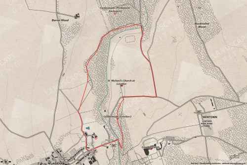
Castlesteads (Prehistoric Enclosure) LiDAR Map

Contains public sector information licensed under the Open Government Licence v3.0
Walks in Castlesteads (Prehistoric Enclosure)
Local History around Castlesteads (Prehistoric Enclosure)
There are some historic monuments around including:
Brougham Roman fort (Brocavum) and civil settlement and Brougham CastleMoated site and annexe east of Setterahpark WoodRound cairn 285m south east of White Raise round cairn, Askham FellRound cairn on Askham Fell, 335m north of the Cop StoneRing cairn on Askham Fell including The Cop StoneLong cairn 330m east of MossthornLittle Round Table hengeRound cairn 50m north east of White Raise round cairn, Askham FellRomano-British settlement and regular aggregate field system north of Yanwath WoodRomano-British settlement at Cragside WoodRound cairn 515m south east of White Raise round cairn, Askham FellMayburgh hengeRound cairn 680m ENE of DalefootKing Arthur's Round Table hengeRound cairn on Heughscar HillRound cairn 520m north east of The Cockpit, Askham FellRound cairn 490m south east of White Raise round cairn, Askham FellRound cairn 280m south-east of The Cockpit stone circleRound barrow 150m east of Scarside PlantationSewborrans standing stone 400m south west of SewborwensRing cairn east of Threepow RaiseRing cairn on Askham Fell and four adjacent stonesThe Countess PillarFour funerary cairns and a surrounding cairnfield on Threepow RaiseThe Giant's Thumb - Anglian high cross in St Andrew's churchyard, PenrithRing cairn on Knipescar CommonLong cairn 370m ESE of Mossthorn FarmSt Ninian's preconquest monastic site, site of nucleated medieval settlement, St Ninian's Church and churchyardBridge over Heltondale Beck 250yds (230m) SSW of WidewathSite of Catterlen Old HallRoman road and enclosures SE of FrenchfieldTwo standing stones and a round cairn south of CrooklandsLong barrow on Trainford BrowRoman marching camp 450yds (410m) NE of BrovacumWhite Raise round cairn, Askham FellStrickland's Pele Tower and Penrith CastleBowl barrow 80m east of Scarside PlantationBowl barrow 850m WSW of Yanwath Woodhouse FarmClifton Hall towerStanding stone 180m NNE of SkirsgillSlight univallate hillfort in Scarside PlantationSettlement 100yds (90m) SE of Sceugh FarmTwo round cairns 415m and 420m NNE of The Cockpit, Moor DivockRing cairn on Knipescar Common south of Inscar PlantationSettlement 1/3 mile (540m) ENE of Brougham CastleBowl barrow 350m north east of The WreayRound cairn 475m south east of White Raise round cairn, Askham FellSkirsgill Romano-British enclosed stone hut circle settlement, Romano-British farmstead, and Romano-British regular aggregate field systemMoated site east of Newton ReignyThe Cockpit stone circle and seven adjacent clearance cairns, Moor DivockMelkinthorpe medieval settlement, part of its associated open field system and the site of Melkinthorpe HallThe Old Kiln, Wetheriggs PotteryAskham Fell stone alignmentBridge over Heltondale Beck 550ft (170m) S of WidewathStone bridge, Cawdale BeckRound cairn 490m ENE of Rough Hill TarnRound cairn 660m north east of The Cockpit, Askham FellCatterlen Hall tower houseLinear stone bank on Askham FellRound cairn on Askham Fell, 270m north of The Cop StoneStone circle 800m east of Wetheriggs PotteryEamont BridgeRound cairn 580m north east of The Cockpit, Askham FellThe Giant's Grave - Two Anglian cross-shafts and four hogback stones in St Andrew's churchyard, PenrithRound cairn west of Riddingleys Top, Askham FellTowtop Kirk early Christian enclosureCastlesteads multivallate prehistoric defended enclosure.


