Castlesteads (Lowther) by munki-boy
Castlesteads (Lowther)
Castlesteads (Lowther) is in The Lake District National Park in England.
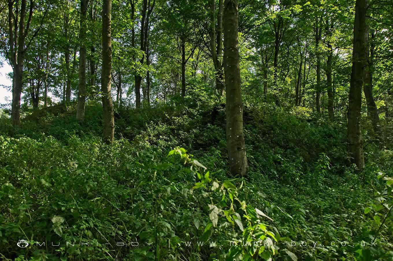
Now an overgrown and tree-covered mound with some sections of bank around the top. Hidden in the woods past the back-gate of Lowther Castle gardens and overlooking the river. There isn’t a lot to see for the casual explorer but interesting if you’re passing by.
The earliest medieval fortified structure at Lowther was Castlesteads, which survives as a substantial earthwork to the north-west of Smirke’s Castle(Lowther III). It was probably a timber ringwork (LUAU 1997, 24).
Earthworks of a rectangular enclosure in Lowther Park. It probably represents the overgrown foundations of a medieval building, possibly a pele tower. Field investigations carried out in 1966 found it to be in good condition. NMR
Castlesteads, an earthwork forming a rectangular enclosure about 30 by 24 yds, probably represents the overgrown foundations of a pele-tower or other Md. building. (The Buildings of England, Nikolaus Pevsner 1967)
It was referred to in a document dated to 1174 as the “castellum deLauudre”. (Michael Jackson 1990, Perriam and Robinson 1998)
Created: 27 October 2020 Edited: 29 November 2023
Castlesteads (Lowther)
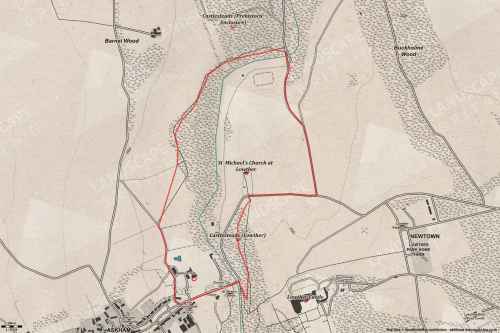
Castlesteads (Lowther) LiDAR Map

Contains public sector information licensed under the Open Government Licence v3.0
Walks in Castlesteads (Lowther)
Local History around Castlesteads (Lowther)
There are some historic monuments around including:
Round cairn 660m north east of The Cockpit, Askham FellBridge over Heltondale Beck 250yds (230m) SSW of WidewathFour funerary cairns and a surrounding cairnfield on Threepow RaiseRound cairn on Heughscar HillThe Old Kiln, Wetheriggs PotteryMayburgh hengeLinear stone bank on Askham FellRound barrow 150m east of Scarside PlantationKing Arthur's Round Table hengeMoated site and annexe east of Setterahpark WoodRing cairn on Knipescar Common south of Inscar PlantationWhite Raise round cairn, Askham FellBowl barrow 350m north east of The WreayRomano-British settlement at Cragside WoodSettlement 100yds (90m) SE of Sceugh FarmEamont BridgeRound cairn 490m south east of White Raise round cairn, Askham FellThe Cockpit stone circle and seven adjacent clearance cairns, Moor DivockTwo round cairns 415m and 420m NNE of The Cockpit, Moor DivockSt Ninian's preconquest monastic site, site of nucleated medieval settlement, St Ninian's Church and churchyardSettlement 1/3 mile (540m) ENE of Brougham CastleBrougham Roman fort (Brocavum) and civil settlement and Brougham CastleRound cairn 580m north east of The Cockpit, Askham FellRound cairn 515m south east of White Raise round cairn, Askham FellClifton Hall towerMoated site east of Newton ReignyStone bridge, Cawdale BeckRound cairn on Askham Fell, 270m north of The Cop StoneRound cairn 285m south east of White Raise round cairn, Askham FellBowl barrow 80m east of Scarside PlantationLittle Round Table hengeRound cairn 280m south-east of The Cockpit stone circleAskham Fell stone alignmentLong cairn 330m east of MossthornRound cairn 475m south east of White Raise round cairn, Askham FellRound cairn 680m ENE of DalefootRing cairn on Knipescar CommonRoman road and enclosures SE of FrenchfieldRound cairn west of Riddingleys Top, Askham FellRoman marching camp 450yds (410m) NE of BrovacumLong barrow on Trainford BrowThe Giant's Thumb - Anglian high cross in St Andrew's churchyard, PenrithTwo standing stones and a round cairn south of CrooklandsRound cairn 520m north east of The Cockpit, Askham FellCastlesteads multivallate prehistoric defended enclosureRing cairn on Askham Fell including The Cop StoneStrickland's Pele Tower and Penrith CastleRound cairn on Askham Fell, 335m north of the Cop StoneSkirsgill Romano-British enclosed stone hut circle settlement, Romano-British farmstead, and Romano-British regular aggregate field systemThe Giant's Grave - Two Anglian cross-shafts and four hogback stones in St Andrew's churchyard, PenrithRound cairn 490m ENE of Rough Hill TarnBridge over Heltondale Beck 550ft (170m) S of WidewathRomano-British settlement and regular aggregate field system north of Yanwath WoodTowtop Kirk early Christian enclosureBowl barrow 850m WSW of Yanwath Woodhouse FarmRound cairn 50m north east of White Raise round cairn, Askham FellThe Countess PillarLong cairn 370m ESE of Mossthorn FarmStanding stone 180m NNE of SkirsgillStone circle 800m east of Wetheriggs PotterySewborrans standing stone 400m south west of SewborwensRing cairn on Askham Fell and four adjacent stonesMelkinthorpe medieval settlement, part of its associated open field system and the site of Melkinthorpe HallSlight univallate hillfort in Scarside PlantationRing cairn east of Threepow Raise.


