Carisbrooke Castle
Carisbrooke Castle
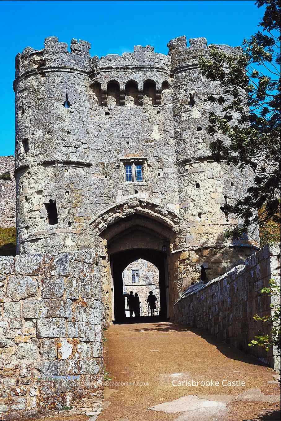
Now the official residence of the Governor of the Isle of Wight, Carisbrooke Castle was used to imprison Charles I in 1647.
At Carisbrooke there are the substantial remains of a series of castles of dating to the 11th or 12th Centuries and earlier. The castle was added-to between the 14th and 16th Centuries.
A section of the castle earthworks date to before the Norman conquest but a section of wall dates to the late-Roman period.
The castle ruins at Carisbrooke have been restored in the 19th Century and the chapel was rebuilt just after the turn-of-the-century by Percy Goddard Stone.
The castle grounds are also home to the famous Carisbrooke donkeys, which have been used to haul water from the well for centuries. Visitors can still see these donkeys at work today.
Carisbrooke Castle is in Isle Of Wight AONB, a designated Area of Outstanding Natural Beauty.
Created: 22 May 2022 Edited: 29 November 2023
Carisbrooke Castle Information
Carisbrooke Castle Address
Castle Hill, Newport
PO30 1XY
Website: https://www.english-heritage.org.uk/visit/places/carisbrooke-castle/
Get directionsCarisbrooke Castle LiDAR Map
please wait...
Contains public sector information licensed under the Open Government Licence v3.0
Local History around Carisbrooke Castle
There are some historic monuments around including:
A twin barrow and bowl barrow 1.6km WSW of Cheverton Farm: part of a round barrow cemetery on Cheverton DownMedieval enclosure in Newbarn Combe, 900m south east of Newbarn FarmMoated site 100m north east of Wolverton ManorTwo bowl barrows 100m south east of Slocum CopseBowl barrow on Newbarn Down: 1km south west of RowridgeBowl barrow 1.3km WSW of Cheverton Farm: part of a round barrow cemetery on Cheverton DownA Bronze Age barrow and Anglo-Saxon cemetery on Bowcombe Down, 575m south east of ApesdownBowl barrow 525m east of Stone Place FarmBowl barrow 450m north of Vittlefields FarmCarisbrooke Romano-British villaClatterford Roman VillaBowl barrow in Brighstone Forest west of Gallibury Fields: 1.65km ESE of Gottenleaze CottagesBowl barrow in Brighstone Forest west of Gallibury Fields: 1.57km ESE of Gottenleaze CottagesRampart and ditch of an unfinished promontory fort on Chillerton Down, known as `Five Barrows'Bowl barrow in Brighstone Forest west of Gallibury Fields: 1.6km ESE of Gottenleaze CottagesBowl barrow 1.35km WSW of Cheverton Farm: part of a round barrow cemetery on Cheverton DownBowl barrow 730m north east of Presford Farm known as `Sheards Barrow'Bowl barrow 570m south west of Swainstondown GateNewport Roman VillaEnclosure and field system on the north side of Cheverton Down, immediately east of Rowborough BottomBowl barrow on Newbarn Down: 1.1km south west of RowridgeBowl barrow 1.2km WSW of Cheverton Farm: part of a round barrow cemetery on Cheverton DownBowl barrow 30m south of Round CopseEnclosure in Brighstone ForestCarisbrooke Castle: a shell keep castle on the site of a Saxon burhBowl barrow 1km south-east of New Barn Farm.


