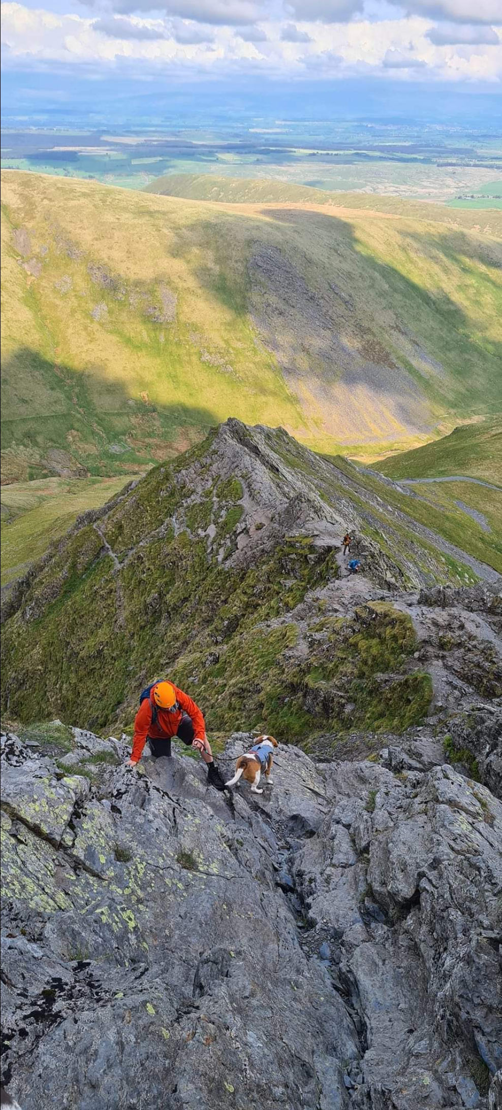
Blencathra by Rebecca Goodwin
Blencathra - Hallsfell Top
Blencathra - Hallsfell Top is in The Lake District National Park in England.
Blencathra, also known as Saddleback due to its distinctive shape, is one of the most renowned fells in the Lake District National Park in Cumbria, England. Esteemed by walkers, climbers, and nature enthusiasts alike, Blencathra stands out with its impressive elevation of 868 meters (2,848 feet) and its unique geological and topographical features. The mountain offers breathtaking views of the surrounding landscape and is a beloved destination for those seeking the quintessential Lake District experience.
Geologically, Blencathra is predominantly composed of Skiddaw slate, part of the Borrowdale Volcanic Group, dating back to the Ordovician period. This ancient rock gives the mountain its rugged and dramatic appearance. The summit of Blencathra provides a panoramic vista, encompassing the Solway Firth, the Scottish Borders, and a vast array of the northern and central Lakeland fells. Its accessibility from the nearby town of Keswick adds to its popularity among visitors.
Blencathra’s most distinctive feature is the series of steep slopes or ‘edges’ leading to its summit. These include Sharp Edge and Hall’s Fell Ridge, both offering exhilarating and challenging routes for more experienced hikers and scramblers. Sharp Edge, in particular, is famed for its narrow arête and steep drops on either side, providing an adrenaline-fueled ascent. For those seeking less demanding routes, there are more gradual paths leading from Threlkeld village, which allow hikers of various skill levels to enjoy the fell.
The area around Blencathra is also rich in wildlife and flora. The slopes and surrounding habitats are home to a variety of bird species, including the peregrine falcon and the ring ouzel. The upland areas are covered with heathery moorlands and peat bogs, nurturing a diverse range of plant life.
Blencathra’s cultural and historical significance is as compelling as its natural beauty. The mountain has inspired poets, writers, and artists for centuries, with its imposing presence and ever-changing moods. Alfred Wainwright, the renowned fellwalker and author, described Blencathra in his Pictorial Guide to the Lakeland Fells as one of his favorite climbs.
In conclusion, Blencathra stands as a symbol of the rugged allure of the Lake District, offering a mix of adventure, tranquility, and natural splendor. Whether it’s the challenging climb along Sharp Edge, a peaceful hike up its gentler slopes, or simply admiring its majestic form from afar, Blencathra captures the essence of the Lake District’s enduring appeal.
Created: 30 October 2023 Edited: 29 November 2023
Blencathra - Hallsfell Top Details
Blencathra - Hallsfell Top is a 868 metre high mountain in Cumbria.
Blencathra - Hallsfell Top
Blencathra - Hallsfell Top LiDAR Map
Contains public sector information licensed under the Open Government Licence v3.0
Local History around Blencathra - Hallsfell Top
There are some historic monuments around including:
Medieval shieling 160m north west of Clough FoldTwo medieval shielings 25m north of Clough FoldPrehistoric stone hut circle settlement, irregular aggregate field system,five enclosures,a well,a cairnfield and trackways on St John's and Threlkeld CommonsWeasel Hills prehistoric cairnfield, associated field system, hut circle and a funerary cairn, immediately north and north west of High Wath FordRound cairn 390m west of LinewathRospow Hills prehistoric cairnfield and associated field system 740m south west of High Wath FordCastlerigg stone circle and two bowl barrowsRound cairn 250m south east of High Wath FordRound cairn 275m south east of High Wath FordTwo medieval shielings 210m north west of Clough FoldMedieval shieling 300m north of Clough FoldTwo medieval shielings 240m north west of Clough FoldTwo medieval shielings 60m north of Clough FoldLarge univallate hillfort, two round cairns and medieval shieling on Carrock FellCarrock End copper mine 230m and 490m south west of LinewathRound cairn 380m north west of Willywood WellCarrock Fell tungsten, lead, copper, and arsenic mines and the remains of an early 20th century tungsten millHaltcliffe copper smelter and associated leat immediately east of High Wath Ford.


