Beggar’s Bridge
Beggar’s Bridge
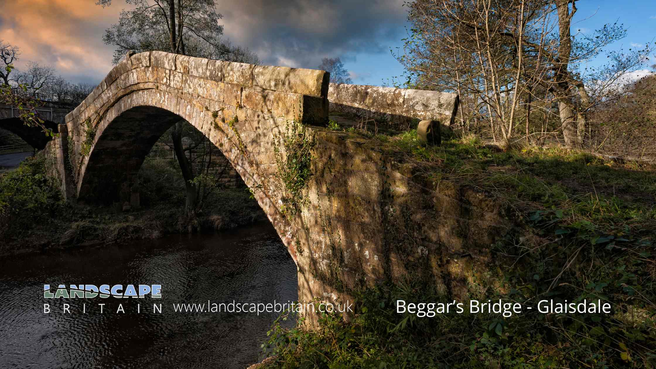
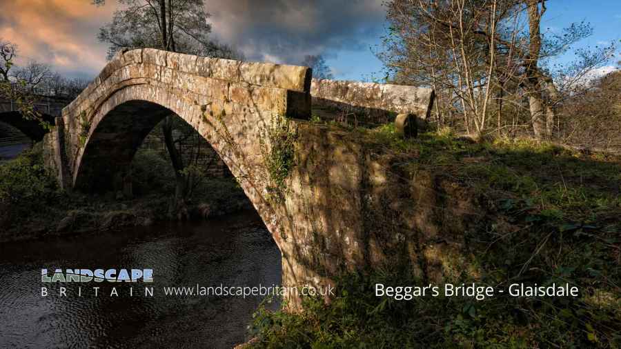
Beggar’s Bridge is in The North York Moors National Park in England.
Beggar’s Bridge in Glaisdale is a historic and picturesque structure with a romantic legend attached to it. Located in the North York Moors National Park in North Yorkshire, England, this charming bridge spans the River Esk and is a well-loved landmark in the area.
The bridge was built in 1619 and is made of local sandstone. It features a single arch design, typical of the period, and has stood the test of time remarkably well. The craftsmanship is a testament to the builders of the era, who skillfully created structures that blended seamlessly with the natural beauty of the landscape.
The legend behind Beggar’s Bridge adds to its allure. It is said to have been built by a local man named Tom Ferries, who was in love with a local squire’s daughter, Agnes. Tom was poor, and in order to seek his fortune and win Agnes’s hand in marriage, he decided to go to sea. On the night before his departure, the River Esk was swollen, and he couldn’t cross it to bid farewell to Agnes. This incident reportedly inspired him to build the bridge so that no lovers would be separated as they had been. Tom eventually returned wealthy and married Agnes, and the bridge stands as a romantic symbol of their love.
Beyond its romantic history, Beggar’s Bridge is a point of interest for visitors to Glaisdale. It offers picturesque views of the River Esk and the surrounding woodlands, making it a popular spot for photographers and nature enthusiasts. The bridge is also a feature on many walking routes in the area, including the Esk Valley Walk, a long-distance footpath that follows the course of the River Esk through the North York Moors.
The story of Beggar’s Bridge is often recounted in local folklore, and it adds a layer of mystique to this already beautiful part of the Yorkshire countryside. The bridge not only serves as a historical monument but also as a reminder of the power of love and determination, themes that resonate with visitors and locals alike.
Created: 7 January 2024 Edited: 26 March 2024
Beggar’s Bridge
Local History around Beggar’s Bridge
There are some historic monuments around including:
Rawland Howe round barrow on Lealholm Moor, 450m North of South View FarmRound barrow on Ugthorpe Moor known as Loose Howe, 130m south west of Day Well HouseRound barrow on Lealholm Rigg, 690m north of Benwell HouseFlat Howe round barrow 790m south east of Pannierman Bridgestone, on the eastern sidee of Glaisdale High MoorBowl barrow known as Brown Rigg Howe on Beacon Hill, Danby, together with a searchlight emplacement upon itRound barrow on Wheeldale Moor, 1250m west of Wheeldale LodgeRound barrow at Lady Cross, 730m south west of Dun BogsCairns on In Moor, Struntry CarrCairnfield on Howl Moor 510m south of Wheeldale Lodge, including an unenclosed hut circle settlement, field system and round burial cairnsPike Hill round cairnsTwo round barrows 1/4 mile (400m) NE of Horse Mire Head FarmRound barrow on Lealholm Rigg, 710m south west of Green Houses FarmEnclosure on In Moor, Struntry CarrBeggar's BridgeRound barrow 860m south west of Dun BogsThree Howes round cairnsRound barrow on Lealholm Moor, 600m north east of South View FarmWheeldale HoweBlack Hill wayside cross on Glaisdale RiggRound barrow on Wheeldale Moor, 1150m west of Wheeldale LodgeWayside cross known as Stump Cross on Beacon Hill, DanbyRound barrow on Thorn Hill, 310m south of the confluence of Black Dike Slack and Mardale SlackRound barrows and entrenchments on Egton High MoorRound barrow on Ugthorpe Moor, 450m south west of High Park FarmMiddle Rigg round barrows and segmented embanked pit alignmentCairnfield, including a standing stone, round barrow, round cairn, enclosed field and part of Cucket medieval deer park boundary, 360m north of Eden HousePit alignment and three round barrows on Ugthorpe Moor, 500m north east of Wood Hill HouseRound cairn on Skivick Crag, 380m south west of Wheeldale LodgeRoman Fort on Lease RiggTwo Howes: two round barrows on Goathland MoorLady Cross wayside cross, north of the A171 and 20m west of the Barnby turn-offRing cairn on Lealholm Moor, 640m north east of South View FarmRound barrow on Ugthorpe Moor, 200m south west of High Park FarmPit alignment and two round barrows on Ugthorpe Moor, 700m south west of High Park FarmPit alignment on Black Dike Moor, 800m south west of Nan Stone.


