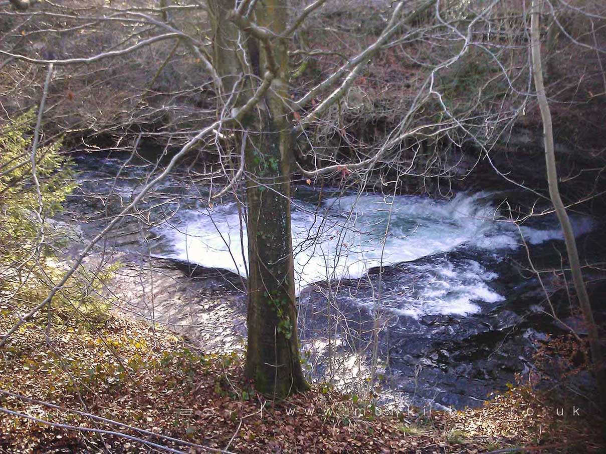
Basin Ghyll by munki-boy
Basin Ghyll
A difficult to view but often impressive waterfall over a shallow but wide step in the River Kent beside Force Lane and the ruins of the old gunpowder works.
Created: 1 November 2021 Edited: 29 November 2023
Basin Ghyll
Kent - confluence with Sprint to tidal Details
Kent - confluence with Sprint to tidal
Kent - confluence with Sprint to tidal is a river in Cumbria
Kent - confluence with Sprint to tidal takes in water from an area around 51.932 km2 in size and is part of the Kent catchment area.
Kent - confluence with Sprint to tidal is 20.922 km long and is not designated artificial or heavily modified.
Basin Ghyll LiDAR Map
please wait...
Contains public sector information licensed under the Open Government Licence v3.0
Local History around Basin Ghyll
There are some historic monuments around including:
Levens Park, round barrows and medieval settlements, including Temple of DianaSedgwick aqueductStramongate BridgeGreenside lime kiln 480m west of Castle HoweMiller BridgeSettlement 440yds (400m) N of Cunswick HallLevens BridgeLow Gatebeck gunpowder works, 540m south west of Gatebeck FarmEarthwork 700yds (640m) N of Levens BridgeBasingill gunpowder works, 130m south of Force BridgeRingwork in Dallam Park 380m south east of Dallam TowerCappleside Hall medieval lordly residence 600m north east of Beetham HouseNether BridgeBeetham Hall (curtain wall and uninhabited portion)Hincaster Tunnel horse pathWatercrook Roman fort and civil settlementPackhorse bridge at the Post OfficeCastle Howe motte and baileyPart of Helsington medieval village immediately west of Briggs House FarmNew Sedgwick gunpowder works, 580m north of Gate HouseCastlesteads small multivallate hillfort on The HelmRound cairn 230m north of Berry HolmeKendal Castle and associated earthworks, and earlier ringwork.


