Baitings Dam
Baitings Dam
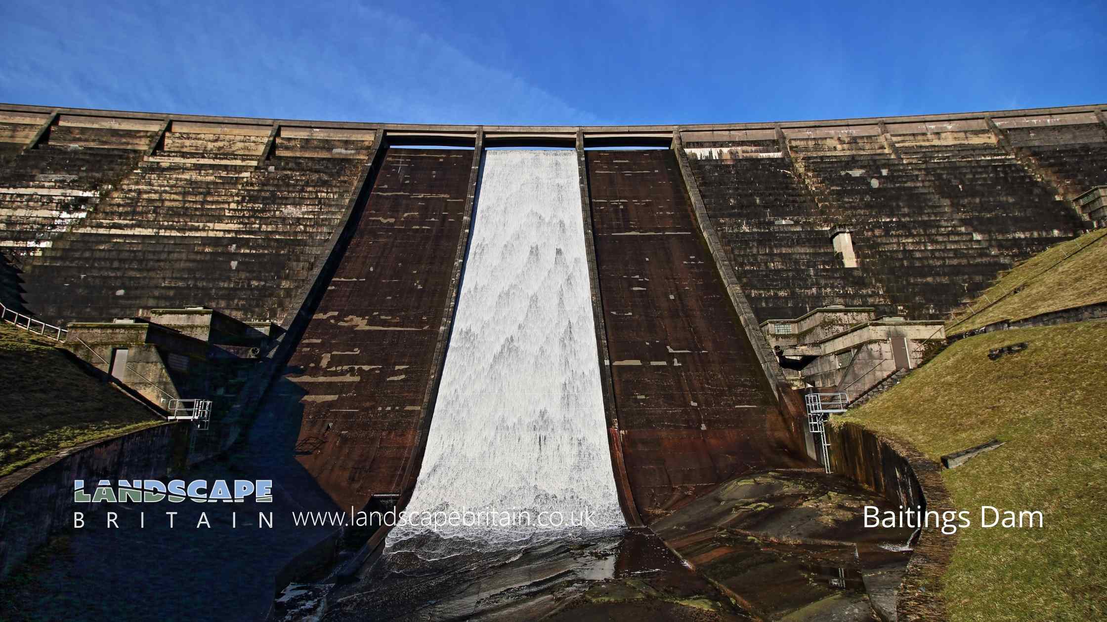
Baitings Dam is at the edge of Baitings Reservoir and features and impressive outflow cascade.
Created: 3 November 2022 Edited: 29 November 2023
Baitings Reservoir Details
Baitings Reservoir is a small freshwater lake in West Yorkshire, situated at an altitude of around 256 meters and is shallow.
The shoreline of Baitings Reservoir is approximately 2.697 Kilometers all the way round.
- Altitude: 256 m
- Shoreline: 2.697 Km
- Depth: Shallow
Baitings Dam
Baitings Dam LiDAR Map
Loading LiDAR
please wait...
please wait...
Contains public sector information licensed under the Open Government Licence v3.0
Local History around Baitings Dam
There are some historic monuments around including:
Ripponden (or Waterloo) BridgeCastle Hill motte castle 270m north east of Rosemary HallWayside cross located on Slate Pit HillBowl barrow known as Beacon HillClose Gate BridgeMeg Dike late prehistoric enclosed settlementCairnfield on Ringstone Edge Moor, 240m south west of Clay HouseOxygrains packhorse bridge, RishworthRing cairn known as the Ring of Stones on Ringstone Edge Moor, 800m south of Upper Gosling Royd.


