Arbor Low Henge by munki-boy
Arbor Low Henge
Arbor Low Henge is in The Peak District National Park in England.
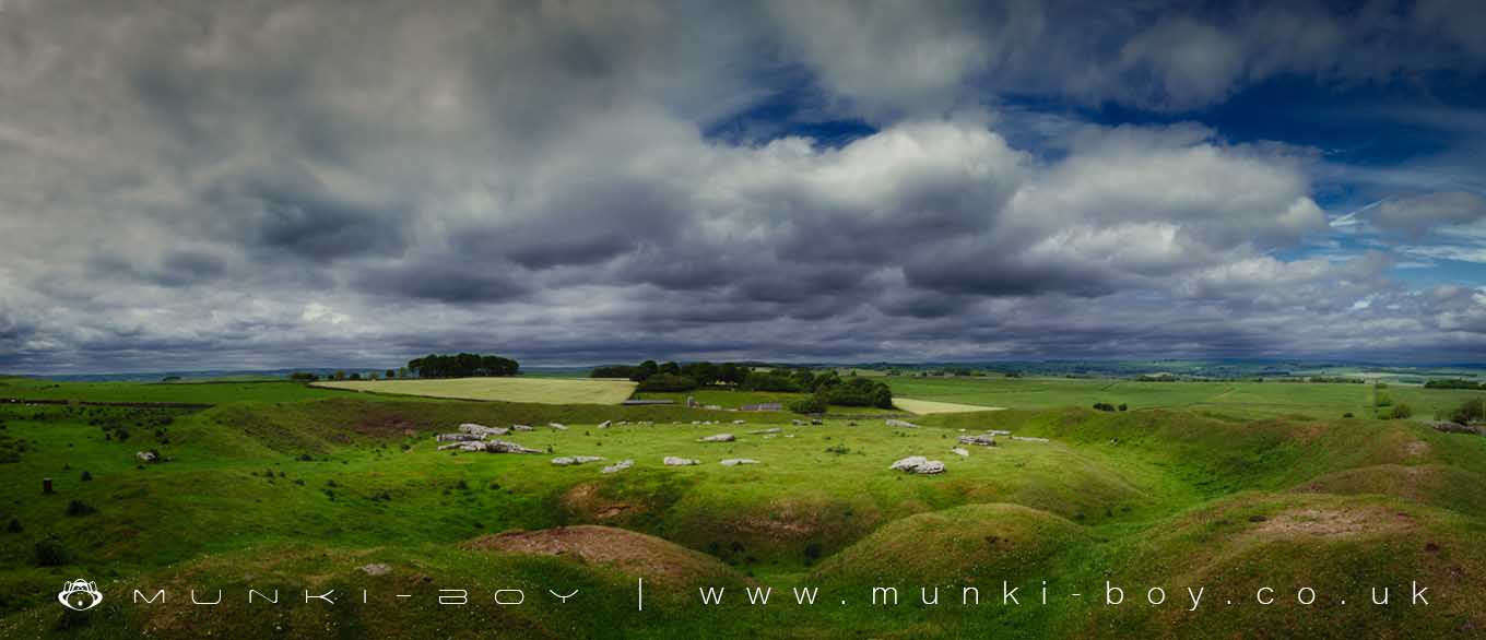
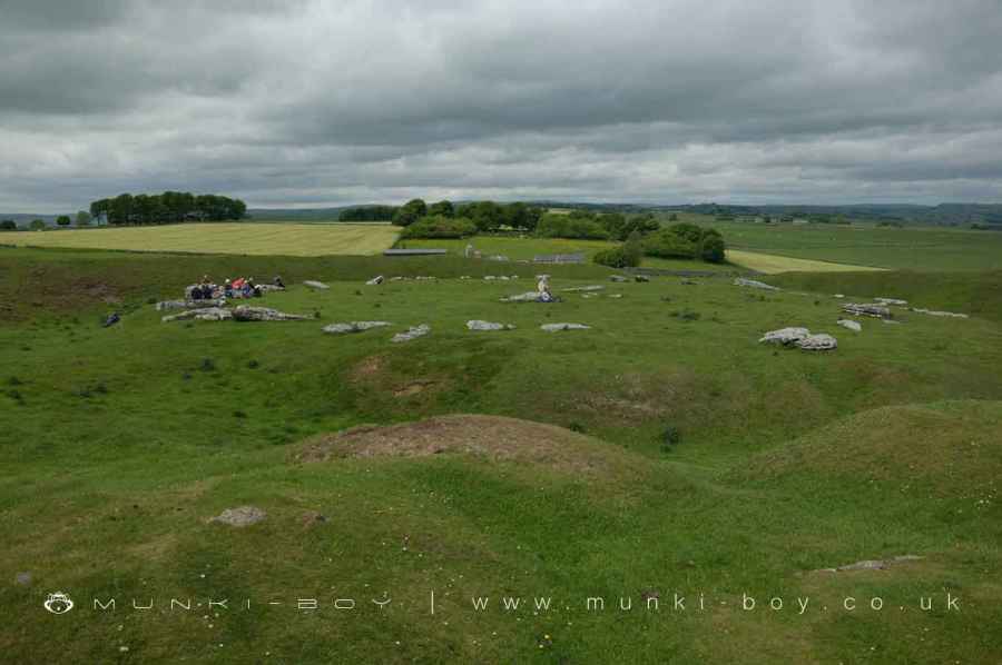
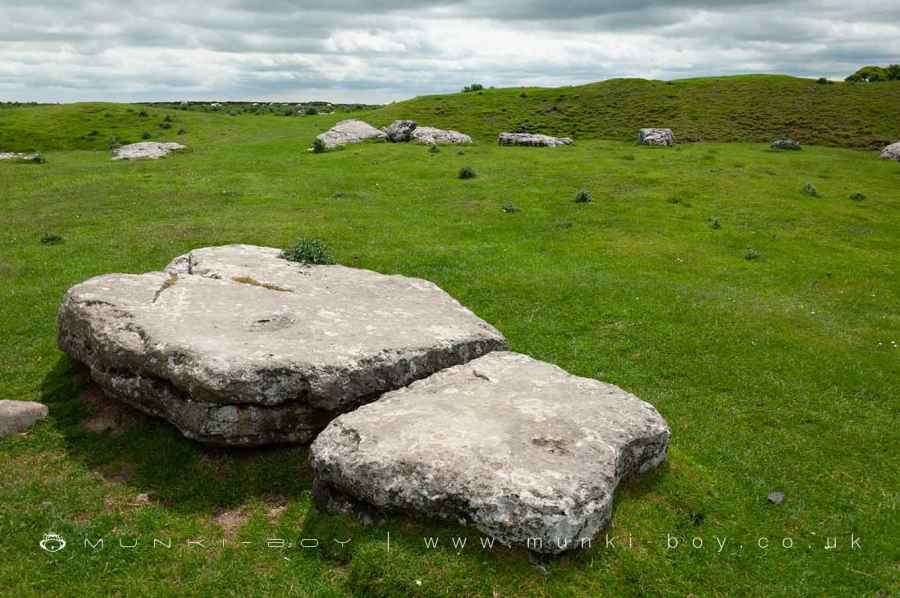
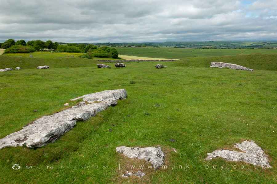
Arbor Low is a spectacular henge monument with inner stone circle, unique as all the stones are laid flat in recumbent style. It is not known whether they were intended to be this way or if the stones where pulled down at some distant time in the past.
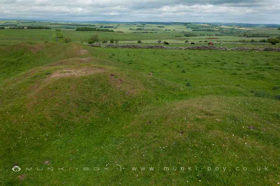
The henge itself is very prominent with large banks and ditches, there is also the remains of a burial mound within the banks of the henge. The stones are large pale slabs of local limestone giving the site the look of a large clock face.
Arbor Low Henge: A Window into Neolithic Ritual and Ceremony
Introduction to Arbor Low Henge Nestled in the heart of Derbyshire’s central uplands, the Arbor Low henge stands as a testament to the intricate ceremonial practices of the Late Neolithic period (2800-2000 BC). This well-preserved Class II henge, encapsulating an array of historical features, offers a unique insight into the ritualistic and social fabric of early prehistoric communities.
Structural Composition Arbor Low henge is distinguished by its massive bank and internal quarry ditch, forming an oval enclosure approximately 40m by 52m in diameter. The ditch, varying between 7m to 12m in width, was originally 2-3m deep with steep rock-cut sides, as revealed by the early 20th-century excavations led by Gray. Surrounding this is a bank, now about 2m high and 8-10m wide, but initially estimated to be around 3m high. This bank, roughly circular in shape, has two main entrances – one to the north-west and another to the south-south-east, each marked by distinct causeways.
Archaeological Discoveries Excavations have uncovered numerous artifacts, including bone and antler tools, flint flakes, and various types of flint arrowheads, suggesting diverse activities and uses of the site. Notably, the entrances may have originally housed portal stones, indicating a significant ceremonial approach to entering the henge.
Within this henge lies a large irregular stone circle, initially composed of 41-43 upright limestone slabs, with only a fraction still standing today. These stones, of varying heights up to nearly 3m, were strategically placed around the ring, with the tallest near the henge entrances. At the circle’s center lies the ‘cove’, a ruined stone setting believed to have been arranged in a rectangle. Gray’s excavations here unearthed human burials, offering a glimpse into the funerary practices of the time.
Adjacent to this is a bowl barrow, a prehistoric funerary monument dating from the Late Neolithic to the Late Bronze Age (c.2400-1500BC), partially constructed from material sourced from the henge bank. This barrow, around 21m in diameter and 2.5m high, contains a limestone cist with human cremation remains and artifacts, including pots akin to Late Neolithic Peterborough ware.
The Linear Earthwork Extending southwards from the henge is a linear bank and ditch, stretching approximately 150m southwards and then turning westward for about 200m. This earthwork, less formal and not leading directly to the henge, is interpreted as a field boundary rather than a part of the ceremonial structure. Its exact date and purpose remain subjects of ongoing research.
Conservation Status Arbor Low, together with nearby Gib Hill, has been under State care since 1884, reflecting its national importance. As a rare and well-preserved example of a Class II henge, it not only showcases the architectural ingenuity of Neolithic societies but also serves as a crucial source of information on their ritual practices, social organization, and interaction with the environment.
Arbor Low henge, with its intricate array of features – from the stone circle to the enigmatic burials – stands as a monumental relic of a past civilization. Its preservation allows us to continue unraveling the mysteries of Neolithic life, beliefs, and practices, making it an invaluable site for both archaeology and public heritage.
Created: 27 November 2016 Edited: 26 March 2024
Arbor Low Henge
Arbor Low Henge LiDAR Map

Contains public sector information licensed under the Open Government Licence v3.0
Local History around Arbor Low Henge
There are some historic monuments around including:
Parsley Hay bowl barrowBowl barrow at south-eastern end of summit of Gratton HillCronkston Low bowl barrowStanding cross in the churchyard of St Michael and All AngelsRomano-British field wall and embankment, 200m south west of Roystone GrangeBowl barrow in Foggy Lees PlantationBorther Low bowl barrowBowl barrow at north-west end of summit of Gratton HillFriden Hollow bowl barrow'Sheepwash' BridgeBowl barrow on Narrowdale HillBowl barrow west of Manor HouseTwo bowl barrows at PilsburyMedieval grange and field system, 200m south of Royston GrangeAshford BridgeArbor Low henge, large irregular stone circle, linear bank and bowl barrowKenslow Knoll bowl barrowBrundcliffe hlaewTwo bowl barrows on Chelmorton LowCalling Low bowl barrowPrehistoric and Romano-British barrow and medieval animal pen, 450m south east of Roystone GrangeThe Fishing House of Charles Cotton, Beresford DaleMedieval settlement on the north western slopes of Cales Dale, 490m north west of Cales FarmFive Wells chambered tombHawks Low bowl barrowRingham Low bowl barrowLarks Low bowl barrowBowl barrow east of Arbor LowGib Hill oval barrow and bowl barrowNettly Knowe bowl barrowLean Low bowl barrowMagpie, Dirty Red Soil, Maypit, Horsesteps and Great Red Soil lead mines and a limekiln, 590m south east of Johnson Lane FarmFin Cop promontory fort, bowl barrow and eighteenth century lime kiln with associated quarryBole Hill bowl barrowWolfscote Hill bowl barrowRoystone Grange bowl barrowBowl barrow north of Manor HouseMoneystones bowl barrow southDimin Dale Romano-British settlement and field system, south of Taddington WoodLiffs Low bowl barrowPilsbury Castle Hills motte and bailey castleSmerrill Barn bowl barrowEnd Low bowl barrowLong Dale bowl barrowBurton Moor bowl barrowVincent Knoll bowl barrowMedieval settlement immediately south east of Smerrill GrangeBrushfield Hough bowl barrowMoneystones bowl barrow northPea Low bowl barrowMeadow Place bowl barrowBee Low bowl barrowBenty Grange hlaewRomano-British settlement and field system immediately north west of Roystone GrangeTrue Blue nucleated lead mine, 600m ESE of Magpie MineSmerrill Moor bowl barrowBowl barrow at north-west end of Gratton HillGrindlow bowl barrowRomano-British field system, 420m south east of Roystone GrangeMouldridge Grange, earthworks immediately south of Mouldrige Grange FarmLathkill Dale and Mandale mines and soughsRomano-British settlement and field system, 600m south of Roystone GrangeAleck Low bowl barrow.