Adam Hill by munki-boy
Adam Hill
A relatively small hill on the south side of Winter Hill, unremarkeable except for an old OS Benchmark hidden in the heather and an interesting pattern of encircling ditches.
Created: 5 March 2021 Edited: 29 November 2023
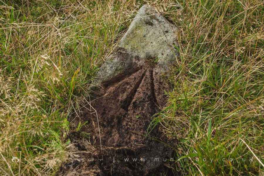
Old OS Benchmark on Adam Hill
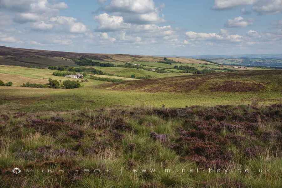
VIew over Walker Fold from Adam Hill
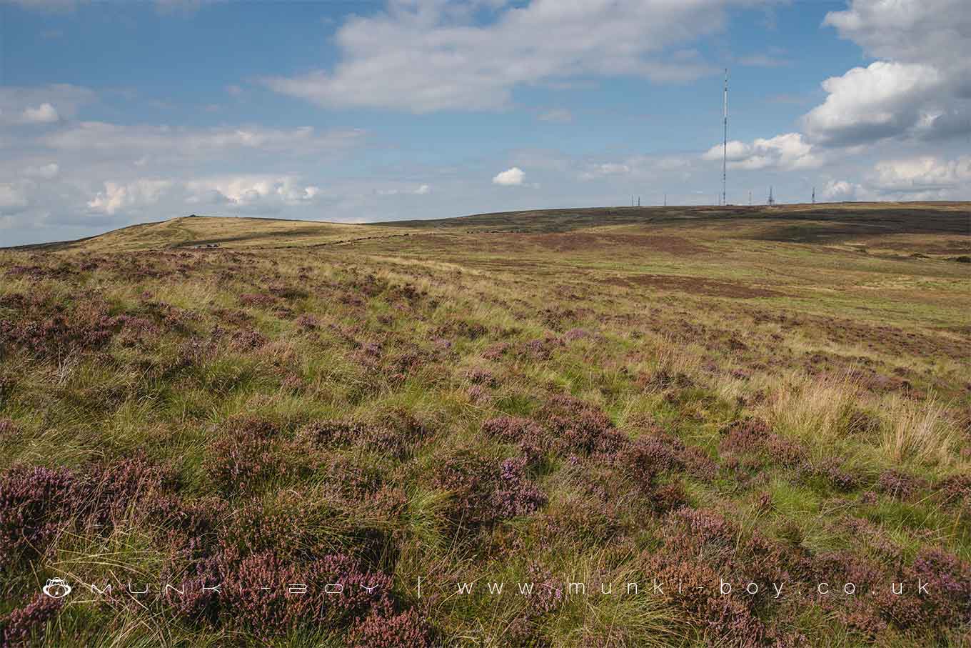
Adam Hill above Horwich
Adam Hill Details
Adam Hill is a 360 metre high hill in Greater Manchester.
Adam Hill
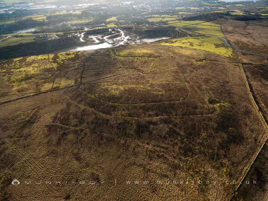
Adam Hill LiDAR Map

Contains public sector information licensed under the Open Government Licence v3.0
Local History around Adam Hill
There are some historic monuments around including:
Round cairn on Noon HillRound cairn 280m west of Old Harpers FarmGidlow Hall moated site, Aspull, 560m NNE of Pennington HallRound Loaf bowl barrow on Anglezarke MoorHeadless Cross, GrimefordRound cairn on Winter HillPike Stones chambered long cairn.


