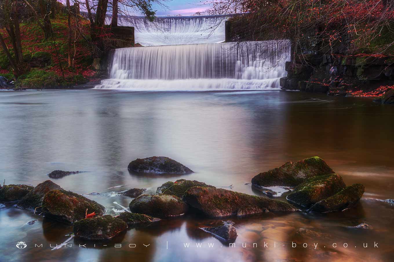
Abbeystead Weir by munki-boy
Abbeystead Weir
The outflow at the western end of Abbeystead Reservoir is spectacular and well-worth a look, despite being an artificial waterfall it is a feat of engineering and looks great.
A large, curved basin like structure allows water to flow from the reservoir down an stone-lined channel to a high weir and into the river Wyre below.
There is a small picnic area adjacent but there has been some disruption to the site in recent years as some major construction work has been in-progress including the addition of a long fish-pass.
Abbeystead Weir is in Forest Of Bowland AONB, a designated Area of Outstanding Natural Beauty.
Created: 11 March 2019 Edited: 29 November 2023
Abbeystead Weir
Wyre - Upper Details
Wyre - Upper
Wyre - Upper is a river in Lancashire
Wyre - Upper takes in water from an area around 59.095 km2 in size and is part of the Wyre and Calder catchment area.
Wyre - Upper is 43.904 km long and is not designated artificial or heavily modified.
Abbeystead Weir LiDAR Map

Contains public sector information licensed under the Open Government Licence v3.0
Local History around Abbeystead Weir
There are some historic monuments around including:
Roman kilns 25yds (20m) NE of Fairyhill CottageCastle Hill motte, DolphinholmeRemains of the gas plant, chimney, wheel pit and mill race of Dolphinholme Worsted Mill.